Hector Silva airstrip is an airport located in Cayo District serving Belmopan, the capital city of Belize. The runway is on the northern edge of the city off the George Price Highway, and has a small terminal building.
Chan Chich Airstrip is an airport serving the Chan Chich Lodge and the Gallon Jug Estate in the Orange Walk District of Belize. The airport is 6 kilometres (4 mi) east of the border with Guatemala.
Monte Caseros Airport is an airport serving Monte Caseros, a town in the Corrientes Province of Argentina. Monte Caseros is 8 kilometres (5.0 mi) south of the triple border between Argentina, Brazil, and Uruguay.
Río Turbio Airport is an airport serving Río Turbio, a town in the Santa Cruz Province of Argentina. The airport is just south of 28 de Noviembre, a town 10 kilometres (6 mi) southeast of Rio Turbio.
Centro Universitario de Aviación is an airport serving La Matanza Partido, a southern district in the Greater Buenos Aires conurbation. The airport is located within a bend of the Matanza River in the partido.

Campo de Mayo Airport is a military airport located near San Miguel, Buenos Aires, Argentina.
Independence Airport, also known as Savannah Airport or Mango Creek Airport, is an airport serving Independence and Mango Creek, a coastal community straddling the border between Toledo and Stann Creek Districts in Belize. The airport runs along the Independence Highway, 4 kilometres (2 mi) inland from the coast.
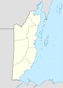
Manatee Airport is a public use airport serving the rural community of Spanish Lookout, Cayo District, Belize.
Orange Walk Airport is a public use airport 3 kilometres (2 mi) southwest of Orange Walk Town, Orange Walk District, Belize. The airport was also known as Tower Hill Airport.
Silver Creek Airport is an airport serving the Stann Creek District, Belize. The rural airport is 7 kilometres (4 mi) inland from the Caribbean coast, and 6 kilometres (4 mi) northeast of Santa Cruz.

Matthew Spain Airport, formerly called Central Farm Airstrip, is a public use airport serving San Ignacio, a town in the Cayo District of Belize. The airport is 5 kilometres (3 mi) northeast of Santa Elena.
Tres Cruces Airport is one of numerous rural airstrips in the agricultural area east of Santa Cruz de la Sierra, a city in the Santa Cruz Department of Bolivia.
Punta Huete Airport is an airport located in the municipality of San Francisco Libre in Managua, Nicaragua. The airport is in a sparsely populated section of the municipality. The nearest town is San Benito, 14 kilometres (9 mi) to the east.
Upala Airport is an airport serving the town of Upala in Alajuela Province, Costa Rica. Upala is 10 kilometres (6 mi) south of the Nicaragua border.
Chacarita Airport is an airport serving the town of Chacarita in Puntarenas Province, Costa Rica. Chacarita is on the Pacific coast at the base of the Puntarenas peninsula, just east of Puntarenas city.
Hato Grande Airport is an airport serving the hamlet of Hato Grande in the Chontales Department of Nicaragua. The runway is 14 kilometres (8.7 mi) southwest of Juigalpa.
Putumayo Airport is an airport serving the Putumayo River village of Puerto El Carmen de Putumayo in Sucumbíos Province, Ecuador. The runway is in a bend of the river 1 kilometre (0.6 mi) east of the village.
Sucúa Airport is an airport serving the town of Sucúa in Morona-Santiago Province, Ecuador.
Campo Municipal de Aterrizaje Airport is an airport serving the town of Minas in Lavalleja Department, Uruguay.
General Villegas Airport is an airport serving the town of General Villegas in the Buenos Aires Province of Argentina. The airport is 3 kilometres (2 mi) north of General Villegas.