Esperanza Airport or Peñuela Airport is an airport 2 kilometres (1.2 mi) east of Esperanza, a city in the Valverde Province of the Dominican Republic.
Cacique Aramare Airport is an airport serving Puerto Ayacucho, the capital of the Amazonas state in Venezuela. The airport and city are on the Orinoco River, locally the border between Venezuela and Colombia.
Tandil Airport, is an airport serving the city of Tandil, in the Buenos Aires Province of Argentina. The airport is 11 kilometres (7 mi) northwest of the city.

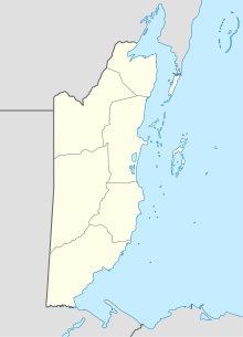
Hector Silva airstrip is an airport located in Cayo District serving Belmopan, the capital city of Belize. The runway is on the northern edge of the city off the George Price Highway, and has a small terminal building.
Chan Chich Airstrip is an airport serving the Chan Chich Lodge and the Gallon Jug Estate in the Orange Walk District of Belize. The airport is 6 kilometres (4 mi) east of the border with Guatemala.
Capitán José Daniel Vazquez Airport, also known as Puerto San Julián Airport or San Julián Airport, is an airport serving Puerto San Julián, a town on San Julian Bay in the Santa Cruz Province of Argentina. The airport is 4 kilometres (2 mi) west of the town.
Río Turbio Airport is an airport serving Río Turbio, a town in the Santa Cruz Province of Argentina. The airport is just south of 28 de Noviembre, a town 10 kilometres (6 mi) southeast of Rio Turbio.
Tolhuin Lago Fagnano Airport is a public use airport located 2 kilometres (1 mi) northeast of Tolhuin, a lakeside village in the Tierra del Fuego Province of Argentina.
Melinda Airport is an airstrip just east of Hope Creek, a village in the Stann Creek District of Belize. The gravel runway is on the south edge of the Melinda Forest Reserve, and just off the Hummingbird Highway.
Manatee Airport is a public use airport serving the rural community of Spanish Lookout, Cayo District, Belize.
Orange Walk Airport is a public use airport 3 kilometres (2 mi) southwest of Orange Walk Town, Orange Walk District, Belize. The airport was also known as Tower Hill Airport.
Silver Creek Airport is an airport serving the Stann Creek District, Belize. The rural airport is 7 kilometres (4 mi) inland from the Caribbean coast, and 6 kilometres (4 mi) northeast of Santa Cruz.
Matthew Spain Airport, formerly called Central Farm Airstrip, is a public use airport serving San Ignacio, a town in the Cayo District of Belize. The airport is 5 kilometres (3 mi) northeast of Santa Elena.
Frutillar Airport is an airport serving Frutillar, a town at the western end of Llanquihue Lake in the Los Lagos Region of Chile.
Puerto Sur Airport is an airport serving Isla Santa María, a Pacific island in the Bío Bío Region of Chile. The island is 31 kilometres (19 mi) west of Coronel.
El Mirador Airport, is an airport just southeast of Puerto Varas, a city in the Los Lagos Region of Chile. Puerto Varas is on the southwest shore of Llanquihue Lake.
Las Vegas Airport is an airport 4 kilometres (2.5 mi) east of Río Dulce, a village in Izabal Department, Guatemala.
Bananera Airport is an airport serving the city of Morales in Izabal Department, Guatemala.
Copán Ruinas Airport is a newly completed airport serving the town of Copán Ruinas in Honduras. The runway is approximately 20 kilometres (12 mi) east of the town.
Putumayo Airport is an airport serving the Putumayo River village of Puerto El Carmen de Putumayo in Sucumbíos Province, Ecuador. The runway is in a bend of the river 1 kilometre (0.6 mi) east of the village.