Mang Gui Kiu

Last updated • 3 min readFrom Wikipedia, The Free Encyclopedia

Mang Gui Kiu (also called: Haunted Bridge, Ghost Bridge) (Chinese :猛鬼橋) is a bridge situated in Tsung Tsai Yuen (松仔園), Tai Po Kau, Tai Po District, New Territories, Hong Kong. It was originally named Hung Shui Kiu (Bridge of Flooding) for being frequently overflown by heavy rains. In 1955, a group of teachers and students from St. James' Settlement died in an accident on a day of heavy rain. Ghost haunting stories related to the incident have continued in the area ever since. [1]

Contents

Incident

Tsung Tsai Yuen is a popular picnic area due to its convenient transportation and natural scenery of trees and a miles-long river.

On 28 August 1955 at around 1:30 in the afternoon, a group of teachers and students from St. James' Settlement on a week-long camp in the nearby Tai Po Rural Orphanage were having a final picnic at Tsung Tsai Yuen before returning home. An unexpected rain came, so they sought shelter under the bridge, but most were washed away to the lower course of the river by a sudden landslide. 28 of them died with only few alive. [2]

Ghost haunting stories related to the accident has never stopped after the accident. Ashen-faced children are said to wave to passing cars and hikers at night. Drivers claim to see white shapes flitting across the road nearby and mini-bus drivers said some of their passengers vanished once they got off the bus. Some families living at the area also claim to see their children holding hands and playing with air multiple times.

Still, in tradition Chinese culture, it is believed one need not to be afraid of supernatural if he is an upright man who has never affront any spirits. It was said a bus driver was driving past the Mang Gui Kiu without any passengers on board. A woman with long hair and pale face got on the bus. But the driver only found joss paper in the cashbox. The angry driver shouted ‘Lady, please pay the fee!’ but received no answer. He found that there was nobody on the bus. He reckoned the woman was a ghost but stayed calm and kept on driving not to offend the spirit. When he drove to the next bus stop, the signal light was on. He stopped the bus and opened the door but suddenly heard a voice saying, "Thank you."

Myth

It was said Dan Kwai Village near Mang Gui Kiu was an execution ground during the Second Sino-Japanese War. The blood of the deceased washed into the sea and the water became red. Therefore, the bridge was named Hung Shui Kiu (and later also called the Mang Gui Kiu), in which "Hung" means "flood" and sounds the same as the word "red" in Chinese language. Years later, villagers heard the marching sound of soldiers and witnessed a ghost at midnight. But the truth as to whether executions were indeed carried out at the village is unknown.

Present

Stone Plaque Stone plague 1955.jpg
Stone Plaque

After the accident, the Tai Po Tsat Yeuk Rural Committee erected a stone plaque to commemorate the tragedy and to placate the restless spirits.

To avoid similar accident from happening, the Hong Kong Government constructed a dam on the head-stream to reduce impulse generated by the flash floods. The downstream area where bodies are found was turned to a private housing estates.

The original Mang Gui Giu has need replaced by a reinforced concrete bridge after several road works and thus no longer exists. Yet, constant car accidents on Tai Po Road close to the original Mang Gui Giu site continues to bring more para-normality to the haunting place.

Related Research Articles

<span class="mw-page-title-main">Yuen Long District</span> District in Hong Kong, China

Yuen Long District is one of the districts of Hong Kong. Located in the northwest of the New Territories, it had a population of 662,000 in 2021

<span class="mw-page-title-main">Sheung Shui</span>

Sheung Shui is an area in the New Territories, Hong Kong. Sheung Shui Town, a part of this area, is part of the Fanling–Sheung Shui New Town in the North District of Hong Kong. Fanling Town is to its southeast.

Castle Peak Road is the longest road in Hong Kong. Completed in 1920, it runs in the approximate shape of an arc of a semi-circle. It runs West from Tai Po Road in Sham Shui Po, New Kowloon, to Tuen Mun, then north to Yuen Long then east to Sheung Shui, in the very north of the New Territories. It is divided into 22 sections. It serves south, west and north New Territories, being one of the most distant roads in early Hong Kong.

<span class="mw-page-title-main">Tai Po</span> Area in Hong Kong

Tai Po is an area in the New Territories of Hong Kong. It refers to the vicinity of the traditional market towns in the area presently known as Tai Po Old Market or Tai Po Kau Hui (大埔舊墟) on the north of Lam Tsuen River and the Tai Po Hui on Fu Shin Street on the south of the Lam Tsuen River, near the old Tai Po Market railway station of the Kowloon-Canton Railway. Both market towns became part of the Tai Po New Town in the late 1970s and early 1980s. In present-day usage, "Tai Po" may refer to the area around the original market towns, the Tai Po New Town, or the entire Tai Po District.

Tai Po Road is the second longest road in Hong Kong. It spans from Sham Shui Po in Kowloon to Tai Po in the New Territories of Hong Kong. Initially, the road was named Frontier Road.

<span class="mw-page-title-main">Yuen Long Town</span> Human settlement in New Territories, Hong Kong

Yuen Long Town is located in the district centre of Yuen Long District, New Territories, Hong Kong. It is the heart of Yuen Long and Yuen Long New Town, with a population of around 200,000.

<span class="mw-page-title-main">Shap Pat Heung</span> Human settlement in Hong Kong

Shap Pat Heung is an area in the New Territories of Hong Kong. Located south of Yuen Long and northeast of Tai Tong, the area occupies the plain north of hills of Tai Lam. The Cantonese name 'Shap Pat Heung' means 'eighteen villages' at its beginning. It was later expanded to thirty villages. Administratively, it is part of the Yuen Long District.

<span class="mw-page-title-main">Tai Po Kau</span>

Tai Po Kau is an area and a village south of the town of Tai Po in Hong Kong, which was the site of the former Tai Po Kau station on the Kowloon–Canton Railway. It is located at a river estuary that empties into Tolo Harbour.

Articles related to Hong Kong include:

There are three plains in Hong Kong, in the northern New Territories. These plains are Yuen Long, Fanling, and Tai Po.

<span class="mw-page-title-main">Yuen Long Kau Hui</span>

Yuen Long Kau Hui is an area in Yuen Long, Yuen Long District, in the western New Territories of Hong Kong.
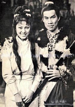
<i>The Legend of the Condor Heroes</i> (1976 TV series) Hong Kong TV series or program

The Legend of the Condor Heroes is a Hong Kong television series adapted from Louis Cha's novel of the same title. The series was first broadcast on CTV in Hong Kong in 1976.

<span class="mw-page-title-main">New towns of Hong Kong</span> Newly developed towns in the 20th century

The Hong Kong government started developing new towns in the 1950s to accommodate Hong Kong's booming population. During the first phase of development, the newly developed towns were called "satellite towns", a concept borrowed from the United Kingdom, of which Hong Kong was a colony. Kwun Tong, located in eastern Kowloon, and Tsuen Wan, located in the south-west of the New Territories, were designated as the first satellite towns, when the urban area in Hong Kong was still relatively small, restricted to the central and western parts of Kowloon Peninsula and the northern side of Hong Kong Island. Wah Fu Estate was also built in a remote corner on the southern side of Hong Kong Island, with similar concepts but at a smaller scale.

Tin Sam Tsuen or Tin Sam Village, sometimes transliterated as Tin Sum Tsuen, is the name of several villages in Hong Kong:

<span class="mw-page-title-main">Hung Shui Hang Reservoir</span> Irrigation reservoir in New Territories, Hong Kong

Hung Shui Hang Reservoir is a reservoir located to the north of Kau Keng Shan, Tuen Mun, New Territories, Hong Kong. It is located at the northwestern edge of Tai Lam Country Park and less than one kilometre away from Lam Tei Reservoir. Like Lam Tei Reservoir, it is part of Tai Lam Chung Reservoir's further water supply plan and an irrigation reservoir. The reservoir is divided into two reservoirs. The water from the reservoir flows through Tan Kwai Tsuen and Chung Uk Tsuen and then through Hung Shui Kiu, passing through the west side of Tin Shui Wai and finally empties into the Deep Bay.

References

  1. Hong Kong & Macau - Page 117 2006 -"The main entrance and the information centre are at the village of Tsung Tsai Yuen in the northernmost part of the reserve along Tai Po Rd. TAI PO KAU NATURE RESERVE Map pp404-5 Tai Po Rd; bus 70 or 72 The Tai Po Kau Nature
  2. Lam, Tiffany. "Haunted Hong Kong: Read if you dare".

Coordinates: 22°25′57″N114°11′07″E / 22.432595°N 114.185364°E / 22.432595; 114.185364