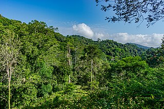
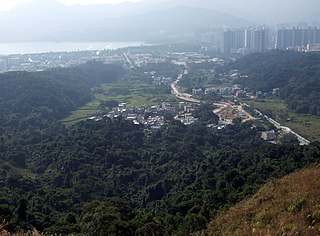
The ecology of Hong Kong is mostly affected by the results of climatic changes. Hong Kong's climate is seasonal due to alternating wind direction between winter and summer.

The Sai Kung Peninsula is a peninsula in the easternmost part of the New Territories in Hong Kong. Its name comes from Sai Kung Town in the central southern area of the peninsula. The southern part of the peninsula is administered by Sai Kung District,the north by Tai Po District and the northwest by Sha Tin District.
The Shing Mun Country Park is a country park of Hong Kong,hugging the Shing Mun Reservoir.

Lion Rock Country Park is a country park,located in the New Territories,Hong Kong. It consists of approximately 5.57 square kilometres (2.15 sq mi) of land,including Lion Rock and Mong Fu Shek and their surrounding scenic hillsides,of which 3.48 square kilometres (1.34 sq mi) is forestry plantation.

Out of the total 1,092 km2 land in Hong Kong,three-quarters is countryside,with various landscapes including beaches,woodlands,and mountain ranges being found within the small territory. Most of Hong Kong's parks have abundant natural diversity,usually containing over 1,000 species of plants.

Plover Cove Country Park is a country park in Hong Kong located in the Northeastern New Territories. The original country park was established on 7 April 1978,covering 4,594 hectares of natural terrain in the administrative North District and Tai Po District. A northern extension to the park,Plover Cove (Extension) Country Park,was designated on 1 June 1979,covering the Double Haven islets and Ping Chau.

Golden Hill Country Park or Kam Shan Country Park,also known in Hong Kong as Monkey Hill,established on 24 June 1977,is a country park located in the ranges north of Kowloon,Hong Kong. It covers an area of 3.37 square kilometres (1.30 sq mi). Most of the area is covered by the Kowloon Group of Reservoirs. Inside the park,there are jogging trails,barbecue and picnic areas,which are easily accessible from Tai Po Road via waterworks access roads. The park takes its name from the 369 metres (1,211 ft) peak,Golden Hill or Kam Shan (金山),which is the highest feature in the area.

Kadoorie Farm and Botanic Garden (KFBG),formerly known as Kadoorie Experimental and Extension Farm (嘉道理試驗及推廣農場),or Kadoorie Farm (嘉道理農場),was originally set up to aid poor farmers in the New Territories in Hong Kong. It later shifted its focus to promote biodiversity conservation in Hong Kong and south China,and greater environmental awareness. It is located near Pak Ngau Shek,encompassing Kwun Yam Shan in the central New Territories;The Farm was built in a valley with streams,woodlands and terraces in 1956 by the Kadoorie Agricultural Aid Association. Now it is managed to integrate nature conservation,including a rescue and rehabilitation programme for native animals,along with holistic education and practices in support of a transition to sustainable living. The farm attracts about 3000 to 5000 visitors per week.

The Amani Forest Reserve,officially listed as Amani Nature Forest Reserve is a protected area located the Muheza and Korogwe Districts in the Tanga Region of Tanzania. The nature reserve was established in 1997 in order to preserve the unique flora and fauna of the East Usambara Mountains. The East and West Usambara Mountains are a biodiversity hotspot. The Amani Nature Reserve includes tropical cloud forest habitats.

Kau To Hang is a river in Sha Tin District,New Territories,Hong Kong. Its source starts near Cheung Lek Mei,inside Tai Po Kau Nature Reserve. It flows eastward past Nim Au,Ma Niu,Kau To,collecting minor streams on the way. Finally,it empties into Sha Tin Hoi,part of Tolo Harbour.

Tai Po Kau is an area and a village south of the town of Tai Po in Hong Kong,which was the site of the former Tai Po Kau station on the Kowloon–Canton Railway. It is located at a river estuary that empties into Tolo Harbour.

Lai Chi Wo is a Hakka village near Sha Tau Kok,in the northeastern New Territories of Hong Kong. It is described as a "walled village" by some sources. Lai Chi Wo is located within Plover Cove Country Park and near Yan Chau Tong Marine Park.

Port Shelter,known in Cantonese as Ngau Mei Hoi,is a harbour south of Sai Kung Peninsula in Hong Kong. The water body connects to Inner Port Shelter,as well as Hebe Haven (白沙灣),Rocky Harbour (糧船灣海) and other water body. Outer Port Shelter,is situated at the mouth of the harbour.

Yim Tin Tze is a small offshore island in Sai Kung District,Hong Kong.
The Hong Kong Bird Watching Society is an environmental non-governmental organization dedicated to the conservation of birds and their habitats in Hong Kong,a territory on the southern coast of China. It is a BirdLife International affiliated organization. The emblem of the HKBWS is the Chinese egret which visits Hong Kong on migration and used to breed in the territory.

Sham Chung is a Hakka village and an area of Neolithic settlement in Hong Kong. It is located in the south of Tolo Channel,beside Three Fathoms Cove on the Sai Kung Peninsula. Administratively,it is part of Tai Po District.
Mang Gui Kiu is a bridge situated in Tsung Tsai Yuen (松仔園),Tai Po Kau,Tai Po District,New Territories,Hong Kong. It was originally named Hung Shui Kiu for being frequently overflown by heavy rains. In 1955,a group of teachers and students from St. James' Settlement died in an accident on a day of heavy rain. Ghost haunting stories related to the incident have continued in the area ever since.

Tai Mo Shan is the highest peak in Hong Kong,with an elevation of 957 metres (3,140 ft) above the Hong Kong Principal Datum,or around 956 metres (3,136 ft) above mean sea level. It is located at approximately the geographical centre of the New Territories.

Maulino forest is a forest type naturally growing in the Chilean Coast Range of Central Chile from latitude 35°55 to 36°20 S. The forest grows in the transition zone between Mediterranean climate and humid temperate climate. Precipitation varies from 1000 to 700 mm/a and is concentrated in winter. According to geographers Humberto Fuenzalida and Edmundo Pisano the forest is one of mesophytes on the transition zone of temperate rain forests.

Fung Yuen is an area and a village located northwest of Tolo Harbour,in Tai Po,Tai Po District,Hong Kong.


