
The Southern District is one of the 18 districts of Hong Kong. It is located in the southern part of Hong Kong Island. It had a population of 274,994 in 2016.

Tai Lam Country Park,established on 23 February 1979,is a country park located in Tai Lam,at the south of Yuen Long Town,Kam Tin and Shek Kong and east of Tuen Mun Town,in the western New Territories of Hong Kong. This country park has an area of 54 km².

Lung Fu Shan Country Park,established 18 December 1998,is a country park in the Central and Western District of Hong Kong. It covers the densely vegetated slopes of Lung Fu Shan,and includes the disused Pinewood Battery as well as the Pinewood Garden picnic area,providing a scenic backdrop to the residential and commercial districts of Hong Kong Island.

Ma On Shan Country Park is a park located in the central neck of the Sai Kung Peninsula in the eastern New Territories of Hong Kong. The park covers an area of 28.8 square kilometres (11.1 sq mi) and links Sai Kung Country Park and Lion Rock Country Park to form an extensive recreation area on the Ma On Shan massif.

Mount Parker is the second-highest peak on Hong Kong Island,after Victoria Peak. It is the 40th-highest peak in the territory of Hong Kong.
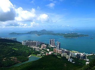
Pok Fu Lam (薄扶林) or Pokfulam is a residential area on Hong Kong Island,at the western end of the Southern District. It is a valley between Victoria Peak and Mount Kellett,around Telegraph Bay.
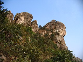
Lion Rock,or less formally Lion Rock Hill,is a mountain in Hong Kong. It is located in Sha Tin District,between Kowloon Tong of Kowloon and Tai Wai of the New Territories,and is 495 metres (1,624 ft) high. The peak consists of granite covered sparsely by shrubs. The Kowloon granite,which includes Lion Rock,is estimated to be around 140 million years old.

Waterfall Bay or Pok Po Wan is a bay in Pok Fu Lam,Hong Kong Island,Hong Kong. Located on the East Lamma Channel off the coast of Wah Fu Estate and Cyberport at Telegraph Bay,it is named after the waterfall that flows into it. The fresh water from this waterfall is said to have given the city its name –the translation of Hong Kong's name in Cantonese 香港means "fragrant harbour". An eponymous park is now situated around the area.

Kowloon Peak,also known as Fei Ngo Shan,is a 1,975-foot-tall (602 m) mountain in the northeast corner of New Kowloon,Hong Kong,situated in Ma On Shan Country Park. With the summit located just to the east of the border between Wong Tai Sin and Sai Kung districts,it is the tallest mountain in Kowloon,and is crossed by both the Wilson Trail and the MacLehose Trail.

Lantau Peak or Fung Wong Shan is a mountain in Lantau South Country Park,Lantau Island,Hong Kong. It is the second highest peak in Hong Kong and the highest point on Lantau Island,with a height of 934 metres (3,064 ft) above the Hong Kong Principal Datum,or around 933 metres (3,061 ft) above mean sea level.

Pok Fu Lam Reservoir,formerly known as the Pokefulum Reservoir,is the first reservoir in Hong Kong. It is located in a valley in Pok Fu Lam. It is actually two reservoirs with capacity of 260,000 m3.

High West or Sai Ko Shan,is a mountain on Hong Kong Island with a height of 494 m (1,621 ft)
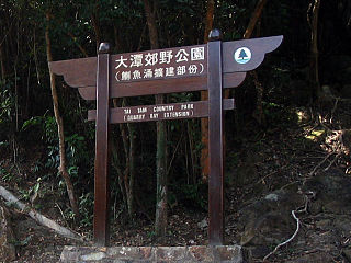
Tai Tam Country Park,also known simply as Quarry Bay Country Park (鰂魚涌郊野公園),on the eastern side of Hong Kong Island,is one of the twenty four statutory country parks in Hong Kong,and the twentieth to be so designated,in 1979.

The Dragon's Back is a mountain ridge in southeastern Hong Kong Island,Hong Kong that passes through Shek O Peak. It lies within the Shek O Country Park. In 2019,the Dragon's Back Trail was selected by CNN as one of the world's 23 best trails. Dragon's Back is part of Stage 8 of the Hong Kong Trail.

The Tai Tam Waterworks Heritage Trail is a heritage trail in Hong Kong that comprises 22 waterworks structures with historical value near the Tai Tam group of reservoirs. The Trail is about 5 km long and takes about two hours to complete. The Trail is located along the Tai Tam Reservoir Road with entrance at Wong Nai Chung Gap near Hong Kong Parkview or at the junction of Tai Tam Road and Tai Tam Reservoir Road. Ten information stations were established en route to introduce the functions and historic values of the structures. Guided tours will be organised for schools and non-profit making organisations.
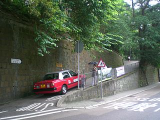
Hatton Road,also known as "The Morning Trail",is a paved,steep,motor vehicle-free road in western Hong Kong Island,Hong Kong,on Lung Fu Shan. It is largely used as a fitness trail for walking,running,and cycling.

Kai Kung Leng is a mountain range in Lam Tsuen Country Park,New Territories,Hong Kong.
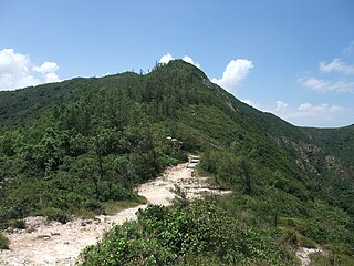
Sai Wan Shan is a hill that lies within Sai Kung East Country Park,south of Tai Long Wan,on the Sai Kung Peninsula in Hong Kong. It has a height of 314 metres (1,030 ft) above sea level. The hill is reasonably easy for hikers and is a popular site for hiking in Hong Kong. A portion of MacLehose Trail Stage 2 is built along the ridge of this hill.

Tin Wan Shan is a hill in southern Hong Kong.

Wa Mei Shan is a mountain in northeastern Hong Kong on Sai Kung Peninsula. It is located within Tai Po District.


