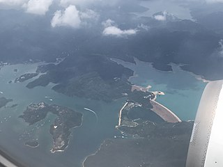
The Southern District is one of the 18 districts of Hong Kong. It is located in the southern part of Hong Kong Island and the largest part of the island. It had a population of 274,994 in 2016.
Hong Kong has a long coastline that is full of twists and turns with many bays and beaches. Many of them are well sheltered by mountains nearby, as Hong Kong is a mountainous place. As a result, large waves seldom appear at the bays, making them suitable for human swimming.

North District is the northernmost district of the 18 districts of Hong Kong. It is located in the northeastern part of the New Territories. The new town of Fanling–Sheung Shui is within this district. It had a population of 298,657 in 2001. The district has the second lowest population density in Hong Kong.

Tung Ping Chau is an island in Hong Kong, part of Hong Kong UNESCO Global Geopark. It is also known as Ping Chau (平洲). Tung is prepended to the name at times so as to avoid possible confusion with Peng Chau, another island in Hong Kong with an identically pronounced name in Cantonese. Administratively, the island is part of the Tai Po District in the New Territories.

Shek O is an area of the south-eastern part of Hong Kong Island, in Hong Kong. It can refer to Shek O village, Shek O Peninsula or Shek O Headland. Administratively, they are part of Southern District.

The kai-to, sometimes kaito or kaido is a type of small, motorised ferry that operates in Hong Kong. They are usually used to serve remote coastal settlements in the territory's outlying islands.

Sheung Shui is an area in the New Territories, Hong Kong. Sheung Shui Town, a part of this area, is part of the Fanling–Sheung Shui New Town in the North District of Hong Kong. Fanling Town is to its southeast.

Ap Chau, also known as Robinson Island, with a size of 0.04 km² is an island in the Crooked Harbour, in the north-eastern New Territories of Hong Kong. It is located in Ap Chau Bay. Islets located close by include Ap Chau Pak Tun Pai, Ap Chau Mei Pak Tun Pai, Ap Lo Chun, Ap Tan Pai and Kau Tau Shek. Ap Chau is considered as the smallest inhabited island in Hong Kong.

Crooked Harbour or Kat O Hoi is a harbour at the northeast of New Territories, Hong Kong. The harbour is connected to Double Haven and the bigger sea of Mirs Bay. Crooked Island, also known as Kat O, and several islands, including Ap Chau, form the harbour with the mainland New Territories.

Sai Kung East Country Park is a country park on the Sai Kung Peninsula in Hong Kong, measuring 44.77 square kilometres (17.29 sq mi). It opened in 1978 and has features including:

Port Shelter, known in Cantonese as Ngau Mei Hoi, is a harbour south of Sai Kung Peninsula in Hong Kong. The water body connects to Inner Port Shelter, as well as Hebe Haven (白沙灣), Rocky Harbour (糧船灣海) and other water body. Outer Port Shelter, is situated at the mouth of the harbour.

Shek Ngau Chau is an uninhabited island of Hong Kong within Tai Po District. It has an area of 0.92 hectares and is located in Mirs Bay, in the north-east of the New Territories.

Tsam Chuk Wan is a bay of the Sai Kung Peninsula in Hong Kong. By extension, it is also the name of the area around the bay. Tsam Chuk Wan Village (斬竹灣村) is one of the villages located within this area.

Shelter Island, known in Cantonese as Ngau Mei Chau, is an island located in the water body Port Shelter, in the Sai Kung District, the New Territories, Hong Kong S.A.R., China.

Tai Tau Chau also known for its less popular name Urn Island, is an island in the water body Sham Tuk Mun (深篤門), Sai Kung District, Hong Kong. Inner Port Shelter and Rocky Harbour are in close proximity to the island.
The Nine Alliances of Lek Yuen or Kau Yeuk was a regional organization of various groups in Sha Tin Valley, Hong Kong.

The Tung O Ancient Trail on Lantau Island, Hong Kong, was once an important passage for villagers to commute between Tung Chung and Tai O. The coastal trail starts at modern Tung Chung in the east, passes mangroves and bays and ends in the traditional Tai O fishing village. About 10 km in length, it is one of the most popular walking trails in Northwest Lantau.


