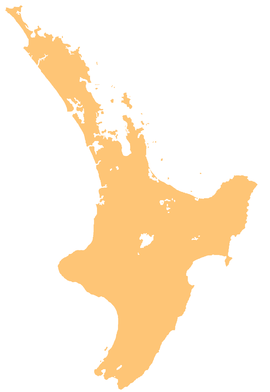
Stratford is the only town in Stratford District, and the seat of the Taranaki region, in New Zealand's North Island. It lies beneath the eastern slopes of Mount Taranaki, approximately halfway between New Plymouth and Hāwera, near the geographic centre of the Taranaki Region. The town has a population of 6,320, making it the 62nd largest urban area in New Zealand, and the fourth largest in Taranaki.

Mount Taranaki is a dormant stratovolcano in the Taranaki region on the west coast of New Zealand's North Island. At 2,518 metres (8,261 ft), it is the second highest mountain in the North Island, after Mount Ruapehu. It has a secondary cone, Fanthams Peak, 1,966 metres (6,450 ft), on its south side.

The Whanganui River is a major river in the North Island of New Zealand. It is the country's third-longest river, and has special status owing to its importance to the region's Māori people. In March 2017 it became the world's second natural resource to be given its own legal identity, with the rights, duties and liabilities of a legal person. The Whanganui Treaty settlement brought the longest-running litigation in New Zealand history to an end.

Manganui Ski Area, located in Taranaki, in New Zealand's North Island is a club skifield. Like all club fields, it has accommodation onsite, in the form of the 33-bed Manganui Lodge. It has 3 rope ski tows and a T-bar covering a beginner-intermediate terrain of 59 hectares. The elevation ranges from 1260 to 1680 m.
Waipuku is a settlement in inland Taranaki, in the western North Island of New Zealand. It is located between Stratford and Inglewood on State Highway 3.
The Taranaki Waste Lands Board was constituted under the Taranaki Waste Lands Act 1874 to manage the sale of confiscated Māori land.
Kaimata is a locality in Taranaki, New Zealand. Inglewood is about 7.5 km to the west. The Manganui River flows past to the west. Kaimata was one of many townships established to service the dairy industry.
Mimi is a locality in northern Taranaki, in the North Island of New Zealand. It is located on State Highway 3 close to the shore of the North Taranaki Bight, 6 kilometres north-east of Urenui and 26 km south-west of Ahititi. The Mimi River flows past the settlement into the North Taranaki Bight.
The Manawapou River is a river of the Taranaki Region of New Zealand's North Island. It flows southwest, from its origins in rough hill country to the northeast of Hāwera, to reach the South Taranaki Bight between Hāwera and Patea.
Manganui River may refer to the following New Zealand rivers:

The Manganuioteao River is a river of the centre of New Zealand's North Island. It has its source in numerous streams and small rivers which flow west from the slopes of Mount Ruapehu, though the main course of the river flows predominantly southwest through rugged hill country to meet with the Whanganui River 10 kilometres (6 mi) north of Pipiriki, at the edge of the Whanganui National Park.

The Mangaturuturu River is a river at the centre of New Zealand's North Island. One of the headwaters of the Manganui o te Ao River, it flows west from the slopes of Mount Ruapehu, joining with numerous other small rivers to become the Manganui o Te Ao 20 kilometres (12 mi) northwest of Ohakune. It has also been known as Sulphur River, or Sulphur Creek. In April 1975 a lahar raised the river to 2.1 m above its flood level. There were also lahars in 1969 and September 1995. Earlier lahars were around 8,500 and 10,500 years ago.
The Omaru River is a river of the Northland Region of New Zealand's North Island. It flows generally north from several streams with origins northwest of Paparoa, reaching the Manganui River 20 kilometres northeast of Ruawai.
The Tauraroa River is a river of the Northland Region of New Zealand's North Island. It flows west from near the North Auckland Peninsula's east coast 15 kilometres southwest of Whangārei, reaching the Manganui River 15 kilometres east of Dargaville.

The Waingongoro River is a river of the Taranaki Region of New Zealand's North Island. It flows initially southeast from the slopes of Taranaki/Mount Egmont and passes through the town of Eltham before veering southwest to meet the Tasman Sea five kilometres west of Hāwera, at Ohawe Beach.
Waikato's Manganui River is located close to the west coast of New Zealand's North Island. It flows south, parallel to the coast of the North Taranaki Bight, before flowing into the Awakino River 5 kilometres (3 mi) from the latter's mouth.

Stratford District is a territorial authority district in the North Island of New Zealand. The Stratford District Council is headquartered in the only town, Stratford. The district is divided between the Manawatū-Whanganui region and the Taranaki region.

The Waiaua River is a river of the Taranaki Region of New Zealand's North Island. It flows southwest from the slopes of Mount Taranaki to reach the Tasman Sea at Ōpunake.
The Motukawa Power Station is a hydroelectric power facility in Taranaki in New Zealand which makes use of water from the Manganui River. Water is drawn from behind a weir on the Manganui River near Tariki and diverts this water through a race to Lake Ratapiko and then through penstocks to the Motukawa Power Station. The power station discharges into the Mākara Stream, a tributary of the Waitara River.
Tariki is a small farming community immediately to the east of Mount Taranaki in the west of New Zealand's North Island. It lies on SH 3 halfway between the towns of Inglewood and Stratford. Several small streams, all tributaries of the Manganui River, pass close to Tariki.


