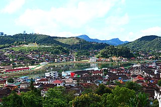
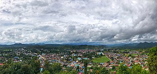
Mankat is a large village in Banmauk Township, Katha District, in the Sagaing Region of northern-central Burma. The area is known for its Mankat Forest reserve.
Mankat is a large village in Banmauk Township, Katha District, in the Sagaing Region of northern-central Burma. The area is known for its Mankat Forest reserve.
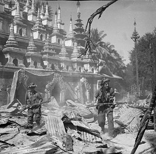
S. St. R. Korper, an Assistant Superintendent, was responsible for building a 46 miles (74 km) road from Mankat to Nawpawng, according to a 1920 British report. [1] In World War II, Bernard Fergusson, Baron Ballantrae, then a major, passed through Mankat via Bonchaung Gorge with the Black Watch unit of the 77th Indian Infantry Brigade.in March 1943. [2] The Japanese had a base at Mankat, which was bombed by the US along with Mogok on 4 January 1945. [3] During conflict in the village in 1980, four houses were burned down. [4]
The village lies in the Nam Pang River valley to the south of Banmauk, [5] and is surrounded by Mankat Forest, a protected forest reserve. [6]

The Tenth Air Force is a unit of the U.S. Air Force, specifically a numbered air force of the Air Force Reserve Command (AFRC). 10 AF is headquartered at Naval Air Station Fort Worth Joint Reserve Base/Carswell Field, Texas.

The Nakajima Ki-43 Hayabusa was a single-engine land-based tactical fighter used by the Imperial Japanese Army Air Force in World War II.

The Burma campaign was a series of battles fought in the British colony of Burma. It was part of the South-East Asian theatre of World War II and primarily involved forces of the Allies; the British Empire and the Republic of China, with support from the United States. They faced against the invading forces of Imperial Japan, who were supported by the Thai Phayap Army, as well as two collaborationist independence movements and armies, the first being the Burma Independence Army, which spearheaded the initial attacks against the country. Puppet states were established in the conquered areas and territories were annexed, while the international Allied force in British India launched several failed offensives. During the later 1944 offensive into India and subsequent Allied recapture of Burma the Indian National Army, led by revolutionary Subhas C. Bose and his "Free India", were also fighting together with Japan. British Empire forces peaked at around 1,000,000 land and air forces, and were drawn primarily from British India, with British Army forces, 100,000 East and West African colonial troops, and smaller numbers of land and air forces from several other Dominions and Colonies.

During the Second World War (1939–1945), India was controlled by the United Kingdom, with the British holding territories in India including over six hundred autonomous Princely States; British-occupied India officially declared war on Nazi Germany in September 1939. The British Raj, as part of the Allied Nations, sent over two and a half million soldiers to fight under British command against the Axis powers. The British government borrowed billions of pounds to help finance the war. India also provided the base for American operations in support of China in the China Burma India Theater.

The South-East Asian Theatre of World War II was the name given to the campaigns of the Pacific War in Burma, Ceylon, India, Thailand, the Philippines, Indochina, Malaya and Singapore. Conflict in this theatre began when the Empire of Japan invaded French Indochina in September 1940 and rose to a new level following the Attack on Pearl Harbor, and simultaneous attacks on Hong Kong, the Philippines, Thailand, Singapore and Malaya on 7 and 8 December 1941. The main landing at Singora on the east side of the Isthmus of Kra preceded the bombing of Pearl Harbor by several hours. Action in the theatre officially ended on 9 September 1945.

The Battle of Kohima proved the turning point of the Japanese U-Go offensive into India in 1944 during the Second World War of 1939-1945. The battle took place in three stages from 4 April to 22 June 1944 around the town of Kohima, the capital of Nagaland in northeast India. From 3 to 16 April the Japanese attempted to capture Kohima ridge, a feature which dominated the road by which the besieged British and Indian troops of IV Corps at Imphal were supplied. By mid-April the small British and Indian force at Kohima was relieved.

Ba Maw was a Burmese barrister and political leader, active during the interwar and World War II periods. He was 1st Burma Premier (1937–1939) and head of State of Burma (Myanmar) from 1943 to 1945.

Mogok is a city in the Pyin Oo Lwin District of Shan State of Myanmar, located 200 kilometres (120 mi) north of Mandalay and 148 kilometres (92 mi) north-east of Shwebo.

British rule in Burma lasted from 1824 to 1948, from the successive three Anglo-Burmese wars through the creation of Burma as a Province of British India to the establishment of an independently administered colony, and finally independence. The region under British control was known as British Burma. Various portions of Burmese territories, including Arakan or Tenasserim were annexed by the British after their victory in the First Anglo-Burmese War; Lower Burma was annexed in 1852 after the Second Anglo-Burmese War. The annexed territories were designated the minor province of British India in 1862.

The 36th Indian Infantry Division was an infantry division of the Indian Army during World War II. The division was subsequently redesignated as a British Army formation, the 36th Infantry Division in September 1944. It served in India and during the Burma Campaign. After the end of the war it was disbanded and its remaining British units were transferred to the British 2nd Infantry Division.
Battle of Yunnan-Burma Road was the name of the Chinese intervention to aid their British allies in the 1942 Burma Campaign. Its forces were composed of the Fifth, Sixth and Sixty-sixth Army under the command of the Chinese Expeditionary Force in Burma, commanded by Lt. General Joseph Stilwell, Lt. General Luo Zhuoying was his Executive Officer.

The United States detonated two nuclear weapons over the Japanese cities of Hiroshima and Nagasaki on August 6 and 9, 1945, respectively. The two bombings killed between 129,000 and 226,000 people, most of whom were civilians, and remain the only uses of nuclear weapons in armed conflict.

The Burma campaign in the South-East Asian Theatre of World War II was fought primarily by British Commonwealth, Chinese and United States forces against the forces of Imperial Japan, who were assisted to some degree by Thailand, the Burmese National Army and the Indian National Army. The British Commonwealth land forces were drawn primarily from the United Kingdom, British India and Africa.

Kyaukme is a town in northern Shan State of Burma. It is situated on the Mandalay - Lashio road, after Pyin Oo Lwin and Nawnghkio, and before Hsipaw, on what is now the Mandalay - Muse road, part of the Asian Highway route 14 (AH14). It is also connected to Momeik (Mongmit) in the Shweli River valley and Mogok with its ruby mines. Kyaukme can be reached by train on the Mandalay-Lashio railway line.

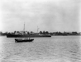
HMIS Indus was a Grimsby-class sloop of the Royal Indian Navy launched in 1934 and sunk during the Second World War in 1942. She was a slightly enlarged version of other vessels in the Grimsby class. She was named after the Indus River. Indus served mainly as an escort vessel, and she was therefore lightly armed. Her pennant number was changed to U67 in 1940.

Chakulia Airport is an airport in India. It is located southwest of Chakulia, a town and a notified area in Purbi Singhbhum district in the state of Jharkhand.

Hkamti Township or Khamti Township is a township in Hkamti District in the Sagaing Region of Burma (Myanmar). The principal town is Hkamti. As of 2014 the township had a population of 47,658 people and covered an area of 8,174 square kilometres (3,156 sq mi). The township is dominated by the Chindwin River and its tributaries and thickly forested areas. Nearly half the active working population are employed in agriculture, forestry or fishing. The township is a producer of rice, and has reserves of gold and jade being mined.

Khamo is a large village in Banmauk Township, Katha District, in the Sagaing Region of northern-central Burma.

Kutkai is a town and seat of Kutkai Township, in the Shan State of eastern-central Burma. It lies along National Highway 3, approximately 24 kilometres to the north of Lashio.

Gwebin is a village in Mogok Township, Pyin Oo Lwin District, in the Mandalay Region of central Burma. It is located 16 miles (26 km) west of Mogok. A track connects it to Shwenyaungbin and Mogok.