Manningford

Last updated

Manningford
Manningford Bruce - geograph.org.uk - 416644.jpg
Manningford Bruce
Wiltshire UK location map.svg
Red pog.svg
Manningford
Location within Wiltshire
Population405 (in 2011) [1]
OS grid reference SU138578
Civil parish
  • Manningford
Unitary authority
Ceremonial county
Region
Country England
Sovereign state United Kingdom
Post town Pewsey
Postcode district SN9
Dialling code 01672
Police Wiltshire
Fire Dorset and Wiltshire
Ambulance South Western
UK Parliament
Website The Manningfords
List of places
UK
England
Wiltshire
51°19′08″N1°48′11″W / 51.319°N 1.803°W / 51.319; -1.803 Coordinates: 51°19′08″N1°48′11″W / 51.319°N 1.803°W / 51.319; -1.803

Manningford is a civil parish in Wiltshire, England. The parish includes the villages of Manningford Abbots, Manningford Bohune and Manningford Bruce, and the hamlet of Manningford Bohune Common, together known as the Manningfords.

Contents

The parish is in the Vale of Pewsey which carries the upper section of the Salisbury Avon. Pewsey is about 2 miles (3.2 km) to the northeast; the nearest towns are Marlborough, 8 miles (13 km) northeast, and Devizes, 9 miles (14 km) to the west. The parish is long and narrow in shape, stretching from the Salisbury Avon valley in the northwest to higher downland towards Upavon, on the northern edge of Salisbury Plain. The A345 Pewsey–Upavon road passes to the south of the three villages.

History

Manningford Abbots or Abbas

The eastern third of the parish, so-called from its ownership by the Abbot of Hyde Abbey, Winchester. [2] The Abbot held it, together with the chapelry at Alton Priors, until the Dissolution of the Monasteries. In 1547 it went to the Seymour family (Dukes of Somerset and then Northumberland) until it was split up in 1768.

In 1428 there were fewer than ten households; by 1801 the population rose to 131, and to 165 by 1831. In 1931, shortly before Manningford Abbots was amalgamated with the other two parishes, the population was 121. [3]

Manningford Bohune

The western third of the parish, held by Amelric de Drewes in 1086. [2] The name is from Humphrey de Bohun in the 12th century (related to the Bohun Earls of Hereford). Formerly a detached tithing of Wilsford parish, lying about 2+12 miles (4.0 km) east of Wilsford village. In 1801 the population of the tithing was 163, rising to 283 in 1841. Wilsford and Manningford Bohune became separate civil parishes in 1871.

The northwestern boundary of the tithing was the Woodborough stream, a tributary of the Avon; [4] thus Bottlesford hamlet was within Manningford Bohune. [5] At some point after 1971, [6] boundary changes moved Bottlesford into North Newnton parish and transferred land north of the railway into Woodborough parish.

Manningford Bruce

The central third of the parish, held by Grimbald the Goldsmith in 1086, [2] named after the Norman William de Breuse in 1275. The site of a Roman villa is near the church. [7]

The population was 213 in 1801, increasing to 275 in 1851, then declining to reach 194 in 1931. [8] A small schoolroom was built c. 1841 in the south of the village; in 1881 around 80 pupils attended, including children from Abbots. [8] Numbers declined in the 1970s and the school closed in 1977. [9]

Swanborough Tump

Markers near Swanborough Tump Wilcot, Swanborough Tump (geograph 4793973).jpg
Markers near Swanborough Tump

The ancient parishes of Abbots and Bruce, and possibly Bohune, were within Swanborough Hundred. [10] One of the hundred's meeting-places was Swanborough Tump, a low earthwork in the north of Abbots parish, near the boundary with Wilcot. The site, now a scheduled monument, [11] is described in the Victoria County History as a bowl barrow [10] but more recently by Historic England as a medieval construction. [12] The tump was on an important east–west road. [13]

In the 20th century a stone with plaques was erected at the roadside near the tump, next to an unidentified older stone.

Religious sites

Parish church

Church of St Peter, Manningford Bruce St. Peter's church - geograph.org.uk - 1731857.jpg
Church of St Peter, Manningford Bruce

The parish church of Saint Peter at Manningford Bruce was described by Pevsner as "a very completely preserved Norman church". [14] The aisleless nave and the chancel are from the late 11th or early 12th centuries and are built in flint laid in a herringbone pattern. [8] There are three windows from the 12th century, [15] and the chancel arch has Norman carving. [16] Two windows were added in the 15th century. [15]

Careful restoration by J.L. Pearson in 1882 included reroofing and the rebuilding of the bell-turret and south porch. [17] Two stained glass windows were added, made by Clayton and Bell, who also painted the reredos. The building was designated as Grade I listed in 1964. [15]

The benefice was united with Manningford Abbots in 1924, together with the southern part of the benefice of Manningford Bohune, to form the parish of Manningford Bruce and Abbots. [18] The benefice was held in plurality with Everleigh from 1967, [19] and in 1975 became part of a team ministry [20] which today covers a wide area in the Pewsey Vale. [21] The former rectory, now known as Manningford Bruce House, is from the 18th century and has fragments of an earlier building. [22]

Chapel

Providence Chapel was built by Baptists on the main road at Manningford Bohune, and carries a date of 1869. The chapel continues in use. [23] [24]

Former churches

There was probably a parish church at Manningford Abbots in the 10th century and certainly one in 1291; its dedication is unknown. [25] The church was rebuilt in 1861–64 to designs by the architect S.B. Gabriel of Bristol. [14] It was declared redundant in 1984. [26] The rectory was a 17th-century timber-framed building, which from 1812 was encased in red brick and enlarged, with a five-bay facade; [27] the house was sold in the 1920s after the union with Manningford Bruce. [3]

Manningford Bohune was anciently a detached tithing of Wilsford. [28] The Church of All Saints was built in 1859 as a chapel of ease, in 13th-century style. [29] The chapelry was severed from Wilsford in 1924; its southern part was united with Manningford Bruce, and its northern part (including the church) was united with Woodborough to form the parish and benefice of Woodborough with Manningford Bohune. [18] The church was declared redundant in 1973 and is in residential use. [30]

Local government

The civil parish elects a parish council. It is in the area of Wiltshire Council unitary authority, which is responsible for all significant local government functions.

Until 1934 there were three parishes: Manningford Abbots, Bruce and Bohune. [3]

Railway

The Berks and Hants Extension Railway from Hungerford to Pewsey and Devizes was built across the north of the parish and opened in 1862. [31] Manningford Halt was opened in 1932, near the bridge carrying the road to Wilcot; it closed in 1966 when local services on the line were withdrawn. [32]

Notable people

Related Research Articles

<span class="mw-page-title-main">Charlton, Pewsey Vale</span> Human settlement in England

Charlton, in full Charlton St Peter, is a small village and civil parish in the Vale of Pewsey in the English county of Wiltshire. The village lies about 4 miles (6 km) southwest of Pewsey.

<span class="mw-page-title-main">All Cannings</span> Human settlement in England

All Cannings is a village and civil parish in the Vale of Pewsey in the English county of Wiltshire, about 4 miles (6 km) east of Devizes. The parish includes the nearby smaller settlement of Allington.

<span class="mw-page-title-main">Alton, Wiltshire</span> Human settlement in England

Alton is a civil parish in Wiltshire, England. The parish includes the adjacent villages of Alton Barnes and Alton Priors, and the nearby hamlet of Honeystreet on the Kennet and Avon Canal. It lies in the Vale of Pewsey about 6 miles (10 km) east of Devizes.

<span class="mw-page-title-main">Beechingstoke</span> Human settlement in England

Beechingstoke is a small village and civil parish in Wiltshire, England. It lies in the Vale of Pewsey about 5 miles (8 km) west of Pewsey and the same distance east of Devizes. The parish includes the hamlet of Broad Street and the northern part of the village of Bottlesford.

<span class="mw-page-title-main">Bishops Cannings</span> Human settlement in England

Bishops Cannings is a village and civil parish in the Vale of Pewsey in Wiltshire, England, 3 miles (5 km) north-east of Devizes. The parish includes the village of Coate and the hamlets of Bourton, Horton and Little Horton.

<span class="mw-page-title-main">Great Cheverell</span> Human settlement in England

Great Cheverell is a village and civil parish in Wiltshire, England, 5 miles (8.0 km) south of Devizes. In some sources the Latinized name of Cheverell Magna is used, especially when referring to the ecclesiastical parish.

<span class="mw-page-title-main">Easterton</span> Human settlement in England

Easterton is a village and civil parish in Wiltshire, England, 4 miles (6.4 km) south of Devizes. The parish includes the hamlets of Easterton Sands and Eastcott.

<span class="mw-page-title-main">Huish, Wiltshire</span> Human settlement in England

Huish is a small village and former civil parish in Wiltshire, England, 2 miles (3.2 km) northwest of Pewsey and 4 miles (6.4 km) southwest of Marlborough. It is on the south-facing edge of the Marlborough Downs, where the downs adjoin the Vale of Pewsey.

<span class="mw-page-title-main">Wilsford, Wiltshire</span> Human settlement in England

Wilsford is a small village and civil parish in the Vale of Pewsey in the English county of Wiltshire, about 4 miles (6 km) southwest of Pewsey.

<span class="mw-page-title-main">West Lavington, Wiltshire</span> Human settlement in England

West Lavington is a village and civil parish in Wiltshire, England, on the north edge of Salisbury Plain, on the A360 road between Devizes and Salisbury, about 5 miles (8 km) south of Devizes. The parish includes the hamlet of Littleton Panell.

<span class="mw-page-title-main">Woodborough, Wiltshire</span> Human settlement in England

Woodborough is a small village and civil parish in the Vale of Pewsey, Wiltshire, England, about 3.5 miles (5.6 km) west of Pewsey.

<span class="mw-page-title-main">Rushall, Wiltshire</span> Human settlement in England

Rushall is a small village and civil parish in Wiltshire, England, 8 miles (13 km) southeast of Devizes and 34 mile (1.2 km) northwest of Upavon on the A342 between Devizes and Andover. The village is near the River Avon in the Vale of Pewsey.

<span class="mw-page-title-main">Bottlesford</span> Human settlement in England

Bottlesford is a small village in Wiltshire, England, in the parish of North Newnton. It is in the Vale of Pewsey and is about 3 miles (4.8 km) west of Pewsey. There is a pub, the Seven Stars Inn.

<span class="mw-page-title-main">Marden, Wiltshire</span> Human settlement in England

Marden is a small village and civil parish 6 miles (9.7 km) southeast of Devizes in the county of Wiltshire, south west England. The parish is in the Vale of Pewsey which carries the upper section of the Salisbury Avon; to the south the parish extends into Salisbury Plain.

<span class="mw-page-title-main">Stanton St Bernard</span> Human settlement in England

Stanton St Bernard is a village and civil parish in the Vale of Pewsey, Wiltshire, England. Its nearest town is Devizes, about 6 miles (10 km) away to the west.

<span class="mw-page-title-main">North Newnton</span> Human settlement in England

North Newnton is a civil parish in Wiltshire, England, 2.5 miles (4.0 km) southwest of Pewsey. The parish is in the Vale of Pewsey which carries the upper section of the Salisbury Avon.

Swanborough was a hundred of the English county of Wiltshire, mostly lying in the centre of the county to the south of the town of Devizes. An area of the hundred reached several miles southwards into Salisbury Plain.

Manningford Halt is a former railway station which opened in 1932 in Manningford parish, Wiltshire, England on the Berks and Hants Extension Railway between Pewsey and Devizes. The halt closed in 1966 when local services were withdrawn.

<span class="mw-page-title-main">All Saints' Church, Manningford Bohune</span>

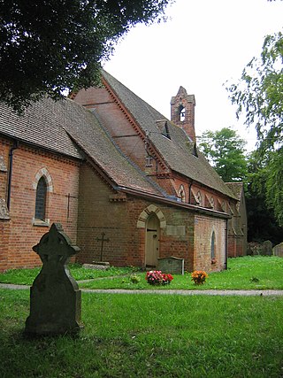
All Saints' Church is a former Church of England church in Manningford Bohune, Wiltshire, England. Designed by Whitley C. Clacy, the church was built in 1858–59 and declared redundant in 1973. It is now a private residence and has been a Grade II listed building since 1952.

References

  1. "Wiltshire Community History – Census". Wiltshire Council. Retrieved 6 March 2015.
  2. 1 2 3 Manningford in the Domesday Book
  3. 1 2 3 "Victoria County History: Wiltshire – vol 10, pp106-112 – Parishes: Manningford Abbots". British History Online. University of London. Retrieved 6 March 2015.
  4. "Hampshire Avon (East) and Woodborough Stream". Environment Agency – Catchment Data Explorer. Retrieved 19 August 2018.
  5. "Ordnance Survey 1:25,000 maps of Great Britain, sheet SU15". National Library of Scotland. 1958. Retrieved 19 August 2018.
  6. VCH Wilsford has Bottlesford in Manningford Bohune; current boundaries from Ordnance Survey Election Maps
  7. Historic England. "Site of probable Roman courtyard villa, Manningford Bruce (220193)". Research records (formerly PastScape). Retrieved 6 March 2015.
  8. 1 2 3 Baggs, A.P.; Crowley, D.A.; Pugh, Ralph B.; Stevenson, Janet H.; Tomlinson, Margaret (1975). Crittall, Elizabeth (ed.). "Victoria County History: Wiltshire: Vol 10 pp113-119 – Parishes: Manningford Bruce". British History Online. University of London. Retrieved 6 August 2018.
  9. "Manningford Bruce Church of England School". Wiltshire Community History. Wiltshire Council. Retrieved 21 August 2018.
  10. 1 2 Baggs, A.P.; Crowley, D.A.; Pugh, Ralph B.; Stevenson, Janet H.; Tomlinson, Margaret (1975). Crittall, Elizabeth (ed.). "Victoria County History: Wiltshire: Vol 10 pp1-7 - Swanborough Hundred". British History Online. University of London. Retrieved 25 August 2018.
  11. Historic England. "Swanborough Tump (1004743)". National Heritage List for England. Retrieved 25 August 2018.
  12. Historic England. "Swanborough Tump (221166)". Research records (formerly PastScape). Retrieved 25 August 2018.
  13. Semple, Sarah; Langlands, Alex (2001). "Swanborough Tump". Wiltshire Archaeological & Natural History Magazine. 94: 239–242. Retrieved 21 August 2016.
  14. 1 2 Pevsner & Cherry, 1975, page 330
  15. 1 2 3 Historic England. "Church of St. Peter, Manningford Bruce (1300103)". National Heritage List for England . Retrieved 6 August 2018.
  16. "St Peter, Manningford Bruce". Corpus of Romanesque Sculpture. King's College London. Retrieved 6 August 2018.
  17. "Church of St. Peter, Manningford Bruce". Wiltshire Community History. Wiltshire Council. Retrieved 6 March 2015.
  18. 1 2 "No. 32940". The London Gazette . 30 May 1924. pp. 4294–4298.
  19. "No. 44306". The London Gazette . 5 May 1967. p. 5081.
  20. "No. 46552". The London Gazette . 22 April 1975. p. 5166.
  21. "Churches". The Vale of Pewsey Team. Retrieved 6 August 2018.
  22. Historic England. "Manningford Bruce House (1033953)". National Heritage List for England. Retrieved 21 August 2018.
  23. "Strict and Particular Baptist Chapel, Manningford Bohune". Wiltshire Community History. Wiltshire Council. Retrieved 19 August 2018.
  24. "New Baptist Chapel: Devizes and Wiltshire Gazette, 31 March 1870" (PDF). Wiltshire OPC. Retrieved 19 August 2018.
  25. "Church at Manningford Abbots". Wiltshire Community History. Wiltshire Council. Retrieved 6 March 2015.
  26. "Scheme for redundancy of Manningford Abbots" (PDF). Church Society Trust. Retrieved 6 March 2015.
  27. Historic England. "Old Rectory (1033949)". National Heritage List for England. Retrieved 18 August 2018.
  28. Baggs, A.P.; Crowley, D.A.; Pugh, Ralph B.; Stevenson, Janet H.; Tomlinson, Margaret (1975). Crittall, Elizabeth (ed.). "Victoria County History: Wiltshire: Vol 10 pp204-214 – Parishes: Wilsford". British History Online. University of London. Retrieved 6 August 2018.
  29. Historic England. "Church of All Saints (1033951)". National Heritage List for England. Retrieved 17 January 2021.
  30. "Church of All Saints, Manningford Bohune". Wiltshire Community History. Wiltshire Council. Retrieved 6 March 2015.
  31. Crittall, Elizabeth, ed. (1959). "Victoria County History: Wiltshire: Vol 4 - Railways". British History Online. University of London. Retrieved 18 August 2018.
  32. Oakley, Mike (2004). Wiltshire Railway Stations. Wimborne: The Dovecote Press. pp. 85–86. ISBN   1-904349-33-1.
  33. Robin, Baker (2013). Caballito. Booklocker.com. ISBN   9781626464674.

Further reading

Commons-logo.svg Media related to Manningford at Wikimedia Commons