The Tiriyó are an Amerindian ethnic group native to parts of northern Brazil, Suriname, and Guyana. In 2014, there were approximately 3,640 Tiriyó in the three countries. They live in several major villages and a number of minor villages in the border zone between Brazil and Suriname. They speak the Tiriyó language, a member of the Cariban language family and refer to themselves as tarëno, etymologically 'people from here' or 'local people'.

The Aluku are a Bushinengue ethnic group living mainly on the riverbank in Maripasoula in southwest French Guiana. The group are sometimes called Boni, referring to the 18th-century leader, Bokilifu Boni.
The Kwinti are a Maroon people, descendants of runaway African slaves, living in the forested interior of Suriname on the bank of the Coppename River, and the eponymous term for their language, which has fewer than 300 speakers. Their language is an English-based creole with Dutch, Portuguese and other influences. It is similar to the languages spoken by the Aluku and Paramaccan Maroons, and split from Sranan Tongo in the middle 18th century. The Kwinti had a population of about 300 in 2014 and adhere to the Moravian Church.
Johannes Alabi (c. 1743–1820) was granman of the Saramaccans, a Maroon people in Suriname. He was of Yoruba West African descent.
Kawemhakan, formerly also known as Anapaikë, is a Wayana village in the Sipaliwini District of Suriname. The village lies on the banks of the Lawa River, which forms the border with French Guiana.

Meerzorg is a town and resort (municipality) in Suriname, located on the eastern bank of the Suriname River, directly opposite the capital Paramaribo. Its population at the 2012 census was 12,405. Since 2000 it has been connected to Paramaribo by the Jules Wijdenbosch Bridge, named after the former President Jules Wijdenbosch.

Beekhuizen is a former sugarcane plantation and currently a resort in Suriname, located in the Paramaribo District. Its population at the 2012 census was 17,185.

Boven Saramacca is a resort in Suriname, located in the Sipaliwini District. Its population at the 2012 census was 1,427. The dominant geographical feature of this resort is the Saramacca River. The resort is mainly inhabited by Maroons of the Matawai tribe.
Poesoegroenoe or Pusugrunu or Psugrunu is a Matawai village in Boven Saramacca, Sipaliwini District, central Suriname. The village lies along the Saramacca River and is the residence of the gaanman of the Matawai maroons.

The Ndyuka people or Aukan people (Okanisi), are one of six Maroon peoples in the Republic of Suriname and one of the Maroon peoples in French Guiana. The Aukan or Ndyuka speak the Ndyuka language. They are subdivided into the Opu, who live upstream of the Tapanahony River in the Tapanahony resort of southeastern Suriname, and the Bilo, who live downstream of that river in Marowijne District.

Granman is the title of the paramount chief of a Maroon nation in Suriname and French Guiana. The Ndyuka, Saramaka, Matawai, Aluku, Paramaka and Kwinti nations all have a granman. The paramount chiefs of Amerindian peoples in Suriname are nowadays also often called “granman”.

The Matawai are a tribe of Surinamese Maroons. The Matawai were originally part of the Saramaka, and signed a peace agreement with the Dutch colonists in 1762. The tribe split from the Saramaka, and in 1769, they were recognized as a separate tribe.

Kananoe Apetina was a Wayana chief, who first in 1937 was recognized by the colonial authorities of Suriname as a captain, and who subsequently in 1952 was recognized by governor Jan Klaasesz as granman of the Wayana of the Tapanahony River in Suriname. Apetina died in 1975 and was succeeded as granman by Aptuk Noewahe in 1976.
Alalapadu is a Tiriyó village in the Sipaliwini District of Suriname. The village was founded by Baptist missionaries next to the Alalapadu Airstrip in order to concentrate the Tiriyó of the area in one central village.

Berg en Dal is a village in the resort of Klaaskreek in the Brokopondo District of Suriname. The village is located on the Suriname River.

Johannes King, was the first Maroon missionary, and the first important writer in Sranan Tongo. King belonged to the Matawai tribe, and performed his missionary activities for the Moravian Church.
The Brooskampers were a Maroon people, descendants of runaway African slaves, living in the forested interior of Suriname. The tribe is related to the Saramaka, and originated from Loango-Angola. The Brooskampers gained autonomy in 1863, but sold their land in 1917.

Uitkijk is a village in the resort of Kampong Baroe in the Saramacca District of Suriname. The village is located on the Saramacca River.
Boslanti is a village of Matawai Maroons in the resort of Boven Saramacca in the Sipaliwini District of Suriname. Boslanti is located on the Saramacca River.

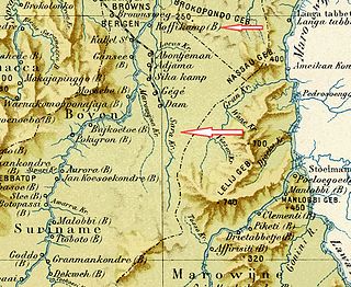
Sara Creek is a former tributary of the Suriname River located in the Para District of Suriname. After the completion of the Afobaka Dam in 1964, the Sara Creek flows into the Brokopondo Reservoir. In 1876, gold was discovered along the Sara Creek, and a railway line from Paramaribo to the river was completed in 1911.


