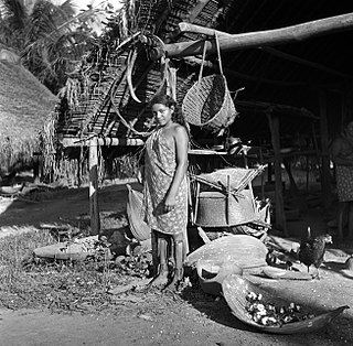
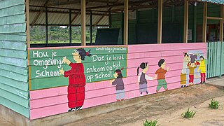
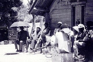
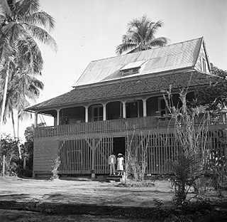
The Kwinti are a Maroon people, descendants of runaway African slaves, living in the forested interior of Suriname on the bank of the Coppename River, and the eponymous term for their language, which has fewer than 300 speakers. Their language is an English-based creole with Dutch, Portuguese and other influences. It is similar to the languages spoken by the Aluku and Paramaccan Maroons, and split from Sranan Tongo in the middle 18th century. The Kwinti had a population of about 300 in 2014 and adhere to the Moravian Church.

Corneliskondre is a village in Suriname, located in the Boven Coppename resort of Sipaliwini District. It has a population of 70 as of 2020, and is inhabited by indigenous people of the Kalina tribe.
Sipaliwini Savanna, also called Sipaliwini, is a Tiriyó village on the Sipaliwini River in the Sipaliwini District of Suriname. The village lies next to the Sipaliwini Airstrip. The nearest village in Suriname is Alalapadu which is located 60 kilometres north on a map, but due to the twists and turns of the river, the town of Kwamalasamutu which lies 83 kilometres west is easier to reach. The Brazilian village of Missão can be reached by an unpaved path.

Apoera, also Apura, is a town in western Suriname. The village has a population of 777 people as of 2020. It is the final destination of the Southern East-West Link. 24 kilometres (15 mi) north-west on the other side of the Courantyne River lies the Guyanese village of Orealla. The village is home to the Lokono tribe, but has been westernized. Due to the influx of people of Guyana, the languages used are English, and Sranan Tongo. Dutch is rarely spoken and the native language has all but disappeared. According to the oral tradition, Apoera was founded around 1920 by the Gordon family.
Heidoti is a village in Boven Saramacca municipality (resort) in Sipaliwini District in Suriname. Heidoti is home to Maroons of the Kwinti tribe.

Paloemeu or Palumeu is an Amerindian village in the interior of Suriname, situated at the site where the Paloemeu River joins the Tapanahoni River. Most inhabitants of the village are native Tiriyó Amerindians. The remainder belongs to the Wayana, and Aparai tribes. The Bosatlas in 1968 identified the village as Pepejoe which was incorrect according to the New West Indian Guide.

Santigron is a Maroon village in Lelydorp, Suriname. The village of Santigron is along the Saramacca River not far from Paramaribo. It is one of Suriname's Maroon villages, where descendants of 18th Century run-away slaves live. Unlike in Brazil or Jamaica, some 20,000 Maroons are still living in Suriname 's rainforest and retain many aspects of their traditional Afro-American culture. The village was founded by Jajasie Adoemakeë in the middle of the 19th century. Adoemakeë started working at a nearby wood plantation, and claimed to have received ownership after the plantation owner died in 1861, however the deed was lost.

The Matawai are a tribe of Surinamese Maroons. The Matawai were originally part of the Saramaka, and signed a peace agreement with the Dutch colonists in 1762. The tribe split from the Saramaka, and in 1769, they were recognized as a separate tribe.

Ganzee is a former village in the Brokopondo District of Suriname. The village was home to Maroons of the Saramaka tribe, and located on the Suriname River. In 1965, the village was flooded after the construction of the Afobaka Dam.
Kuruni is a village in the Coeroeni resort in the Sipaliwini District of Suriname. The village is inhabited by indigenous people of the Tiriyó tribe. The inhabitants are of the subgroup Aramayana or the Bee people.
Kasuela is an indigenous village of the Tiriyó people in the East Berbice-Corentyne region of Guyana. The village has a population of about 80 people. The inhabitants are of the subgroup Mawayana or the Frog people.

Redi Doti is an indigenous village of Lokono and Kalina Amerindians in the resort of Carolina in the Para District in Suriname. The village is located near the site of Jodensavanne.

Kalebaskreek is an indigenous village of Kalina Amerindians in the resort of Calcutta in the Saramacca District in Suriname.

Donderskamp is an indigenous village of Kalina Amerindians in the resort of Boven Coppename in the Sipaliwini District in Suriname. The village is located on the Wayambo River.
Witsanti is an indigenous village of Lokono and Kalina Amerindians in the resort of Zuid in the Para District in Suriname. The village is located on the John F. Kennedyweg near the Johan Adolf Pengel International Airport.

Cabendadorp is an indigenous village of Kalina Amerindians in the resort of Zuid in the Para District in Suriname. The village is located on the Afobakaweg south of the Johan Adolf Pengel International Airport.

Powakka is an indigenous village of Lokono Amerindians in the resort of Oost in the Para District in Suriname. The village is located on the road to Carolina which connects to the Afobakaweg to Paramaribo.
Alfonsdorp is a village of indigenous Lokono people in the Albina resort of the Marowijne District of Suriname. The village is located on the East-West Link. The Wanekreek Nature Reserve is located near the village.
Hollandse Kamp is an indigenous village of Lokono Amerindians in the resort of Zuid in the Para District in Suriname. The village is located south of the Johan Adolf Pengel International Airport.
Marijkedorp is a village of indigenous Lokono people in the Albina resort of the Marowijne District of Suriname. Grace Watamaleo has been the village captain since 2011.


