The economy of Suriname was largely dependent upon the exports of aluminium oxide and small amounts of aluminium produced from bauxite mined in the country. However, after the departure of Alcoa, the economy depended on the exports of crude oil and gold. Suriname was ranked the 124th safest investment destination in the world in the March 2011 Euromoney Country Risk rankings.
The early history of Suriname dates from 3000 BCE when Native Americans first inhabited the area. The Dutch acquired Suriname from the English, and European settlement in any numbers dates from the 17th century, when it was a plantation colony utilizing slavery for sugar cultivation. With abolition in the late 19th century, planters sought labor from China, Madeira, India, and Indonesia, which was also colonized by the Dutch. Dutch is Suriname's official language. Owing to its diverse population, it has also developed a creole language, Sranan Tongo.

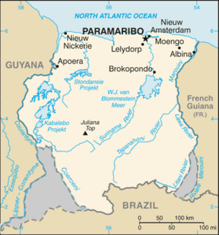
Marowijne is a district of Suriname, located on the north-east coast. Marowijne's capital city is Albina, with other towns including Moengo and Wanhatti. The district borders the Atlantic Ocean to the north, French Guiana to the east, the Surinamese district of Sipaliwini to the south, and the Surinamese districts of Commewijne and Para to the west.

Para is a district of northern Suriname. Para's capital city is Onverwacht, with other towns including Paranam, and Zanderij. Para has a population of 24,700 and an area of 5,393 km2. The district is the mining and forestry centre of Suriname, with many large bauxite mining operations operating. The district is a mixture of forest and savannas.

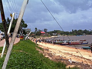
Moengo is a town in Suriname, located in the Marowijne district, between Paramaribo and the border town Albina on the Cottica River. Moengo is also a resort (municipality) in the district of Marowijne. Moengo was the capital of Marowijne District between 1932 and 1945. The current capital is Albina.

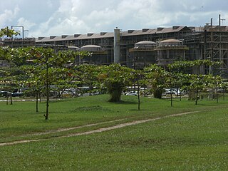
Paranam is a town in the Para District, Suriname. Paranam was created in 1938 for a bauxite factory. In 1965, an aluminium smelter was added. The factories closed down in 2017.

Meerzorg is a town and resort (municipality) in Suriname, located on the eastern bank of the Suriname River, directly opposite the capital Paramaribo. Its population at the 2012 census was 12,405. Since 2000 it has been connected to Paramaribo by the Jules Wijdenbosch Bridge, named after the former President Jules Wijdenbosch.

Klaaskreek is a resort in Suriname, located in the Brokopondo District. Its population at the 2012 census was 2,124. Located northeast of Brokopondo, the main town is Reinsdorp. In 2007, a technical training centre in biological agriculture was established at Klaaskreek to teach locals about enhancing agriculture in the area.

Zuid is a resort in Suriname, located in the Para District. Its population at the 2012 census was 6,113. The main ethnic groups are indigenous, Creoles, and mixed race.

Beekhuizen is a former sugarcane plantation and currently a resort in Suriname, located in the Paramaribo District. Its population at the 2012 census was 17,185.

Stolkertsijver is a town in the Commewijne District of Suriname. It is situated on the East-West Link. At Stolkertsijver, a bridge spanning the Commewijne River was built in 1970s.

The West Suriname Plan was an economic development plan for the western part of Suriname. As originally conceived, it consists among others of the mining of bauxite in the Bakhuis Mountains, the building of a hydroelectric power plant on the Kabalebo River, and the construction of a harbour and an aluminium smelter at Apoera. The plan was the brainchild of former Surinamese Minister of Development Frank Essed.
Javanese Surinamese are an ethnic group of Javanese descent in Suriname. They have been present since the late 19th century, when their first members were selected as indentured laborers by the Dutch colonizers from the former Dutch East Indies.

Surinam, also unofficially known as Dutch Guiana, was a Dutch plantation colony in the Guianas, bordered by the equally Dutch colony of Berbice to the west, and the French colony of Cayenne to the east. It later bordered British Guiana from 1831 to 1966.

Granman is the title of the paramount chief of a Maroon nation in Suriname and French Guiana. The Ndyuka, Saramaka, Matawai, Aluku, Paramaka and Kwinti nations all have a granman. The paramount chiefs of Amerindian peoples in Suriname are nowadays also often called “granman”.

The geology of Suriname is predominantly formed by the Guyana Shield, which spans 90% of its land area. Coastal plains account for the remaining ten percent. Most rocks in Suriname date to the Precambrian. These crystalline basement rocks consists of granitoid and acid volcanic rocks with enclaves of predominantly low-grade metamorphic, geosynclinal rocks in the Marowijne area and of probably considerably older rocks in the Falawatra group of the Bakhuisgebirge and the Coronie area. There are also small, scattered bodies of gabbro and ultramafitite. These are about the same age as the granite and volcanics. It has been found that the construction of the basement was largely created during the final phase of the Trans-Amazonian Orogeny Cycle, about 1.9 billion years ago. This cycle has had a significant influence on the geology of Suriname, characterized by sedimentation, metamorphosis, corrugation and magmatism.
The Brooskampers were a Maroon people, descendants of runaway African slaves, living in the forested interior of Suriname. The tribe is related to the Saramaka, and originated from Loango-Angola. The Brooskampers gained autonomy in 1863, but sold their land in 1917.

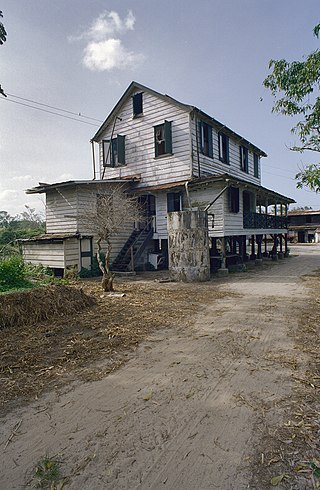
Katwijk is coffee plantation and village in the Alkmaar resort of the Commewijne District of Suriname. It is the only coffee plantation in Suriname which is still in operation. During World War II, Katwijk was an internment camp for prostitutes.

Berlijn is a village and former wood plantation in the resort of Zuid in the Para District in Suriname. It is located on the Para Creek, and about 4 kilometres (2.5 mi) from the Johan Adolf Pengel International Airport.

The history of Suriname during World War II was mainly focused on protecting the bauxite industry and guarding the borders with French Guiana which was part of Vichy France. From November 1941 onwards, 2,000 American troops were stationed in Suriname who transformed Airstrip Zanderij into a major airport, and constructed defensive works. No actual battles took place in Suriname. There was a political crisis in 1943, because Governor Johannes Kielstra used the state of emergency to imprison political opponents.


