Paramaribo is the capital and largest city of Suriname, located on the banks of the Suriname River in the Paramaribo District. Paramaribo has a population of roughly 241,000 people, almost half of Suriname's population. The historic inner city of Paramaribo has been a UNESCO World Heritage Site since 2002.
Commewijne is a district of Suriname, located on the right bank of the Suriname River. Commewijne's capital city is Nieuw Amsterdam. Tamanredjo is another major town, while Meerzorg is the most populated.

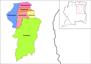
Brokopondo is a district of Suriname. Its capital city is Brokopondo; other towns include Brownsweg and Kwakoegron.
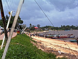
Marowijne is a district of Suriname, located on the north-east coast. Marowijne's capital city is Albina, with other towns including Moengo and Wanhatti. The district borders the Atlantic Ocean to the north, French Guiana to the east, the Surinamese district of Sipaliwini to the south, and the Surinamese districts of Commewijne and Para to the west.

Para is a district of northern Suriname. Para's capital city is Onverwacht, with other towns including Paranam, and Zanderij. Para has a population of 24,700 and an area of 5,393 km2. The district is the mining and forestry centre of Suriname, with many large bauxite mining operations operating. The district is a mixture of forest and savannas.

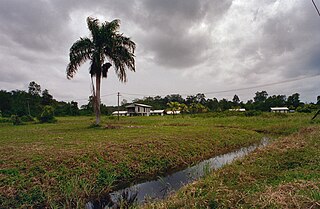
Wageningen is a community resort and an agricultural place in the Republic of Suriname and located in the coastal area of West Suriname in the Nickerie District, at the harbour of the Nickerie River across the right estuary of the Maratakka River. The town was known as the rice centre of Suriname, Wageningen has been founded in 1949 and named after the Dutch city of Wageningen.

Totness is a town in Suriname, located in the Coronie district, of which it is the capital. Totness is the oldest settlement in the district.

Wanhatti is a village and resort in Suriname, located in the Marowijne district on the Cottica River. The resort is inhabited by the Ndyuka Maroons, and has a population of 468 people as of 2012. The village is primarily inhabited by Ndyuka of the Ansu clan or lo.

Tapanahoni is a resort in Suriname, located in the Sipaliwini District. Its population at the 2012 census was 13,808. Tapanahoni is a part of Sipaliwini which has no capital, but is directly governed from Paramaribo. Tapanahony is an enormous resort which encompasses a quarter of the country of Suriname. The most important town is Diitabiki which is the residence of the granman of the Ndyuka people since 1950, and the location of the oracle.

Brownsweg is a town and resort in Suriname in the Brokopondo District. Its population at the 2012 census was 4,793.

Meerzorg is a town and resort (municipality) in Suriname, located on the eastern bank of the Suriname River, directly opposite the capital Paramaribo. Its population at the 2012 census was 12,405. Since 2000 it has been connected to Paramaribo by the Jules Wijdenbosch Bridge, named after the former President Jules Wijdenbosch.

Klaaskreek is a resort in Suriname, located in the Brokopondo District. Its population at the 2012 census was 2,124. Located northeast of Brokopondo, the main town is Reinsdorp. In 2007, a technical training centre in biological agriculture was established at Klaaskreek to teach locals about enhancing agriculture in the area.

Johan & Margaretha or sometimes just Margaretha is a resort in Suriname, located in the Commewijne District. Its population at the 2012 census was 756. It is located along a peninsula northeast of Paramaribo. It is named after the coffee plantation Johan & Margaretha which was founded in 1745 by Johan Knöffel. It is safe to assume that his wife was called Margaretha.

Tamanredjo is a resort and town in Suriname, located in the Commewijne District. Its population at the 2012 census was 6,601.

Patamacca is a resort in Suriname, located in the Marowijne District. Its population at the 2012 census was 427. Patamacca is a tribal area inhabited by Maroons

Noord is a resort in Suriname, located in the Para District. Its population at the 2012 census was 9,703. Noord is mainly an agricultural area, and has a school.

Boven Suriname is a resort in Suriname, located in the Sipaliwini District. Its population at the 2012 census was 17,954. Almost its entire population consists of Maroons
Galibi is a resort in Suriname, located in the Marowijne District. Its population at the 2012 census was 741. Galibi is a tribal area inhabited by an indigenous population of Kalina Amerindians.

Kwatta is a resort in Suriname, located in the Wanica District. Its population at the 2012 census was 14,151.

Paramacca is a resort in Suriname, located in the Sipaliwini District. The population is estimated between 1,500 and 2,000 people. In 1983, the Sipaliwini District was created, and the eastern part became the resort of Tapanahony. The Paramacca resort is the northern part of Tapanahony, and mainly inhabited by the Paramaccan people, the border of the resorts is the island of Bofoo Tabiki in the Marowijne River.