Brokopondo is a district of Suriname. Its capital city is Brokopondo; other towns include Brownsweg and Kwakoegron.

Saramacca is a district of Suriname, in the north. Saramacca's capital city is Groningen, with other towns and cities including Batavia, Kampong Baroe, Uitkijk, Maho and Boskamp. Saramacca has a population of 17,480 and an area of 3,636 km2.

Wanica is a district of Suriname located in the north of the country. Wanica's capital city is Lelydorp, the second-largest city in Suriname. Wanica has a population of 118,222 and an area of 443 km2. Following neighboring Paramaribo, Wanica is the second most populated and urbanized district of Suriname. Two-thirds of the country's population live in these two districts.

Nieuw Amsterdam is the capital of the Commewijne District in Suriname. It is a small coastal town situated at the confluence of the Suriname River and Commewijne River, just across from Paramaribo, the country's capital. Its population at the 2012 census was 5,650, with around 1,200 people living in the main town, most of whom are of Javanese and East Indian origin. It is the location of the historical Fort Nieuw-Amsterdam, today an open-air museum. The town of Mariënburg with former sugarcane factory is located 3 km from Nieuw Amsterdam and part of the resort.

Tapanahoni is a resort in Suriname, located in the Sipaliwini District. Its population at the 2012 census was 13,808. Tapanahoni is a part of Sipaliwini which has no capital, but is directly governed from Paramaribo. Tapanahony is an enormous resort which encompasses a quarter of the country of Suriname. The most important town is Diitabiki which is the residence of the granman of the Ndyuka people since 1950, and the location of the oracle.

Boskamp is a town on the East-West Link in Suriname, in the central north of the country, in the Calcutta resort of the Saramacca District. It lies opposite to Jenny, to which it is connected via the Coppename bridge. Boskamp is mainly a fishing village.

Johan & Margaretha or sometimes just Margaretha is a resort in Suriname, located in the Commewijne District. Its population at the 2012 census was 756. It is located along a peninsula northeast of Paramaribo. It is named after the coffee plantation Johan & Margaretha which was founded in 1745 by Johan Knöffel. It is safe to assume that his wife was called Margaretha.

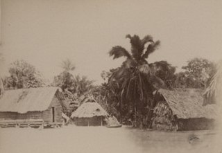
Patamacca is a resort in Suriname, located in the Marowijne District. Its population at the 2012 census was 427. Patamacca is a tribal area inhabited by Maroons

Noord is a resort in Suriname, located in the Para District. Its population at the 2012 census was 9,703. Noord is mainly an agricultural area, and has a school.
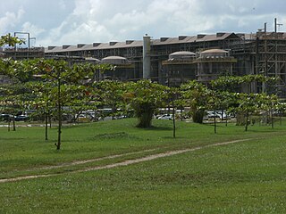
Oost is a resort in Suriname, located in the Para District. Its population at the 2012 census was 8,016. The main town in the resort is Paranam. Oost is also home to the former leper colony Bethesda. The Paranam alumina refinery is located near the town of Paranam. The Accaribo area is becoming tourist spot with the main attractions White Beach and Caribo Beach Resort.

Zuid is a resort in Suriname, located in the Para District. Its population at the 2012 census was 6,113. The main ethnic groups are indigenous, Creoles, and mixed race.
Tammenga is a resort in Suriname, located in the Paramaribo District. Its population at the 2012 census was 15,819. The resort has been named after Henderijkes Tammenga (1815-1864), who after his first plantation did not succeed, started farming in a swampy area near Paramaribo in 1852. Most of the area was sold to East Indian indentured workers in the late 19th century.

Weg naar Zee is a resort in Suriname, located in the Paramaribo District. Its population at the 2012 census was 16,037, and has a large East Indian population. The name can be translated as "road to sea", and it is indeed the road to the sea. Weg naar Zee is home to the Open Air Crematorium which opened in 1968, and there is a pilgrimage site for Hindus nearby. In 1968, oil had been discovered in Weg naar Zee, and is being exploited by Staatsolie. In 2015, a mangrove conservation effort was launched. The rising sea tide due to climate change, and the decline for the forests, increase the risk of flooding. The project aims to increase the number of mangrove forests near the coast. A part of the resort is still an agricultural area.

Boven Suriname is a resort in Suriname, located in the Sipaliwini District. Its population at the 2012 census was 17,954. Almost its entire population consists of Maroons
Boven Saramacca is a resort in Suriname, located in the Sipaliwini District. Its population at the 2012 census was 1,427. The dominant geographical feature of this resort is the Saramacca River. The resort is mainly inhabited by Maroons of the Matawai tribe.

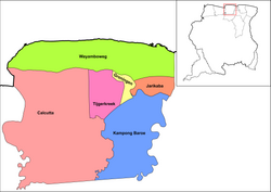
Kampong Baroe is a resort in Suriname, located in the Saramacca District. Its population at the 2012 census was 2,248, the majority being Javanese, and East Indian. The main agricultural crop is peanuts. Kampong Baroe also contains cattle, pig, and chicken farms. "Kampong Baroe" in Malay language literally means "New Village".

Tijgerkreek is a resort in Suriname, located in the Saramacca District. Its population at the 2012 census was 3,244, the majority being Javanese, and East Indian. The resort is mainly agricultural. In the 21st century, there has been an emphasis on peanuts. The development of a modern agricultural centre is being planned.
Wayamboweg is a resort in Suriname, located in the Saramacca District. Its population at the 2012 census was 1,560. The largest ethnic group is East Indian. The resort is mainly agricultural. A rice project has started in late 2017.

Houttuin is a resort in Suriname, located in the Wanica District. Its population at the 2012 census was 15,656. The largest ethnic group are the Indo-Surinamese. The resort is named after the sugar plantation Houttuyn which was founded in 1737. The resort was mainly agricultural, and is planned to remain an agricultural centre. In the early 21st century, it has seen a steady population growth, and is becoming suburban with housing projects like Tout Lui Faut.
Koewarasan is a resort in Suriname, located in the Wanica District. Its population at the 2012 census was 27,713. It is located to the west of Paramaribo, and is mainly a suburban area. The municipality was founded in 1939, and was originally intended for the Javanese settlers from Java, however due to World War II, only a single group arrived. The majority of the population are East Indian. Prior to 1939, Koewarasan was an agricultural area used for the cultivation of rice.