
Coronie is a district of Suriname, situated on the coast. Coronie's capital city is Totness. The district border the Atlantic Ocean to the north, the Surinamese district of Saramacca to the east, the Surinamese district of Sipaliwini to the south and the Surinamese district of Nickerie to the west. The district is served by the Totness Airstrip.

Nickerie is a district of Suriname, on the north-west coast. Nickerie's capital city is Nieuw-Nickerie. Another town is Wageningen. The district borders the Atlantic Ocean to the north, the Surinamese district of Coronie to the east, the Surinamese district of Sipaliwini to the south and the region of East Berbice-Corentyne in Guyana to the west.

Sipaliwini is the largest district of Suriname, located in the south. Sipaliwini is the only district that does not have a regional capital, as it is directly administered by the national government in Paramaribo.

Nieuw Nickerie is the third largest city in Suriname with a population estimated at 12,818. It is the capital city of the Nickerie district, and the terminus of the East-West Link.

Wageningen is a community resort and an agricultural place in the Republic of Suriname and located in the coastal area of West Suriname in the Nickerie District, at the harbour of the Nickerie River across the right estuary of the Maratakka River. The town was known as the rice centre of Suriname, Wageningen has been founded in 1949 and named after the Dutch city of Wageningen.
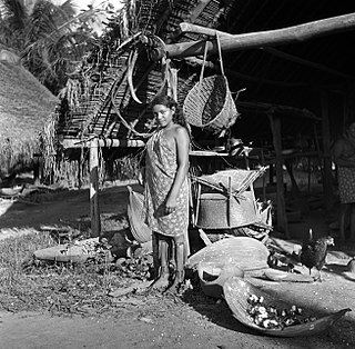
Corneliskondre is a village in Suriname, located in the Boven Coppename resort of Sipaliwini District. It has a population of 70 as of 2020, and is inhabited by indigenous people of the Kalina tribe.

Tapanahoni is a resort in Suriname, located in the Sipaliwini District. Its population at the 2012 census was 13,808. Tapanahoni is a part of Sipaliwini which has no capital, but is directly governed from Paramaribo. Tapanahony is an enormous resort which encompasses a quarter of the country of Suriname. The most important town is Diitabiki which is the residence of the granman of the Ndyuka people since 1950, and the location of the oracle.

The ten districts of Suriname are divided into 63 resorts. Within the capital city of Paramaribo, a resort entails a neighbourhood; in other cases it is more akin to a municipality, consisting of a central place with a few settlements around it. The resorts in the Sipaliwini District are especially large, since the interior of Suriname is sparsely inhabited.

Paradise is a village in the Nickerie District of Suriname. It has a population of about 966 residents. The village is located about two kilometers from the town of Nieuw Nickerie.

Johan & Margaretha or sometimes just Margaretha is a resort in Suriname, located in the Commewijne District. Its population at the 2012 census was 756. It is located along a peninsula northeast of Paramaribo. It is named after the coffee plantation Johan & Margaretha which was founded in 1745 by Johan Knöffel. It is safe to assume that his wife was called Margaretha.

Johanna Maria is a town and resort in Suriname, located in the Coronie District. Its population at the 2012 census was 648. The town is named the cotton plantation Johanna Maria founded in 1801 which was owned by Johanna Maria Christina van Onna from 1863 onwards. The coast line subject to flooding and erosion caused by the degradation of the mangrove forests. Plans have been drawn up to construct a 12 kilometre long dike near the coast.

Oostelijke Polders is a resort in Suriname located in the Nickerie District. Its population at the 2012 census was 7,153. Villages in the resort include Glasgow, Hamptoncourtpolder, and Paradise. Oostelijke Polders is an agricultural area with a focus on rice production. Oostelijke Polder has a clinic and a school.
Westelijke Polders is a resort in Suriname, located in the Nickerie District. Its population at the 2012 census was 8,616. Its Dutch place name reflects Suriname's colonial past. Its western boundary is the Courantyne River, between Suriname and Guyana.

Kabalebo is a resort in Suriname, located in the Sipaliwini District. Its population at the 2012 census was 2,291.
Coeroeni is a resort in Suriname, located in the Sipaliwini District. Its population at the 2012 census was 1,046. The resort is mainly inhabited by indigenous people of the Tiriyó tribe. Kwamalasamutu is the main village of the resort and home to the granman Asongo Alalaparu.

Boven Coppename is a resort in Suriname, located in the Sipaliwini District. Its population at the 2012 census was 539. The resort is mainly inhabited by indigenous people of the Tiriyó, and Maroons of the Kwinti tribe. The main village is Bitagron. Other villages include Corneliskondre and Donderskamp.

Tijgerkreek is a resort in Suriname, located in the Saramacca District. Its population at the 2012 census was 3,244, the majority being Javanese, and East Indian. The resort is mainly agricultural. In the 21st century, there has been an emphasis on peanuts. The development of a modern agricultural centre is being planned.

De Nieuwe Grond is a resort in Suriname, located in the Wanica District. Its population at the 2012 census was 26,161. Its main ethnic groups are East Indian, and Creoles. The resort is named after a sugar plantation in 1770. The plantation was already abandoned in 1863, when slavery was abolished, because that year, it was up for public auction. The area used to consist of small scale agriculture with a focus on vegetables and rice, but due to its proximity to Paramaribo, it has become a suburban area with a young population. In 2019, a new bigger market opened in the town.

Saramacca Polder is a resort in Suriname, located in the Wanica District. Its population at the 2012 census was 10,217. And the majority of the population is of East Indian descent. The Saramacca Polder was created between 1894 and 1904. The main function was agriculture. The Commissaris Weytinghweg was built in 1906, and connects the polder with Paramaribo. Initially the area was mainly used for rice cultivation, but has become home to companies and suburban housing.
The (northern) East-West Link is a road in Suriname between Albina in the eastern part of the country to Nieuw Nickerie in the western part, via the capital city of Paramaribo. The southern East-West Link connects Paramaribo with Apoera via Bitagron. Construction of the road link started in the 1960s.

