A request that this article title be changed to Marnoo is under discussion . Please do not move this article until the discussion is closed. |
| Marnoo Victoria | |
|---|---|
 Entering Marnoo | |
 Marnoo | |
| Coordinates | 36°39′0″S142°53′0″E / 36.65000°S 142.88333°E |
| Population | 99 (2021 census) [1] |
| Postcode(s) | 3387 |
| Location | |
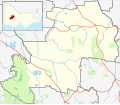
| LGA(s) | Shire of Northern Grampians |
| State electorate(s) | Ripon |
| Federal division(s) | Mallee |
Marnoo is a town in the Wimmera region of Victoria, Australia. Its postal code is 3387. At the 2021 census, Marnoo and the surrounding area had a population of 99. [1]