
Dingwall is a town and a royal burgh in the Highland council area of Scotland. It has a population of 5,491. It was an east-coast harbour that now lies inland. Dingwall Castle was once the biggest castle north of Stirling. On the town's present-day outskirts lies Tulloch Castle, parts of which may date back to the 12th-century building. In 1411 the Battle of Dingwall is said to have taken place between the Clan Mackay and the Clan Donald.

Kingussie is a small town in the Badenoch and Strathspey ward of the Highland council area of Scotland. Historically in Inverness-shire, it lies beside the A9 road, although the old route of the A9 serves as the town's main street which has been bypassed since 1979. Kingussie is 42 miles south of Inverness, 12 mi (19 km) south of Aviemore, and 3 mi (5 km) north of Newtonmore.

Calderbank is a village outside the town of Airdrie, North Lanarkshire, Scotland. It lies west of the M73, on the west bank of the North Calder Water. The village lies 13 miles (21 km) east of Glasgow city centre and around 34 miles (55 km) west of Edinburgh. Other nearby towns include: Airdrie, Coatbridge, Bellshill and Motherwell. It has a population of about 1,610.

The geography of Scotland is varied, from rural lowlands to unspoilt uplands, and from large cities to sparsely inhabited islands. Located in Northern Europe, Scotland comprises the northern half of the island of Great Britain as well as 790 surrounding islands encompassing the major archipelagos of the Shetland Islands, Orkney Islands and the Inner and Outer Hebrides.

Postwick with Witton is a civil parish on the Broads in the English county of Norfolk, comprising the two adjacent villages of Postwick and Witton. Postwick is some 4.5 miles (7.2 km) east of the city of Norwich, just south of the eastern end of the A47 Norwich southern bypass on the north bank of the River Yare. Witton lies 1.75 miles (2.8 km) to the north-east, north of the A47.

Old Deer is a parish and village in the district of Buchan, Aberdeenshire, Scotland. The population in 2011 was 152. The village lies on the Deer or South Ugie Water, 10.1 miles (16.3 km) west of Peterhead and 2 miles (3 km) from Mintlaw. Industries include distilling, brewing, and the manufacture of woollens, and there are quarries of granite and limestone.

Haggs is a small village in the Falkirk council area of Scotland. The village is situated 2.1 miles (3.4 km) south-west of Bonnybridge, 4.6 miles (7.4 km) north-northeast of Kilsyth and 2.0 miles (3.2 km) south-southwest of Denny, on the east side of the M80 motorway which separates it from Banknock.
Westhill is a commuter village on the eastern outskirts of the city of Inverness, in the Highland council area of Scotland. It is about 3 miles (4.8 km) from the city centre, between Cradlehall and Culloden, to the south of the Moray Firth. The historic Culloden Battlefield lies 2 miles (3.2 km) away, to the east.
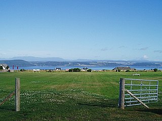
Muir of Ord is a village in the Highlands of Scotland. It is situated near the western boundary of the Black Isle, about 9 miles (14 km) west of the city of Inverness and 5+1⁄2 miles (9 km) south of Dingwall. The village has a population of 2,690 and sits 35 metres (115 ft) above sea level. The Scottish geologist, Sir Roderick Murchison was born in the village in 1792.

Jackton is a small village lying just beyond the western periphery of East Kilbride in South Lanarkshire, on the B764 road connecting it to the village of Eaglesham. It is also adjacent to Thorntonhall, and the two villages share a newsletter, the Peel News, derived from the name of the road connecting the two. The settlement has recently been encroached upon by new build housing on the outskirts of East Kilbride. It lies approximately 150 metres (490 ft) above sea level.

Loch Broom is a sea loch located in northwestern Ross and Cromarty, in the former parish of Lochbroom, on the west coast of Scotland. The small town of Ullapool lies on the eastern shore of the loch.

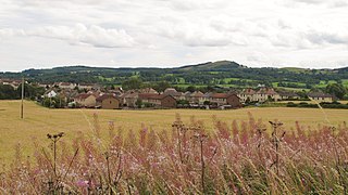
Sauchie is a town in the Central Lowlands of Scotland. It lies north of the River Forth and south of the Ochil Hills, within the council area of Clackmannanshire. Sauchie has a population of around 6000 and is located 1.0 mile (1.6 km) north-east of Alloa and 2.1 miles (3.4 km) east-southeast of Tullibody.

Torwood is a small village located 2 miles (3.2 km) north-northwest of Larbert, 4 miles (6.4 km) north-west of Falkirk and 6 miles (9.7 km) south-southeast of Stirling. Torwood lies within the Falkirk Council area of Scotland. The population recorded in the 2011 UK Census was 245.

Maoile Lunndaidh is a Scottish mountain situated 13 km south of Achnasheen in the Ross and Cromarty district of the Highland council area. It is part of the high ground between Loch Monar and Gleann Fhiodhaig.

Urray is a scattered village and coastal parish, consisting of Easter, Old and Wester Urray and is located in the county of Ross in the Scottish council area of the Highland. Urray is also a parish in the district of Wester Ross and Cromarty. It comprises the parishes of Carnoch and Kinlochlychart, with the ancient parish of Kilchrist.

The Moine Supergroup is a sequence of Neoproterozoic metamorphic rocks that form the dominant outcrop of the Scottish Highlands between the Moine Thrust Belt to the northwest and the Great Glen Fault to the southeast. The sequence is metasedimentary in nature and was metamorphosed and deformed in a series of tectonic events during the Late Proterozoic and Early Paleozoic. It takes its name from A' Mhòine, a peat bog in northern Sutherland.
Inverchoran is a small remote hamlet, situated in the upper reaches of Strathconon, in Ross-shire, in the Highland council area of Scotland. It is on the Strathconon Estate, 1 km east of Loch Beannacharain, near where the Allt Gleann Chorainn joins the River Meig.
Whitecross is a small village within the Falkirk council area, close to the boundary of West Lothian council in Scotland. It lies 2.0 miles (3.2 km) west-southwest of Linlithgow and 2.5 miles (4.0 km) south-east of Polmont on the west bank of the River Avon.
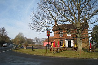
Blackham is a village in the Wealden district of East Sussex. It lies within the Withyham civil parish. Its nearest town is Royal Tunbridge Wells, which lies approximately 5.3 miles (8.5 km) east from the village. The village is situated on the East Sussex-Kent border.

Marybank is a small township lying to the north of Nelson, New Zealand. It lies on State Highway 6 close to the northern end of Nelson Haven, between Atawhai and Wakapuaka.

