
The Great Dividing Range, also known as the East Australian Cordillera or the Eastern Highlands, is a cordillera system in eastern Australia consisting of an expansive collection of mountain ranges, plateaus and rolling hills, that runs roughly parallel to the east coast of Australia and forms the fifth-longest land-based mountain chain in the world. It is mainland Australia's most substantial topographic feature and serves as the definitive watershed for the river systems in eastern Australia, hence the name.

Dubbo is a city in the Orana Region of New South Wales, Australia. It is the largest population centre in the Orana region, with a population of 38,392 at June 2018.

Gulgong is a 19th-century gold rush town in the Central Tablelands and the wider Central West regions of the Australian state of New South Wales. The town is situated within the Mid-Western Regional Council local government area. It is located about 300 km (190 mi) north west of Sydney, and about 30 km north of Mudgee along the Castlereagh Highway. At the 2016 Census, Gulgong had a population of 2,521.
Rail transport in Australia is a component of the Australian transport system. It is to a large extent state-based. As of 2018, the Australian rail network consists of a total of 36,064 kilometres (22,409 mi) of track built to three major track gauges:14,814 kilometres (9,205 mi) of standard gauge ), 15,625 kilometres (9,709 mi) of broad gauge, and 4,225 kilometres (2,625 mi) of narrow gauge lines. Additionally, about 1,400 kilometres (870 mi) of 610 mm / 2 ft gauge lines support the sugar-cane industry.

The Australian state of New South Wales has an extensive network of railways, which were integral to the growth and development of the state. The vast majority of railway lines were government built and operated, but there were also several private railways, some of which operate to this day.

The Main North Line is a major railway in New South Wales, Australia. It runs through the Central Coast, Hunter and New England regions. The line was the original main line between Sydney and Brisbane, however this required a change of gauge at Wallangarra. As of 1988, the line closed progressively north of Armidale with services gradually withdrawn till 2004, with the main route between Sydney and Brisbane now the North Coast line.

Bylong Valley Way is a New South Wales country road linking the Golden Highway near Sandy Hollow to the Castlereagh Highway near Ilford. It is named after the Bylong Valley, through which the road passes.

Sandy Hollow is a small rural town in New South Wales, Australia in Muswellbrook Shire. The town is located on the Golden Highway in the far west of the Upper Hunter Region, about 260 km north of Sydney.
The Main Western Railway is a major railway in New South Wales, Australia. It runs through the Blue Mountains, Central West, North West Slopes and the Far West regions. It is 825 kilometres (513 mi) with 484 kilometres (301 mi) operational & 341 kilometres (212 mi) under construction & repairs.

Bylong is a village in New South Wales, Australia, in the Mid-Western Regional Council. It is located on the Bylong Valley Way.

The Gwabegar Railway Line is a railway line in the Central West and North West Slopes of New South Wales, Australia, which passes through the towns of Mudgee, Gulgong, Dunedoo, Coonabarabran and terminates at Gwabegar.

The Merriwa Branch Railway Line is in the Hunter Valley of Northern New South Wales, Australia.
The line branches from the Main North line at Muswellbrook and travels southwest to Denman then generally northwest through Sandy Hollow to the town of Merriwa, a distance of approximately 80 kilometres (50 mi). The line was completed to Merriwa on 29 October 1917, however the section north west of Sandy Hollow closed in 1988.
There are 3 mines, Bengalla & Mt Pleasant, just southwest & west of Muswellbrook & Mangoola, 1/2 way to Denman with Ballon Loops of this line & a number of Passing Sidings have been built with the traffic to / from the 3 mines @ Ulan near Gulgong.
The section between Muswellbrook and Sandy Hollow, combined with the Sandy Hollow – Gulgong railway line forms the Australian Rail Track Corporation's Ulan line between Muswellbrook and Gulgong on the Gwabegar railway line.
The Sandy Hollow–Gulgong railway line is a railway line in eastern New South Wales, Australia. The line forms a cross country connection from the Main North line in the Upper Hunter region to the Gwabegar line in the Central West region. The line is approximately 125 kilometres in length. From the Gwabegar line, trains can then ultimately reach the Main West line creating a circuitous bypass of Sydney for freight traffic heading between the west and north of New South Wales. The line was opened in 1985.
The Troy Junction–Merrygoen railway line is a railway line in northern New South Wales, Australia. It forms part of a cross country railway line between Dubbo in the state's Central West, and Werris Creek on the Main North line, allowing goods from the west of the state to access the Hunter ports, bypassing Sydney.

Goolma is a tiny village community in the Central West of New South Wales, Australia. It is located on the Dubbo road, which links the towns of Mudgee, Gulgong and Wellington. At the 2006 census, the Goolma region had a population of 201 people.
The Maldon – Dombarton railway line is a partially constructed railway line in New South Wales, Australia. Construction commenced in December 1983 with the project being cancelled in June 1988. Following a feasibility study, contracts for pre-construction works were awarded in December 2012. The Government of New South Wales is currently running a Registration of Interest process, seeking market interest to construct, operate and maintain the proposed line.

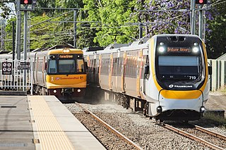
NSW TrainLink is an Australian train and coach operator providing services throughout New South Wales and into the Australian Capital Territory. It also operates some interstate services to Victoria, Queensland and South Australia. It is the operating name of NSW Trains, an agency of Transport for NSW.

Dubbo railway station is a heritage-listed railway station and bus interchange located on the Main Western line in Dubbo in the Dubbo Regional Council local government area of New South Wales, Australia. The station serves the city of Dubbo and was opened on 1 February 1881. The station is also known as Dubbo Railway Station and yard group. The property was added to the New South Wales State Heritage Register on 2 April 1999. The station and associated yards were designed by the office of the Engineer-in-Chief of the NSW Government Railways, under the direction of John Whitton.

The Dubbo Regional Council is a local government area located in the Central West and Orana regions of New South Wales, Australia. The council was formed on 12 May 2016 through a merger of the City of Dubbo and Wellington Council. Originally named Western Plains Regional Council, the name was changed to Dubbo Regional Council on 7 September 2016.

Gulgong railway station is a heritage-listed former railway station on the Gwabegar railway line at Gulgong, Mid-Western Regional Council, New South Wales, Australia. The property was added to the New South Wales State Heritage Register on 2 April 1999.
