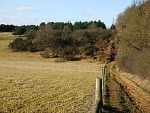
Bookham Commons are two commons, situated just to the north of the villages of Great Bookham and Little Bookham, in Surrey, England, 154.7 hectares in extent; the individual parts are named Great Bookham Common and Little Bookham Common. A group of dwellings known as the Isle of Wight is situated within the site, and a track, Common Road, leads to it from the northwest. Little Bookham Common lies south and west of this track, whereas Great Bookham Common lies to the east.

The Great Fen is a habitat restoration project being undertaken on The Fens in the county of Cambridgeshire in England. It is one of the largest restoration projects in the country, and aims to create a 3,700 hectare wetland and aims to connect Woodwalton Fen National Nature Reserve (NNR), Holme Fen NNR and other nature reserves to create a larger site with conservation benefits for wildlife and socio-economic benefits for people.

Black Down and Sampford Commons is a 155.2-hectare (384-acre) biological Site of Special Scientific Interest in Devon and Somerset, notified in 1952.

Brampton Wood is a 132.1-hectare (326-acre) biological Site of Special Scientific Interest in Cambridgeshire. The site is west of Brampton in Cambridgeshire. It is managed by the Wildlife Trust for Bedfordshire, Cambridgeshire and Northamptonshire.

Cooper's Hill is an 18.1-hectare (45-acre) biological Site of Special Scientific Interest in Ampthill in Bedfordshire. It was notified under Section 28 of the Wildlife and Countryside Act 1981 in 1984, and the planning authority is Central Bedfordshire Council. A smaller area of 12.7 hectares is also a Local Nature Reserve, Part of the site is managed by the Wildlife Trust for Bedfordshire, Cambridgeshire and Northamptonshire.

Cherry Hinton Pit is a 12.8-hectare (32-acre) biological Site of Special Scientific Interest (SSSI) on the south-eastern outskirts of Cambridge. The site consists of East Pit and most of the smaller West Pit. East Pit is part of the Limekiln Close and East Pit Local Nature Reserve, which is managed by the Wildlife Trust for Bedfordshire, Cambridgeshire and Northamptonshire under the name Cherry Hinton Chalk Pits. West Pit is a separate Local Nature Reserve (LNR).

Kings and Bakers Woods and Heaths is a 212.8-hectare (526-acre) Site of Special Scientific Interest (SSSI) between Heath and Reach in Bedfordshire and Great Brickhill in Buckinghamshire. The site is mainly in Bedfordshire but includes Rammamere Heath in Buckinghamshire. It was notified in 1984 under Section 28 of the Wildlife and Countryside Act 1981, and the local planning authorities are Central Bedfordshire Council and Aylesbury Vale Council. Part of it is a National Nature Reserve, and part of it is a nature reserve managed by the Wildlife Trust for Bedfordshire, Cambridgeshire and Northamptonshire. it is also a Nature Conservation Review site.
Woolmer Forest is a 1,298.5-hectare (3,209-acre) biological Site of Special Scientific Interest south of Bordon in Hampshire and West Sussex. It is also a Special Area of Conservation and part of the Wealden Heaths Phase II Special Protection Area. Two areas are Nature Conservation Review sites, Grade I.

Cotswold Commons and Beechwoods is a 665.5-hectare (1,644-acre) biological Site of Special Scientific Interest in Gloucestershire, notified in 1954.

Crickley Hill and Barrow Wake is a 56.8-hectare (140-acre) biological and geological Site of Special Scientific Interest in Gloucestershire, notified in 1974.
Dixton Wood is a 13.14-hectare (32.5-acre) biological Site of Special Scientific Interest in Gloucestershire, notified in 2000. Dixton Wood is recognised as a Special Area of Conservation (SAC) under the EU Habitats Directive.

Highbury Wood is a 50.74-hectare (125.4-acre) biological Site of Special Scientific Interest in Gloucestershire, notified in 1983.

Hanger Wood is an ancient woodland and Site of Special Scientific Interest (SSSI) in the parish of Stagsden, Bedfordshire in the United Kingdom. Situated approximately one kilometre east of the village of Stagsden, the 24.12 hectares woodland was declared a SSSI in 1988, being described by Natural England as "one of the best remaining examples of wet ash-maple woodland in Bedfordshire". The name "Hanger" comes from Old English/Anglo-Saxon term for "wood on a hill" or "wooded hill", applied to Hanger Wood due to its situation on a northwest-facing slope of a narrow ridge. Commenting on the wood's character, A. Simco said in 1984 that "It has been strongly influenced by the geology and topography of the area, particularly by the south-west/north-east boulder clay ridge along which the parish boundary runs."

Odell Great Wood is an ancient woodland and biological Site of Special Scientific Interest (SSSI) in Odell in Bedfordshire. Located around the centre of the parish of Odell, the site was described by Natural England as "in many respects the best example in Bedfordshire" of wet ash-maple woodland, and in historical sources as "the noblest wood in this county". Being one of the largest of Bedfordshire's ancient woodlands, the wood hosts a wide variety of flora and fauna in its ash, oak and hazel coppice habitat.

Maulden Church Meadow is a 4.1-hectare (10-acre) biological Site of Special Scientific Interest in Maulden in Bedfordshire. It was notified in 1987 under section 28 of the Wildlife and Countryside Act 1981, and the local planning authority is Central Bedfordshire Council. Most of it is also a Local Nature Reserve, owned and managed by Central Bedfordshire Council.

Maulden Heath is a 7.6-hectare (19-acre) Site of Special Scientific Interest in Maulden in Bedfordshire. It was notified in 1986 under Section 28 of the Wildlife and Countryside Act 1981, and the local planning authority is Central Bedfordshire Council. The site is owned by the Forestry Commission and managed by The Greensand Trust.

Beeding Hill to Newtimber Hill is a 321 ha (790-acre) biological and geological Downland Site of Special Scientific Interest (SSSI) north of Shoreham-by-Sea in West Sussex. It is a Nature Conservation Review site, Grade 2, and it includes Devil's Dyke Geological Conservation Review site.