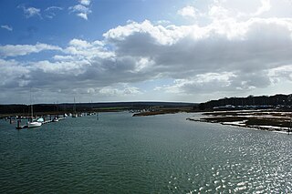
The River Yar on the Isle of Wight, England, rises near the beach at Freshwater Bay, on the south coast, and flows only a few miles north to Yarmouth where it meets the Solent. Most of the river is a tidal estuary. Its headwaters have been truncated by erosion of the south coast.

Ingrebourne Marshes are a 74.8 hectare biological Site of Special Scientific Interest in Hornchurch in the London Borough of Havering. Ingrebourne Valley Local Nature Reserve includes a small part of the SSSI west of the River Ingrebourne. The site is managed by the Essex Wildlife Trust

Ashwell Springs is a 0.3-hectare (0.74-acre) biological Site of Special Scientific Interest in Ashwell in Hertfordshire, England. The local planning authority is North Hertfordshire District Council.

Dropshort Marsh is a 2.7-hectare (6.7-acre) biological Site of Special Scientific Interest in Toddington in Bedfordshire. It was notified under Section 28 of the Wildlife and Countryside Act 1981 in 1985, and the local planning authority is Central Bedfordshire Council. The site is managed by the Wildlife Trust for Bedfordshire, Cambridgeshire and Northamptonshire.
Bonemills Hollow is a 17.5-hectare (43-acre) biological Site of Special Scientific Interest east of Wittering in Cambridgeshire.

Whitewater Valley is a 4.3-hectare (11-acre) biological Site of Special Scientific Interest north-west of Wittering in Cambridgeshire.

Bassenhally Pit is an 8.6-hectare (21-acre) biological Site of Special Scientific Interest north-east of Whittlesey in Cambridgeshire.

St Neots Common is a 33.4-hectare (83-acre) biological Site of Special Scientific Interest in St Neots in Cambridgeshire.

Upper Nene Valley Gravel Pits is a 1,382.4 hectare biological Site of Special Scientific Interest in a chain of flooded gravel pits along 35 kilometres of the valley of the River Nene between Northampton and Thorpe Waterville in Northamptonshire. It is a Ramsar wetland site of international importance, a Special Protection Area under the European Communities Birds Directive and part of the Nene Valley Nature Improvement Area. It is also part of the River Nene Regional Park. Two areas are managed by the Wildlife Trust for Bedfordshire, Cambridgeshire and Northamptonshire, Summer Leys and Titchmarsh Nature Reserve.

Titchmarsh Meadow is a 2.2-hectare (5.4-acre) biological Site of Special Scientific Interest north-east of Titchmarsh in Northamptonshire.

Wadenhoe Marsh and Achurch Meadow is a 47.5-hectare (117-acre) biological Site of Special Scientific Interest south of Wadenhoe in Northamptonshire.

Bugg's Hole Fen is a 3.7-hectare (9.1-acre) biological Site of Special Scientific Interest north-west of Thelnetham in Suffolk.

Tickencote Marsh is a three hectare biological Site of Special Scientific Interest west of Tickencote and Great Casterton in Rutland.
Frisby Marsh is a 10.2-hectare (25-acre) biological Site of Special Scientific Interest east of Frisby on the Wreake in Leicestershire.
Holwell Mouth is a 14.5-hectare (36-acre) biological Site of Special Scientific Interest south-east of Nether Broughton in Leicestershire. It is common land.

Castle Acre Common is a 17.8-hectare (44-acre) biological Site of Special Scientific Interest east of King's Lynn in Norfolk.

Stiffkey Valley is a 44.4-hectare (110-acre) biological Site of Special Scientific Interest east of Wells-next-the-Sea in Norfolk. It is in the Norfolk Coast Area of Outstanding Natural Beauty.

Burgh Common and Muckfleet Marshes is a 121.5-hectare (300-acre) biological Site of Special Scientific Interest south of Fleggburgh in Norfolk. It is part of the Broadland Ramsar site and Special Protection Area, and The Broads Special Area of Conservation.

Hurst Castle and Lymington River Estuary is a 1,077.3-hectare (2,662-acre) biological and geological Site of Special Scientific Interest near Lymington in Hampshire. It is a Nature Conservation Review site and two areas are Geological Conservation Review sites. Three areas are local nature reserves, Boldre Foreshore, Sturt Pond and Lymington and Keyhaven Marshes; the latter site is managed by the Hampshire and Isle of Wight Wildlife Trust. Part of it is North Solent National Nature Reserve. It is part of Solent and Southampton Water Ramsar site and Special Protection Area. Parts of it are in Solent Maritime and Solent and Isle of Wight Lagoons Special Areas of Conservation.


