
Woburn Sands is a town that straddles the border between Buckinghamshire and Bedfordshire in England, and also is part of the Milton Keynes urban area. The larger part of the town is in Woburn Sands civil parish, which is in the City of Milton Keynes, Smaller parts of the town are in the neighbouring parishes of Aspley Guise and Aspley Heath. The meandering boundary between Buckinghamshire and Bedfordshire means the Lower and Middle Schools that serve all of the town are both in Aspley Guise CP. Bedfordshire Police and Thames Valley Police both deal with law enforcement issues in the town. At the 2011 Census, the population of the civil parish (only) was 2,916, that of the built-up area was 5,959. Woburn Sands, Aspley Guise and Aspley Heath each has its own centre but together the three settlements are a contiguous built-up area.

The Wildlife Trust for Bedfordshire, Cambridgeshire and Northamptonshire (WTBCN) is a registered charity which manages 126 nature reserves covering 3,945 hectares. It has over 35,000 members, and 95% of people in Bedfordshire, Cambridgeshire and Northamptonshire live within five miles of a reserve. In the year to 31 March 2016 it employed 105 people and had an income of £5.1 million. It aims to conserve wildlife, inspire people to take action for wildlife, offer advice and share knowledge. The WTBCN is one of 36 wildlife trusts covering England, and 46 covering the whole of the United Kingdom.
Esher Commons is a 360.1-hectare (890-acre) biological Site of Special Scientific Interest south-west of Esher in Surrey. It includes Esher Common, Fairmile Common, West End Common and Oxshott Heath. Esher Common and West End Common are Local Nature Reserves.

Dropshort Marsh is a 2.7-hectare (6.7-acre) biological Site of Special Scientific Interest in Toddington in Bedfordshire. It was notified under Section 28 of the Wildlife and Countryside Act 1981 in 1985, and the local planning authority is Central Bedfordshire Council. The site is managed by the Wildlife Trust for Bedfordshire, Cambridgeshire and Northamptonshire.

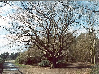
King's Wood is an area of ancient woodland in the parish of Heath and Reach in Bedfordshire, England. The wood lies north of the village of Heath and Reach and east of Great Brickhill and with neighboring Bakers Wood forms the largest area of ancient woodland in Bedfordshire. Much of the wood lies within Kings Wood and Rushmere National Nature Reserve, jointly owned and managed by the Greensand Trust, Wildlife Trust for Bedfordshire, Cambridgeshire and Northamptonshire, Central Bedfordshire Council and Tarmac Aggregates. Kings Wood and many parts of the National Nature Reserve are part of a Site of Special Scientific Interest named Kings and Bakers Woods and Heaths, which also includes Rammamere Heath in Buckinghamshire and Shire Oak Heath in Bedfordshire.

Overhall Grove is a 17.4-hectare (43-acre) biological Site of Special Scientific Interest to the east of Knapwell in Cambridgeshire. It is a Nature Conservation Review site, Grade II, and it is managed by the Wildlife Trust for Bedfordshire, Cambridgeshire and Northamptonshire.

Kings and Bakers Woods and Heaths is a 212.8 hectare Site of Special Scientific Interest (SSSI) between Heath and Reach in Bedfordshire and Great Brickhill in Buckinghamshire. The site is mainly in Bedfordshire but includes Rammamere Heath in Buckinghamshire. It was notified in 1984 under Section 28 of the Wildlife and Countryside Act 1981, and the local planning authorities are Central Bedfordshire Council and Aylesbury Vale Council. Part of it is a National Nature Reserve, and part of it is a nature reserve managed by the Wildlife Trust for Bedfordshire, Cambridgeshire and Northamptonshire. it is also a Nature Conservation Review site.
Fancott Woods and Meadows is a 13.3-hectare Site of Special Scientific Interest near the hamlet of Fancott in Bedfordshire. It was notified under Section 28 of the Wildlife and Countryside Act 1981, and the local planning authority is Central Bedfordshire Council. The site is managed by the Wildlife Trust for Bedfordshire, Cambridgeshire and Northamptonshire.
Galley and Warden Hills is a 47 hectare biological Site of Special Scientific Interest in Warden Hill, a suburb of Luton in Bedfordshire. The local planning authority is Central Bedfordshire Council, and it was notified in 1986 under Section 28 of the Wildlife and Countryside Act 1981. It is also a Local Nature Reserve.

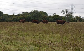
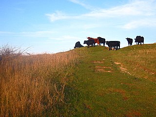
Naphhill Common is a 71.1 hectare Site of Special Scientific Interest in Naphill in Buckinghamshire. It is in of the Chilterns Area of Outstanding Natural Beauty, and it is listed in A Nature Conservation Review. It is common land, with commoners' rights to estovers, grazing and firebote.

Danbury Common is a 70.2-hectare (173-acre) biological Site of Special Scientific Interest in Danbury in Essex, England. Most of it is common land owned by the National Trust, and two areas, the Backwarden and Hitchcock's Meadows, are part of Essex Wildlife Trust's Danbury Ridge Nature Reserves.

Bricket Wood Common is a 70 hectare open space and biological Site of Special Scientific Interest in Bricket Wood in Hertfordshire. It is managed by St Albans City and District Council together with the Countryside Management Service and Bricket Wood Joint Management Committee.

Hertford Heath nature reserve is a 28 hectare biological Site of Special Scientific Interest in Hertford Heath in Hertfordshire. It is managed by the Herts and Middlesex Wildlife Trust and the local planning authority is East Hertfordshire District Council.

Kings Wood and Glebe Meadows is a 36.1 hectare Site of Special Scientific Interest in Houghton Conquest in Bedfordshire. A local teenage boy, Peter Sollars, discovered many rich communities of plants there, including a number of rare species, e.g. Butcher's Broom, Small Teasel and Green Hellebore in the wood, and combinations of Lady's Bedstraw, Spiny Restharrow, Great Burnet, Adders Tongue Fern and Cowslips in the meadows. The County Botanist at the time, John Dony, was notified of his findings, which were confirmed by a site visit with Peter. The site was notified in 1984 under the Wildlife and Countryside Act 1981, and the planning authority is Central Bedfordshire. It is also a Local Nature Reserve.

Nine Acres Pit is a 20.7-hectare (51-acre) geological Site of Special Scientific Importance north-east of Leighton Buzzard in Bedfordshire. It was notified in 1986 under Section 28 of the Wildlife and Countryside Act 1981, and the local planning authority is Central Bedfordshire Council. It is a Geological Conservation Review site.

Tilwick Meadow is a 2.6-hectare (6.4-acre) biological Site of Special Scientific Interest between Thurleigh and Wilden in Bedfordshire. It was notified in 1988 under Section 28 of the Wildlife and Countryside Act 1981, and the local planning authority is Bedford Borough Council.

Blindley Heath SSSI is a 26.3-hectare (65-acre) biological Site of Special Scientific Interest in the hamlet Blindley Heath, on the southern outskirts of Godstone in Surrey. It is also a Local Nature Reserve. It is owned by Godstone Parish Council and managed by the Surrey Wildlife Trust

Brentmoor Heath is a 28.6-hectare (71-acre) Local Nature Reserve east of Camberley in Surrey. It is part of Brentmoor Heath and Folly Bog nature reserve, the ownership of which is divided between the Ministry of Defence, Surrey County Council and Surrey Heath Borough Council, and is managed by Surrey Wildlife Trust. The site is also part of Colony Bog and Bagshot Heath site of Special Scientific Interest, Thursley, Ash, Pirbright & Chobham Special Area of Conservation and Thames Basin Heaths Special Protection Area.

Forest Mere is a 14.6-hectare (36-acre) biological Site of Special Scientific Interest north of Midhurst in West Sussex.
