
Bedfordshire is a ceremonial county in the East of England. The county is administered by three unitary authorities: Borough of Bedford, Central Bedfordshire, and Borough of Luton, after Bedfordshire County Council was abolished in 2009.

Leighton Buzzard is a market town in Bedfordshire, England, in the southwest of the county and close to the Buckinghamshire border. It lies between Aylesbury, Tring, Luton/Dunstable and Milton Keynes, near the Chiltern Hills. It is 36 miles (58 km) northwest of Central London and linked to the capital by the Grand Union Canal and the West Coast Main Line. The built-up area extends on either side of the River Ouzel to include its historically-separate neighbour Linslade, and is administered by the Leighton-Linslade Town Council.

Linslade is a town in the Central Bedfordshire unitary authority area of Bedfordshire, England. It borders the town of Leighton Buzzard, with which it forms the civil parish of Leighton-Linslade. Linslade was transferred from Buckinghamshire in 1965. Before then, it was a separate urban district. It remained a part of the Diocese of Oxford until 2008 when it joined Leighton Buzzard in the Diocese of St Albans.

South Bedfordshire was, from 1974 to 2009, a non-metropolitan district of Bedfordshire, in the East of England. Its main towns were Dunstable, Houghton Regis and Leighton Buzzard.

Toddington is a large village and civil parish in the county of Bedfordshire, England. It is situated 5 miles north-north-west of Luton, 4 miles (6 km) north of Dunstable, 6 miles (10 km) south-west of Woburn, and 35 miles north-north-west of London on the B5120 and B579. It is 0.5 miles from Junction 12 of the M1 motorway and lends its name to the nearby motorway service station. The hamlet of Fancott also forms part of the Toddington civil parish.

Heath and Reach is an English village and civil parish near the Chiltern Hills in Bedfordshire. It is 2 miles (3.2 km) north of Leighton Buzzard and 3 miles (4.8 km) south of Woburn and adjoins the county boundary with Buckinghamshire. Nearby places are Leighton-Linslade, Great Brickhill and the Duke of Bedford's Woburn Abbey, Woburn Safari Park and Woburn Golf Club.
Eaton Bray was a rural district in Bedfordshire, England from 1894 to 1933.

The Leighton Buzzard Light Railway (LBLR) is a light railway in Leighton Buzzard in Bedfordshire, England. It operates on 2 ft narrow-gauge track and is just under 3 miles (4.8 km) long. The line was built after the First World War to serve sand quarries north of the town. In the late 1960s the quarries switched to road transport and the railway was taken over by volunteers, who now run the line as a heritage railway.

Central Bedfordshire is a unitary authority area in the ceremonial county of Bedfordshire, England. It was created in 2009.

Felmersham Gravel Pits is a 21.6 hectare Site of Special Scientific Interest between the villages of Felmersham and Sharnbrook in Bedfordshire. It was notified under Section 28 of the Wildlife and Countryside Act 1981 in 1986 and the local planning authority is Bedford Borough Council. The site is managed by the Wildlife Trust for Bedfordshire, Cambridgeshire and Northamptonshire.
Roxton is a small village and civil parish in the Borough of Bedford, Bedfordshire, England about 7 miles (11 km) north-east of the county town of Bedford.
Oak Bank School is a co-educational special school with academy status located in Leighton Buzzard, Bedfordshire, England. The school accepts pupils from all over the Central Bedfordshire area.

Kensworth is a village and civil parish located in the Central Bedfordshire district of Bedfordshire, England. The parish is located on the edge of Dunstable Downs, and includes the hamlets of California and Kensworth Lynch.

Biddenham Pit is a gravel pit and Site of Special Scientific Interest (SSSI), 0.41 hectares in size located in Biddenham, Bedfordshire. The pit was notified to Bedford Borough Council and Bedfordshire County Council under the Wildlife and Countryside Act (1981) in 1988, and is also a Geological Conservation Review site. The site is owned by Persimmon Homes and Kier Homes, with management advice given by Natural England.
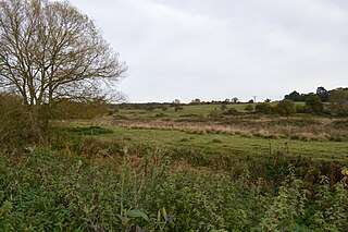
Nares Gladley Marsh is a 5.1 hectare Site of Special Scientific Interest north-west of Leighton Buzzard in Bedfordshire. It was notified in 1990 under Section 28 of the Wildlife and Countryside Act 1981, and the local planning authority is Central Bedfordshire Council.

Nine Acres Pit is a 20.7 hectare geological Site of Special Scientific Importance north-east of Leighton Buzzard in Bedfordshire. It was notified in 1986 under Section 28 of the Wildlife and Countryside Act 1981, and the local planning authority is Central Bedfordshire Council. It is a Geological Conservation Review site.
