The Sembakung River is a river in Borneo that flows from Sabah, Malaysia to North Kalimantan, Indonesia, about 1600 km northeast of the capital Jakarta.
The Polapare River is a river of Sumba Barat Daya Regency in the island of Sumba, East Nusa Tenggara, Indonesia. The length of the river is 18 km. Offshore of the river mouth are the islands of Baholokmonegoro and Barenggemonokodi; Malondobara Island is 1¼ km to the west.
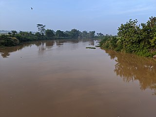
The Kadassa River is a river of Sumba, East Nusa Tenggara, Indonesia.
The Kadumbul River is a river of Sumba, East Nusa Tenggara, Indonesia.
The Widas River is a river in northern East Java, Indonesia. It is a tributary of the Brantas River.
The Sanen River is a river in southern East Java province, Java island, Indonesia, about 800 km east of the capital Jakarta.
The Tabai River is a river in northern part of Western Papua, Papua province, Indonesia.
The Waruta River is a river in northern Western Papua in the province of Papua, Indonesia. It is a tributary of the Taritatu River.
The Muturi River is a river in West Papua province, Indonesia.
The Wildeman River is a river in southern Papua province, Indonesia. It is a tributary of the Pulau River.

Walanae River is a river in South Sulawesi on the island of Sulawesi, Indonesia, about 1500 km northeast of the capital Jakarta.
Kalaena River is a river in South Sulawesi, Sulawesi island, Indonesia, about 1600 km northeast of the capital Jakarta.
Teunom River is a river in northern Sumatra, in the province of Aceh, Indonesia, about 1700 km northeast of the capital Jakarta.
The Jamboaye River is a river in the province of Aceh in northern Sumatra, Indonesia, about 1600 km northwest of the capital Jakarta.
Silau River is a river in northern Sumatra, Indonesia, about 1300 km northwest of the capital Jakarta. It is a tributary of Asahan River.
The Sinamar River is a river in West Sumatra province, in the central part of Sumatra island, Indonesia, about 900 km northwest of the capital Jakarta. It is a tributary of the Ombilin/Indragiri River.
Rokan-kiri River is a river in Riau province, central part of Sumatra island, Indonesia, about 1100 km northwest of the capital Jakarta. It is a tributary of the Rokan River.
Tembesi River is a river in Jambi province, Sumatra island, Indonesia, about 600 km northwest of the capital Jakarta. It is a tributary of the Batang Hari River. Tributaries include the Merangin River.
The Kambaniru River is a river in the island of Sumba, Indonesia, about 1,500 km east of the capital Jakarta. With a length of approximately 118 km, it flows periodically through 9 districts in the East Sumba Regency, exiting to the Bay of Kambaniru near the city of Waingapu to the Sawu Sea, with high debit in the wet season, but very low in the dry season.
The Wanokaka River is a river in Sumba island, Province of East Nusa Tenggara, Indonesia. It is located a few kilometers south of Waikabubak, with the District of Wanokaka (Wanukaka), east of the District of Lamboya.

