List of rivers flowing in the island of Sumba, Indonesia. [1]
List of rivers flowing in the island of Sumba, Indonesia. [1]
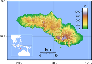
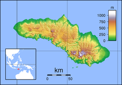
Sumba, natively also spelt as Humba or Hubba is an Indonesian island located in the Eastern Indonesia and administratively part of the East Nusa Tenggara provincial territory. Sumba has an area of 11,005.62 square kilometres, and the population was 686,113 at the 2010 Census and 779,049 at the 2020 Census; the official estimate as of mid-2022 was 799,771. To the northwest of Sumba is Sumbawa, to the northeast, across the Sumba Strait, is Flores, to the east, across the Savu Sea, is Timor, and to the south, across part of the Indian Ocean, is Australia.

Manupeu Tanah Daru National Park is located on the island of Sumba in Indonesia. This national park consists lowland forests on steep slopes that rise up to ca. 600m.

East Sumba Regency is geographically the largest of the four regencies which divide the island of Sumba, within East Nusa Tenggara Province of Indonesia. It occupies 64% of the entire island, being much less densely populated than the western third. The town of Waingapu is the capital of East Sumba Regency. The population of East Sumba Regency was 227,732 at the 2010 Census and 244,820 at the 2020 Census, comprising 125,967 male and 118,853 female; the official estimate as at mid 2022 was 248,776.
The Polapare River is a river of Sumba Barat Daya Regency in the island of Sumba, East Nusa Tenggara, Indonesia. The length of the river is 18 km. Offshore of the river mouth are the islands of Baholokmonegoro and Barenggemonokodi; Malondobara Island is 1¼ km to the west.
The Kadassa River is a river of Sumba, East Nusa Tenggara, Indonesia.
The Kadumbul River is a river of Sumba, East Nusa Tenggara, Indonesia.
The Melolo River is a river of Sumba, Indonesia.

The Sumbanese traditional house refers to the traditional vernacular house of the Sumba people from the island of Sumba, Lesser Sunda Islands, Indonesia. A Sumbanese house is characterized by a high-pitched central peak in its roof and a strong connection with the spirits or marapu.
The Kambaniru River is a river in the island of Sumba, Indonesia, about 1,500 km east of the capital Jakarta. With a length of approximately 118 km, it flows periodically through 9 districts in the East Sumba Regency, exiting to the Bay of Kambaniru near the city of Waingapu to the Sawu Sea, with high debit in the wet season, but very low in the dry season.
The Wanokaka River is a river in Sumba island, Province of East Nusa Tenggara, Indonesia. It is located a few kilometers south of Waikabubak, with the District of Wanokaka (Wanukaka), east of the District of Lamboya.