| Widas River | |
|---|---|
 | |
  | |
| Location | |
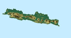
| Country | Indonesia |
| Physical characteristics | |
| Source | |
| • location | East Java |
| Mouth | |
• location | Brantas River |
The Widas River is a river in northern East Java, Indonesia. [1] It is a tributary of the Brantas River. [2]
| Widas River | |
|---|---|
| | |
| | |
| Location | |
| Country | Indonesia |
| Physical characteristics | |
| Source | |
| • location | East Java |
| Mouth | |
• location | Brantas River |
The Widas River is a river in northern East Java, Indonesia. [1] It is a tributary of the Brantas River. [2]
The river flows in the eastern area of Java with predominantly tropical monsoon climate (designated as Am in the Köppen–Geiger climate classification). [3] The annual average temperature in the area is 26 °C. The warmest month is October, when the average temperature is around 29 °C, and the coldest is January, at 23 °C. [4] The average annual rainfall is 2982 mm. The wettest month is March, with an average of 496 mm rainfall, and the driest is August, with 28 mm rainfall. [5]
| Widas River | ||||||||||||||||||||||||||||||||||||||||||||||||||||||||||||
|---|---|---|---|---|---|---|---|---|---|---|---|---|---|---|---|---|---|---|---|---|---|---|---|---|---|---|---|---|---|---|---|---|---|---|---|---|---|---|---|---|---|---|---|---|---|---|---|---|---|---|---|---|---|---|---|---|---|---|---|---|
| Climate chart (explanation) | ||||||||||||||||||||||||||||||||||||||||||||||||||||||||||||
| ||||||||||||||||||||||||||||||||||||||||||||||||||||||||||||
| ||||||||||||||||||||||||||||||||||||||||||||||||||||||||||||

The Brantas is the longest river in East Java, Indonesia. It has a length of 320 km, and drains an area over 11,000 km2 from the southern slope of Mount Kawi-Kelud-Butak, Mount Wilis, and the northern slopes of Mount Liman-Limas, Mount Welirang, and Mount Anjasmoro. Its course is semi-circular or spiral in shape: at its source the river heads southeast, but gradually curves south, then southwest, then west, then north, and finally it flows generally eastward at the point where it branches off to become the Kalimas and Porong River.

Pembuang River or Seruyan River is a river of Borneo, Indonesia. The river has its source near Bikit Tikung in the Schwaner Mountain Range. The eastern side of the river contains dense forest down to Sembulu (Belajau) lakes and is said to be a major habitat of the orangutan. Pembuang means "place of rejection".
The Liman River is a river in northern Java, Indonesia.
Beet River is a river in northern West Java, Indonesia. It is a tributary of the Citarum River.
Pemali River is a river in northern Central Java, Indonesia, about 250 km east of the capital Jakarta.
Serang River is a river in northern Central Java, Indonesia, about 400 km east of the capital Jakarta. The largest tributary is Lusi River, which discharges into Serang River after passing the city of Purwodadi.
Lusi River is a river in northern Central Java, Indonesia, about 400 km east of the capital Jakarta. It is a tributary of the Serang River, meeting after passing the city of Purwodadi.
The Porong River is a river flowing through Sidoarjo, East Java, Indonesia, about 700 km east of the capital Jakarta. It is one of the main distributary of the Brantas River that discharges into Bali Sea, close to the Madura Strait, and is the main outlet for the Lusi mudflow.
The Setail River is a river in southeastern Java, Indonesia.
The Progo River is a river in southern central Java, Indonesia. The river passes through two provinces; Central Java and Yogyakarta Special Region. The source of the river is on the slopes of Mount Sindoro, Central Java.
The Sanen River is a river in southern East Java province, Java island, Indonesia, about 800 km east of the capital Jakarta.
The Oyo River is a river in southern Central Java and Yogyakarta, in the central south area of Java island, Indonesia. It is a tributary of the Opak River.
The Wamma River is a river in northern part of Western Papua, Papua province, Indonesia.
The Muturi River is a river in West Papua province, Indonesia.
Tungkal River is a river in Jambi province, Sumatra island, Indonesia, about 700 km northwest of the capital Jakarta.
Mesuji River is a river in Lampung province, Sumatra island, Indonesia, about 250 km northwest of the capital Jakarta.
The Bila River is a river in northern Sumatra, Indonesia, about 1200 km northwest of the capital Jakarta. It is a tributary of the Barumun River.
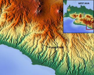
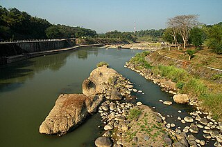
The Kaso River, also Ci Kaso, is a river in the Garut Regency of West Java, Indonesia, about 190 km southeast of the capital Jakarta. Coal-bearing sandstones, clays and limestones are typical geological traits of the Bandung area of southern Java. It flows past Pameungpeuk before flowing into the Indian Ocean.
The Tuntang is a major river of northern Central Java, Indonesia, about 400 km east of the capital Jakarta. It connects Lake Rawa Pening to the Java Sea, east of Semarang. There is a hydroelectric powerstation on the river near the lake.

The Ci Banten, or Ci Peteh, is a river in Banten province on the island of Java, Indonesia.