Ci Manceuri

Last updated

Ci Manceuri
Tjimantjeuri, Tji Mantjeuri
Indonesia Java relief location map.png
Red pog.svg
Location in Java
Location
Country Indonesia
Physical characteristics
Source 
  location Java
Mouth  
  location
Java Sea
  coordinates
6°02′18″S106°27′31″E / 6.038425°S 106.458716°E / -6.038425; 106.458716

The Ci Manceuri, or Cimanceuri, [lower-alpha 1] is a river in the Banten province of western Java, Indonesia.

Contents

Location

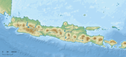
The Ci Manceuri forms at the confluence of the Ci Dangdeur and Ci Jengir and flows northwest and then north to discharge into the Java Sea near Lontar, Kemiri District in the Tangerang Regency. [1] The rivers in Banten, the westernmost province of Java, run roughly parallel to each other. The main ones are the Peteh, called the Banten on the lower reaches near the city of Kota Banten, the Ujung, which enters the sea at Pontang, the Durian, which enters the sea at Tanara, the Manceuri, and the Sadane, which rises in the mountainous region of Priyangan and in 1682 formed the border between the Dutch East India Company (VOC) territory and Batavia (modern Jakarta). [2] The Durian, Manceuri and Sadane rivers flow through the Tangerang Plain. [3] The rivers fan out into deltas near the coast. There are marshes between the mouth of the Durian at Tanara and the mouth of the Sadane. [2]

Irrigation works

The Tangerang Plain was still owned by private landlords in the early 20th century. The farmers grew low-quality rice, mostly using rainfall-based water storage and irrigation systems that depended on the whims of landlords for functioning of key components, with arbitrary water distribution. They suffered from poverty and famine or food shortages. [3]

In 1911 the colonial government started to prepare an irrigation plan, and in 1914 determined that various tracts in the plain should be subject to compulsory purchase for this purpose. The original plan was to use waters from the Ci Durian, Ci Manceuri and Ci Sadane rivers. Plans to use the Cimanceuri were dropped due to its irregular supply and poor quality water. In 1919 a plan was issued where the north of the plain would be irrigated by the Ci Sadane and the southern area by the Ci Durian. [4] In this plan the Ci Durian canal would extend to the Ci Manceuri. Later this was changed to extend the canal by an aqueduct over the Ci Manceuri. [5]

Planned extensions to the Ci Durian irrigation network were delayed in the post-colonial era, as were repairs to the existing works. The planned aqueduct over the Ci Manceuri was not completed until the 1970s. [6]

Geography

The river flows in the northeastern part of Java with predominantly tropical rainforest climate (designated as Af in the Köppen-Geiger climate classification). [7] The annual average temperature in the area is 26 °C. The warmest month is September, when the average temperature is around 28 °C, and the coldest is March, at 24 °C. [8] The average annual rainfall is 3471 mm. The wettest month is February, with an average of 429 mm rainfall, and the driest is September, with 116 mm rainfall. [9]

See also

Notes

  1. The river's name is also written as Tji Mantjeuri or Tjimantjeuri
  1. Jakarta, Bogor, Depok,Tangerang...
  2. 1 2 Talens 1999, p. 40.
  3. 1 2 Kop, Ravesteijn & Kop 2016, p. 298.
  4. Kop, Ravesteijn & Kop 2016, p. 299.
  5. Kop, Ravesteijn & Kop 2016, p. 310.
  6. Kop, Ravesteijn & Kop 2016, p. 314.
  7. Peel, M C; Finlayson, B L; McMahon, T A (2007). "Updated world map of the Köppen-Geiger climate classification". Hydrology and Earth System Sciences. 11. doi: 10.5194/hess-11-1633-2007 .
  8. "NASA Earth Observations Data Set Index". NASA. 30 January 2016. Archived from the original on 26 April 2020. Retrieved 29 November 2018.
  9. "NASA Earth Observations: Rainfall (1 month – TRMM)". NASA/Tropical Rainfall Monitoring Mission. 30 January 2016. Archived from the original on 19 April 2019. Retrieved 29 November 2018.

Sources

Related Research Articles

Liman river or Ci Liman is the name of a river located at the western tip of Java Island, Banten Province, Indonesia. It originates from its headwaters in the southern mountains of Banten, around the Sareweh in the Lebak Regency, near the settlement of the Baduy Dalam tribe. It flows westward towards the coast in the Panimbang, region of Pandeglang and empties into Lada Bay, the Sunda Strait. It is approximately 73 km from the center of Cilegon city to the mouth of the river.

<span class="mw-page-title-main">Ci Durian</span> River in Java, Indonesia

The Ci Durian, or Ci Kandi, is a river in the Banten province of western Java, Indonesia. It rises in the mountains to the south and flows north to the Java Sea. The delta of the river, now canalized, has long been used for rice paddies and for a period was also used for sugarcane plantations. Extensive irrigation works diverted water from the river into a canal system in the 1920s, but these works were not completed and suffered from neglect in the post-colonial era. Plans were made in the 1990s to rehabilitate the irrigation works and dam the river to provide water for industrial projects, with Dutch and Japanese assistance, but these were cancelled by the Indonesian government.

<span class="mw-page-title-main">Cisadane River</span> River in West Java and Banten, Indonesia

The Cisadane River is a 138 kilometres (86 mi) long river in northern West Java, Indonesia. The river has its source at Mount Pangrango, and passes through Bogor and Tangerang before flowing to the Java Sea.

<span class="mw-page-title-main">Asem River</span> River in Java, Indonesia

Asem River is a river in northern West Java province on Java island, Indonesia. The river rises on Mount Tangkuban Perahu and discharges into the Bay of Ciasem, Java Sea, traversing Ciasem, Subang Regency, around 90 km east of the capital Jakarta.

<span class="mw-page-title-main">Manuk River</span> River in Indonesia

The Manuk River is a river in West Java, Indonesia, about 170 km east of the capital Jakarta.

The Baliung River is a river flowing in southern Java, within the Banten province, Indonesia. The upstream starts in the southern mountains of Java; it flows southward into the Indian Ocean, about 130 kilometres (81 mi) southwest of Jakarta.

<span class="mw-page-title-main">Kaso River (Sukabumi)</span> River in Sukabumi city, west Java

Kaso River, also known as Ci Kaso is a river in Sukabumi Regency, West Java, Indonesia, about 140 km south of the capital Jakarta.

<span class="mw-page-title-main">Kaso River (Garut)</span> River in Indonesia

The Kaso River, also Ci Kaso, is a river in the Garut Regency of West Java, Indonesia, about 190 km southeast of the capital Jakarta. Coal-bearing sandstones, clays and limestones are typical geological traits of the Bandung area of southern Java. The river flow merges with the Cipalebuh River, near the center of Pameungpeuk, southern coastal area of Garut, West Java.

<span class="mw-page-title-main">Cikawalon River</span> River in Central Java, Indonesia

Cikawalon River is an important river at Dayeuhluhur, Cilacap Regency, Central Java in Java Island, Indonesia, about 220 km southeast of the capital Jakarta. It is a tributary river of the Cibeet River.

<span class="mw-page-title-main">Angke River</span> River in Jakarta, Indonesia

The Angke River is a 91.25-kilometre (56.70 mi) long river in Jakarta, Indonesia. The river flows from the Bogor area of West Java, passing through the cities of Tangerang (Banten) and Jakarta into the Java Sea via the Cengkareng Drain. The river is connected with the Cisadane River by Mookervaart Canal.

Tanara is a district in the Banten province on the island of Java, Indonesia.

<span class="mw-page-title-main">Ci Banten</span> River in Indonesia

The Ci Banten, or Ci Peteh, is a river in Banten province on the island of Java, Indonesia.

<span class="mw-page-title-main">Ci Ujung</span> River in Indonesia

The Ciujung is a river in the province of West Java and Banten on the island of Java, Indonesia.

Ci Kaengan is a river in the island of Java, Indonesia, that flows mainly in the Garut Regency of West Java province, about 210 km to the southeast of the capital Jakarta.

<span class="mw-page-title-main">Mookervaart River</span> River in Jakarta, Indonesia

The Mookervaart River is a canal connecting the Cisadane River in Tangerang and Kali Angke in Jakarta. Constructed from 1678 to 1689, this 25–30 meter wide channel is one of the important flood control water channels in Jakarta.

<span class="mw-page-title-main">Pesanggrahan River</span> River in Indonesia

The Pesanggrahan River is a river with the upstream in the Bogor Regency, flowing through the cities of Depok, Jakarta and Tangerang, Banten. The river passes the districts of Tanah Sereal, Bojong Gede, Sawangan, Limo, Kebayoran Lama, Pesanggrahan, Kembangan, and Kebun Jeruk before flowing into the Cengkareng Drain. Based on 2005 data, 55 percent of the watershed area of the Pesanggrahan River is occupied by housing, only 7 percent is still forests, 20 percent rice fields, and 13 percent other agriculture fields.

<span class="mw-page-title-main">Krukut River</span> River in Indonesia

The Krukut River is a river flowing in Jakarta originating in Bogor Regency. In the past the river was clean and one of the tourist attractions during the Dutch East Indies administration, but due to denser housing on the banks and lack of maintenance, the water turned dark and filled with trash, causing routine flooding in rainy seasons.

<span class="mw-page-title-main">Baru Timur River</span> River in Jakarta, Indonesia

Baru Timur River is a man-made canal flowing from Ci Liwung in Bogor Regency to Jakarta, Indonesia. It was one of two canals built in the 18th century under the order of the Governor-General Gustaaf Willem van Imhoff originally to transport agriculture harvest from Bogor to Batavia. Currently both canals, now known as Kali Baru Timur and Kali Baru Barat, are among the main rivers in Jakarta, and part of the Ciliwung Cisadane flood control project. Baru Timur River flows from Katulampa flood gate, built at the same time as the canal, along the major road Bogor Highway, passing Cimanggis, Depok, Cilangkap, until reaching Java Sea in Kali Besar, Tanjung Priok, North Jakarta.

<span class="mw-page-title-main">Baru Barat River</span> River in Jakarta, Indonesia

The Baru Barat River is a man-made canal flowing from the Cisadane River in Bogor Regency to Jakarta, Indonesia. It was one of two canals built in the 18th century under the order of the Governor-General Gustaaf Willem van Imhoff, the other being the Baru Timur River. Both canals were originally built to transport agricultural harvests from Bogor to Batavia. They are among the main rivers in Jakarta, and part of the Ciliwung Cisadane flood control project. The Baru Barat River flows through the districts of Pancoran and Tebet in South Jakarta, and drains into the Banjir Kanal Barat.