| Setail River | |
|---|---|
  | |
| Location | |
| Country | Indonesia |
| Physical characteristics | |
| Source | |
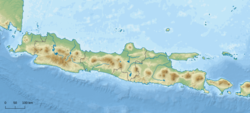
| • location | Mount Raung area, East Java |
| Mouth | |
• location | Strait of Bali |
The Setail River is a river in southeastern Java, Indonesia. [1] [2] [3]
| Setail River | |
|---|---|
| | |
| Location | |
| Country | Indonesia |
| Physical characteristics | |
| Source | |
| • location | Mount Raung area, East Java |
| Mouth | |
• location | Strait of Bali |
The Setail River is a river in southeastern Java, Indonesia. [1] [2] [3]
The river flows in the southeastern area of Java with predominantly tropical monsoon climate (designated as Am in the Köppen–Geiger climate classification). [4] The annual average temperature in the area is 24 °C. The warmest month is October, when the average temperature is around 26 °C, and the coldest is July, at 22 °C. [5] The average annual rainfall is 2160 mm. The wettest month is January, with an average of 475 mm rainfall, and the driest is August, with 31 mm rainfall. [6]