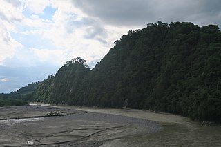
The Mina River is a river of Timor, in the province of East Nusa Tenggara, Indonesia, about 2000 km east of the capital Jakarta. Above this river also stretches the Noelmina Bridge which connects Kupang with the South Central Timor Regency.
Asem River is a river in northern West Java province on Java island, Indonesia. The river rises on Mount Tangkuban Perahu and discharges into the Bay of Ciasem, Java Sea, traversing Ciasem, Subang Regency, around 90 km east of the capital Jakarta.
Serang River is a river in northern Central Java, Indonesia, about 400 km east of the capital Jakarta. The largest tributary is Lusi River, which discharges into Serang River after passing the city of Purwodadi.
Lusi River is a river in northern Central Java, Indonesia, about 400 km east of the capital Jakarta. It is a tributary of the Serang River, meeting after passing the city of Purwodadi.
The Baliung River is a river flowing in southern Java, within the Banten province, Indonesia. The upstream starts in the southern mountains of Java; it flows southward into the Indian Ocean, about 130 kilometres (81 mi) southwest of Jakarta.
Mandiri River is a river in southwestern Java of West Java province, Indonesia. It flows mainly in the Sukabumi Regency.
Buni River is a river in southern West Java, Indonesia. The 109-km-long river flows in the Bandung and Cianjur regencies, with the upstream at the west slope of Mount Patuha and discharge into the Indian Ocean.
The Serayu River is a river in Central Java, Indonesia, about 300 km southeast of the capital Jakarta.
The Progo River is a river in southern central Java, Indonesia. The river passes through two provinces; Central Java and Yogyakarta Special Region. The source of the river is on the slopes of Mount Sindoro, Central Java.
The Oyo River is a river in southern Central Java and Yogyakarta, in the central south area of Java island, Indonesia. It is a tributary of the Opak River.
The Kamundan River is a river in southern West Papua province, Indonesia. Kamundan is mostly still natural with the upstream in Manokwari Regency and river mouth at the border of Bintuni Bay and Sorong Selatan Regency. It is also known as the "Sungai Kamundan".
Paguyaman River is a river in Gorontalo (province), Sulawesi island, Indonesia, about 1900 km northeast of capital Jakarta.
Tungkal River is a river in Jambi province, Sumatra island, Indonesia, about 700 km northwest of the capital Jakarta.
The Bila River is a river in northern Sumatra, Indonesia, about 1200 km northwest of the capital Jakarta. It is a tributary of the Barumun River.

Deli River is a river located in Sumatra, Indonesia, and courses through Medan before discharging to the Strait of Malacca near the port city of Belawan. It is one of the eight rivers in Medan. The Deli Sultanate was founded on the delta of the river around 1640, and later around the 19th century, this river acted as an artery of trade for the sultanate to other areas.
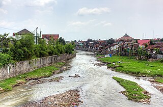
Code is the name of a river that flows through the city of Yogyakarta on the island of Java, Indonesia. Pollution is a problem along the river. Sayidan Bridge crosses the river.
The Madiun River is a river in East Java, Indonesia, about 500 km to the east of the capital Jakarta. It is the largest tributary of the Solo River. Its name indicates that it passes through the major city of Madiun, East Java, Indonesia. This river starts as a number of smaller tributaries converging near the city of Ponorogo, in particular the Kali Slahung, Kali Keyang and Kali Sungkur. It eventually converges with the Solo River near the city of Ngawi.
Ci Kaengan is a river in the island of Java, Indonesia, that flows mainly in the Garut Regency of West Java province, about 210 km to the southeast of the capital Jakarta.

The Mookervaart River is a canal connecting the Cisadane River in Tangerang and Kali Angke in Jakarta. Constructed from 1678 to 1689, this 25–30 meter wide channel is one of the important flood control water channels in Jakarta.
Sambas River, or specifically referred to Big Sambas River, is a river in Sambas Regency, West Kalimantan, Indonesia. The upstream is located in Kabupaten Bengkayang, flowing through the city of Sambas, continuing to Pemangkat where it discharges into South China Sea.