Buni River

Last updated
Buni River
Cibuni, Tjibuni
Native nameCi Buni (Indonesian)
Location
Country Indonesia
State West Java
Region Cianjur Regency, Bandung Regency
Physical characteristics
Source 
  location Mount Patuha, West Java, Indonesia
  elevation2,200 m (7,200 ft)
Mouth Indian Ocean
  location
Sindangbarang, Indonesia
  coordinates
7°26′09″S106°47′36″E / 7.4359°S 106.7932°E / -7.4359; 106.7932
  elevation
1 m (3 ft 3 in)
Length109 km (68 mi)
Basin size1,435 km2 (554 sq mi) [1]
Basin features
River system DAS Cibuni (DAS220718) [1]
Waterbodies Situ Patenggang
Basin Management AuthorityBPDAS Citarum-Ciliwung [1]
Buni River
Southern coast of Java. The mouth of the Cibuni (blue pin) and the location of Patenggang Lake (green pin) in the upper sub-basin in the Patuha valley.

Buni River (Indonesian: Ci Buni, Sungai Cibuni) is a river in southern West Java, Indonesia. The 109-km-long river flows in the Bandung and Cianjur regencies, with the upstream at the west slope of Mount Patuha and discharge into the Indian Ocean. [2] [3]

Contents

Geography

The river flows in the southwest area of Java with predominantly tropical rainforest climate (designated as Af in the Köppen-Geiger climate classification). [4] The annual average temperature in the area is 18 °C. The warmest month is October, when the average temperature is around 20 °C, and the coldest is August, at 18 °C. [5] The average annual rainfall is 3766 mm. The wettest month is December, with an average of 570 mm rainfall, and the driest is September, with 89 mm rainfall. [6]

Hidrology

Ci Buni is the main river in the Cibuni river system, covering a total area of 1,435 km2 (554 sq mi) across three regencies, including Cianjur, Bandung and Sukabumi . The upper part of the Cibuni Basin is adjacent to the upper part of the Citarum Basin in the north, where the flow of the Citarum River goes northward in Java and flows into the Java Sea. Meanwhile, the Cibuni Basin directs its stream southward and flows into the Indian Ocean. [7]

The upstream is located in Rancabali of Bandung Regency, then it flows to the southwest direction to Pasirkuda, Tanggeung, Kadupandak, and Agrabinta (all in Cianjur Regency) then turns to the southeast passing Sindangbarang, Cianjur at the south coast of Java. [8] The main tributaries of Ci Buni are:

  1. Cijampang
  2. Cilumut
  3. Cibangoah
  4. Cidolog
  5. Cikarang
  6. Cibalapulang

With the high rainfall between 2239 mm to 5579 mm, the river has high debit and large watershed area for the population to be the source of drinking water, irrigation and washing. [8] Along the stream is a topical forest with diverse plants, fish, birds, boars, apes, wild cats and reptiles. [9] Closer to the ocean, the river mouth widens to almost 200 m and hosts sweet water crocodiles. [9]

See also

Related Research Articles

<span class="mw-page-title-main">Brantas River</span> River in East Java in Indonesia

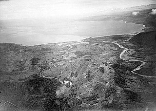
The Brantas is the longest river in East Java, Indonesia. It has a length of 320 km, and drains an area over 11,000 km2 from the southern slope of Mount Kawi-Kelud-Butak, Mount Wilis, and the northern slopes of Mount Liman-Limas, Mount Welirang, and Mount Anjasmoro. Its course is semi-circular or spiral in shape: at its source the river heads southeast, but gradually curves south, then southwest, then west, then north, and finally it flows generally eastward at the point where it branches off to become the Kalimas and Porong River.

Liman river or Ci Liman is the name of a river located at the western tip of Java Island, Banten Province, Indonesia. It originates from its headwaters in the southern mountains of Banten, around the Sareweh in the Lebak Regency, near the settlement of the Baduy Dalam tribe. It flows westward towards the coast in the Panimbang, region of Pandeglang and empties into Lada Bay, the Sunda Strait. It is approximately 73 km from the center of Cilegon city to the mouth of the river.

Beet River is a river in northern West Java, Indonesia. It is a tributary of the Citarum River.

<span class="mw-page-title-main">Asem River</span> River in Java, Indonesia

Asem River is a river in northern West Java province on Java island, Indonesia. The river rises on Mount Tangkuban Perahu and discharges into the Bay of Ciasem, Java Sea, traversing Ciasem, Subang Regency, around 90 km east of the capital Jakarta.

<span class="mw-page-title-main">Manuk River</span> River in Indonesia

The Manuk River is a river in West Java, Indonesia, about 170 km east of the capital Jakarta.

Pemali River is a river in northern Central Java, Indonesia, about 250 km east of the capital Jakarta.

The Baliung River is a river flowing in southern Java, within the Banten province, Indonesia. The upstream starts in the southern mountains of Java; it flows southward into the Indian Ocean, about 130 kilometres (81 mi) southwest of Jakarta.

<span class="mw-page-title-main">Mandiri River</span> River in Indonesia

Mandiri River is a river in southwestern Java of West Java province, Indonesia. It flows mainly in the Sukabumi Regency.

<span class="mw-page-title-main">Kaso River (Sukabumi)</span> River in Sukabumi city, west Java

Kaso River, also known as Ci Kaso is a river in Sukabumi Regency, West Java, Indonesia, about 140 km south of the capital Jakarta.

The Laki River is a river in southern Java, Indonesia, about 160 kilometres (99 mi) south of the capital Jakarta. This river is the natural boundary between the Cianjur and Garut regencies.

<span class="mw-page-title-main">Serayu River</span> River in Central Java, Indonesia

The Serayu River is a river in Central Java, Indonesia, about 300 km southeast of the capital Jakarta.

<span class="mw-page-title-main">Progo River</span> River

The Progo River is a river in southern central Java, Indonesia. The river passes through two provinces; Central Java and Yogyakarta Special Region. The source of the river is on the slopes of Mount Sindoro, Central Java.

The Oyo River is a river in southern Central Java and Yogyakarta, in the central south area of Java island, Indonesia. It is a tributary of the Opak River.

The Kamundan River is a river in southern West Papua province, Indonesia. Kamundan is mostly still natural with the upstream in Manokwari Regency and river mouth at the border of Bintuni Bay and Sorong Selatan Regency. It is also known as the "Sungai Kamundan".

<span class="mw-page-title-main">Kaso River (Garut)</span> River in Indonesia

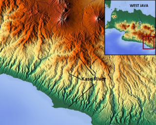
The Kaso River, also Ci Kaso, is a river in the Garut Regency of West Java, Indonesia, about 190 km southeast of the capital Jakarta. Coal-bearing sandstones, clays and limestones are typical geological traits of the Bandung area of southern Java. The river flow merges with the Cipalebuh River, near the center of Pameungpeuk, southern coastal area of Garut, West Java.

Cidayeuh River is a river in Dayeuhluhur, Cilacap, Central Java in Indonesia, about 220 km southeast of the capital Jakarta.

<span class="mw-page-title-main">Cikawalon River</span> River in Central Java, Indonesia

Cikawalon River is an important river at Dayeuhluhur, Cilacap Regency, Central Java in Java Island, Indonesia, about 220 km southeast of the capital Jakarta. It is a tributary river of the Cibeet River.

<span class="mw-page-title-main">Ci Banten</span> River in Indonesia

The Ci Banten, or Ci Peteh, is a river in Banten province on the island of Java, Indonesia.

The Ci Manceuri, or Cimanceuri, is a river in the Banten province of western Java, Indonesia.

Ci Kaengan is a river in the island of Java, Indonesia, that flows mainly in the Garut Regency of West Java province, about 210 km to the southeast of the capital Jakarta.

References

  1. 1 2 3 Hukum Online. "Keputusan Menteri Kehutanan No. SK.511/MENHUT-V/2011" (in Indonesian).
  2. Ci Buni at Geonames.org (cc-by); Last updated 2013-06-04; Database dump downloaded 2015-11-27
  3. Rand McNally, The New International Atlas, 1993.
  4. Peel, M C; Finlayson, B L; McMahon, T A (2007). "Updated world map of the Köppen-Geiger climate classification". Hydrology and Earth System Sciences. 11: 1633–1644. doi: 10.5194/hess-11-1633-2007 . Retrieved 30 January 2016.
  5. "NASA Earth Observations Data Set Index". NASA. 30 January 2016. Archived from the original on 10 May 2020. Retrieved 31 May 2018.
  6. "NASA Earth Observations: Rainfall (1 month - TRMM)". NASA/Tropical Rainfall Monitoring Mission. 30 January 2016. Archived from the original on 19 April 2019. Retrieved 31 May 2018.
  7. "Peta Interaktif". WebGIS MenLHK (in Indonesian).
  8. 1 2 Dwi Kurnia Adi Yuda. Kajian Pembangunan Waduk Cibuni Sebagai Upaya Pemenuhan Kebutuhan Air Baku Di Wilayah Kabupaten Cianjur Bagian Selatan Archived 2017-09-06 at the Wayback Machine . JBPTITBPP. 2009.
  9. 1 2 Flora and Fauna of Cibuni