
The Digul River is a major river in South Papua province, Indonesia, on the island of New Guinea. It is the fourth longest river in New Guinea after Sepik, Mamberamo, and Fly. With a total length of 853 km (530 mi) and a drainage basin of 45,900 km2 (17,700 sq mi).

The Barito River is the second longest river in Borneo after the Kapuas River with a total length of 1,090 km (680 mi) and a drainage basin of 81,675 square kilometers (31,535 sq mi) in South Kalimantan, Indonesia. It originates in the Muller Mountain Range, from where it flows southward into the Java Sea. Its most important affluent is the Martapura River, and it passes through the city of Banjarmasin.
Sekayam River is a river of Borneo, West Kalimantan province, Indonesia. It is a tributary of the Kapuas River. The Public Forest System Utility Program has a scheme on the river aimed at reducing the level of mercury content absorbed by humans.

Melawi River is a river in north-western Borneo, Indonesia, about 900 km northeast of the capital Jakarta. It is a tributary of the Kapuas River.
Arut River is a river in the province of Kalimantan Tengah, island of Borneo, Indonesia, about 700 km northeast of the capital Jakarta. It is a tributary of the Lamandau River. The river flows through the north side of Pangkalan Bun town.

The Sampit River or Mentaya River is a river of Central Kalimantan, Borneo, Indonesia. The river takes its name from the town of Sampit which lies on the river not far from the Java Sea. Near the mouth of the river is a noted beach park named "Pandaran Beach". The Sampit flows into the Java Sea at 2°58′20″S113°2′23″E.
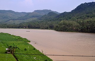
Mendawai River or Katingan River is a river of Borneo, it is located in Central Kalimantan, Indonesia. With a total length of 616 km (383 mi). The longhouses of the Pendahara are located along the river in its upper course. The river has its source in the Schwaner Mountain Range.
The Telen River is a river in East Kalimantan, Borneo island, Indonesia, about 110 kilometers north of the provincial capital Samarinda. It is a tributary of the Mahakam River.
The Belayan River is a river of Borneo, Indonesia, 1300 km northeast of the capital Jakarta. It is a tributary of the Mahakam River.
The Negara River is a river of Borneo, Indonesia. It flows in the southeast region of the island, within the Negara District, province of South Kalimantan. It is the second longest river in the province after the Barito River, which the Negara River flows into.
The Sembakung River is a river in Borneo that flows from Sabah, Malaysia to North Kalimantan, Indonesia, about 1600 km northeast of the capital Jakarta.
The Kelai River is a river of Borneo, in the province of East Kalimantan, Indonesia, about 300 kilometers (190 mi) north of the provincial capital Samarinda. It is a tributary of the Berau River.
The Polapare River is a river of Sumba Barat Daya Regency in the island of Sumba, East Nusa Tenggara, Indonesia. The length of the river is 18 km. Offshore of the river mouth are the islands of Baholokmonegoro and Barenggemonokodi; Malondobara Island is 1¼ km to the west.
The Baliung River is a river flowing in southern Java, within the Banten province, Indonesia. The upstream starts in the southern mountains of Java; it flows southward into the Indian Ocean, about 130 kilometres (81 mi) southwest of Jakarta.
The Serayu River is a river in Central Java, Indonesia, about 300 km southeast of the capital Jakarta.
Paguyaman River is a river in Gorontalo (province), Sulawesi island, Indonesia, about 1900 km northeast of capital Jakarta.

Barumun River is a Sumatran river that begins in Siraisan, Padang Lawas Regency in the southeastern North Sumatra, Indonesia, about 1,200 km northwest of the capital Jakarta.

The Kampar River is on the island of Sumatra in Indonesia, about 800 km northwest of the capital Jakarta. It is a well-known river surfing destination because of its tidal bore, known as Bono.
The Kaso River is a stream in the Indonesian part of the island of Borneo, about 1100 km northeast of the Indonesian capital Jakarta. One of its tributaries is the Seputan River. The Kaso flows into the Mahakam River. In 1889, Tromp reported three villages of Bukat people on the Kaso. The villages were on the Penane River, a tributary of the Kacu at Long Mecai. The semi-nomadic Seputan people also live on the Kacu at times.
Sambas River, or specifically referred to Big Sambas River, is a river in Sambas Regency, West Kalimantan, Indonesia. The upstream is located in Kabupaten Bengkayang, flowing through the city of Sambas, continuing to Pemangkat where it discharges into South China Sea.

