
South Kalimantan is a province of Indonesia. It is the second most populous province on the island of Kalimantan, the Indonesian territory of the island of Borneo after West Kalimantan. The provincial capital was Banjarmasin until 15 February 2022 when it was legally moved 35 kms southeast to Banjarbaru. The population of South Kalimantan was recorded at just over 3.625 million people at the 2010 Census, and at 4.07 million at the 2020 Census. The official estimate as at mid 2023 was 4,221,929. One of the five Indonesian provinces in Kalimantan, it is bordered by the Makassar Strait in the east, Central Kalimantan in the west and north, the Java Sea in the south, and East Kalimantan in the northeast. The province also includes the island of Pulau Laut, located off the eastern coast of Kalimantan, as well as other smaller offshore islands. The province is divided into 11 regencies and 2 cities. South Kalimantan is the traditional homeland of the Banjar people, although some parts of East Kalimantan and Central Kalimantan are also included in this criterion. Nevertheless, South Kalimantan, especially the former capital city Banjarmasin has always been the cultural capital of Banjarese culture. Many Banjarese have migrated to other parts of Indonesia, as well as neighbouring countries such as Singapore and Malaysia. In addition, other ethnic groups also inhabit the province, such as several groups of the Dayaks, who mostly live in the interior part of the province, as well as the Javanese, who mostly migrated from Java due to the Transmigration program which dated from the Dutch colonial era. It is one of the provinces in Indonesia that has a larger population than Mongolia.

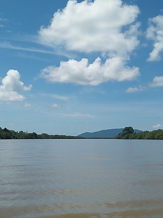
The Barito River is the second longest river in Borneo after the Kapuas River with a total length of 1,090 km (680 mi) and a drainage basin of over 80,000 km2 (31,000 sq mi) in South Kalimantan, Indonesia. It originates in the Müller Mountain Range, from where it flows southward into the Java Sea. Its most important affluent is the Negara and Martapura, and it passes through the city of Banjarmasin.
The Lawa River is a river in East Kalimantan province, Borneo island, Indonesia, about 150 kilometers northwest of Balikpapan. It is a branch of the Mahakam River in eastern Borneo, which is situated entirely within the Kutai Barat and flows into the Mahakam approximately 200 kilometers (120 mi) upstream from Samarinda. The indigenous communities of Lotaq and Mejaun are situated near its source.
The Maro River also known as Sungai Merauke and Merauke-rivier, Merauki River flows in Merauke Regency, Papua, Indonesia. It is located just to the west of the Bensbach River of Western Province, Papua New Guinea.
Sesayap River is a river in Borneo island, flowing in North Kalimantan Province, Indonesia. It forms a delta which has islands including Bunyu and Tarakan Island.
Sekayam River is a river of Borneo, West Kalimantan province, Indonesia. It is a tributary of the Kapuas River. The Public Forest System Utility Program has a scheme on the river aimed at reducing the level of mercury content absorbed by humans.

Melawi River is a river in north-western Borneo, Indonesia, about 900 km northeast of the capital Jakarta. It is a tributary of the Kapuas River.

Pembuang River or Seruyan River is a river of Borneo, Indonesia. The river has its source near Bikit Tikung in the Schwaner Mountain Range. The eastern side of the river contains dense forest down to Sembulu (Belajau) lakes and is said to be a major habitat of the orangutan. Pembuang means "place of rejection".

The Sampit River or Mentaya River is a river of Central Kalimantan, Borneo, Indonesia. The river takes its name from the town of Sampit which lies on the river not far from the Java Sea. Near the mouth of the river is a noted beach park named "Pandaran Beach". The Sampit flows into the Java Sea at 2°58′20″S113°2′23″E.
Mendawai River or Katingan River is a river of Borneo, it is located in Central Kalimantan, Indonesia. With a total length of 616 km (383 mi). The longhouses of the Pendahara are located along the river in its upper course. The river has its source in the Schwaner Mountain Range.

The Martapura River is a river in southeast Borneo, Indonesia. It is a tributary of the Barito River. Other names for the river are Banjar Kecil River or Kayutangi River and due to many activities of Chinese merchants in the past in the downstream area also called China River. It merges with the Barito River in Banjarmasin, flowing from the source in Martapura, Banjar Regency, South Kalimantan.
The Telen River is a river in East Kalimantan, Borneo island, Indonesia, about 110 kilometers north of the provincial capital Samarinda. It is a tributary of the Mahakam River.
The Belayan River is a river of Borneo, Indonesia, 1300 km northeast of the capital Jakarta. It is a tributary of the Mahakam River.
Berau River is a river of East Kalimantan, Indonesia, about 300 kilometers north of the provincial capital Samarinda. Tributaries include the Kelai River.
The Sembakung River is a river in Borneo that flows from Sabah, Malaysia to North Kalimantan, Indonesia, about 1600 km northeast of the capital Jakarta.
The Kelai River is a river of Borneo, in the province of East Kalimantan, Indonesia, about 300 kilometers (190 mi) north of the provincial capital Samarinda. It is a tributary of the Berau River.
The Kaso River is a stream in the Indonesian part of the island of Borneo, about 1100 km northeast of the Indonesian capital Jakarta. One of its tributaries is the Seputan River. The Kaso flows into the Mahakam River. In 1889, Tromp reported three villages of Bukat people on the Kaso. The villages were on the Penane River, a tributary of the Kacu at Long Mecai. The semi-nomadic Seputan people also live on the Kacu at times.
Sekonyer is a river in southern Borneo, Central Kalimantan province, Indonesia, about 700 km northeast of the capital Jakarta.

The Tabalong River is a river traversing Tabalong Regency, in the province of South Kalimantan, Indonesia. The river flows into the Negara River. It is a confluence of two tributaries: the Left Tabalong and Right Tabalong rivers.
Sambas River, or specifically referred to Big Sambas River, is a river in Sambas Regency, West Kalimantan, Indonesia. The upstream is located in Kabupaten Bengkayang, flowing through the city of Sambas, continuing to Pemangkat where it discharges into South China Sea.

