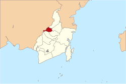
North Hulu Sungai Regency is one of the regencies in the Indonesian province of South Kalimantan. It was created from the bifurcation of the original Hulu Sungai Regency and formerly covered a much larger area in the north of the province, but on 14 July 1965 the northern districts were split off to create a separate Tabalong Regency, and on 25 February 2003 the eastern districts were split off to create a separate Balangan Regency. It now has a land area of 907.72km2, and had a population of 209,246 at the 2010 Census[2] and 226,727 at the 2020 Census;[3] the official estimate as of mid-2024 was 238,250 (comprising 118,822 males and 119,428 females).[1] The capital of the regency is the town of Amuntai.
North Hulu Sungai Regency is divided into ten districts (kecamatan), listed below with their areas and their populations at the 2010 Census[2] and 2020 Census,[3] together with the official estimates as of mid-2024.[1] The table includes the locations of the district administrative centres, the number of administrative villages in each district (a total of 214 rural desa and 5 urban kelurahan - the latter all in Amuntai Tengah District), and its postcode.
Kode Wilayah
Name of District (kecamatan)
Area in km2
Pop'n Census 2010
Pop'n Census 2020
Pop'n Estimate mid 2024
Admin centre
No. of villages
Post code
63.08.01
Danau Panggang
136.24
19,593
20,514
21,536
Danau Panggang
16
71453
63.08.09
Paminggir
192.77
7,377
8,000
8,470
Paminggir
7
71451
63.08.02
Babirik
82.01
17,833
19,402
20,556
Babirik
23
71454
63.08.03
Sungai Pandan (Pandan River)
59.92
25,905
27,639
29,297
Alabio
33
71455
63.08.10
Sungai Tabukan (Tabukan River)
22.25
13,801
14,828
15,509
Sungai Tabukan
17
71456
63.08.04
Amuntai Selatan (South Amuntai)
149.99
26,466
30,153
32,075
Telaga Silaba
30
71452
63.08.05
Amuntai Tengah (Central Amuntai)
77.09
47,961
50,609
52,477
Amuntai
29 (a)
71412 -71419
63.08.07
Banjang
110.64
16,185
18,693
19,127
Banjang
20
71416
63.08.06
Amuntai Utara (North Amuntai)
37.85
19,955
20,510
21,788
Teluk Daun
26
71471
63.08.08
Haur Gading
38.96
14,170
16,379
17,415
Sungai Limas
18
71472
Totals
907.72
209,246
226,727
238,250
Amuntai
219
Note: (a) including the 5 kelurahan of Antasari, Kebun Sari, Murung Sari, Paliwara and Sungai Malang.
Climate
Amuntai has a tropical rainforest climate (Af) with moderate rainfall from July to September and heavy rainfall in the remaining months.
This page is based on this Wikipedia article Text is available under the CC BY-SA 4.0 license; additional terms may apply. Images, videos and audio are available under their respective licenses.