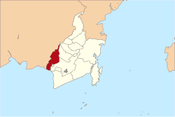
Barito Kuala Regency is one of the regencies (kabupaten) in the Indonesianprovince of South Kalimantan. It is situated in the southwest of the province, bordering Central Kalimantan province to its immediate west and separated from Banjarmasin city to its east by the lower reaches of the Barito River. The regency's land area is 2,425.83km2, and the population was 276,147 at the 2010 Census[2] and 313,021 at the 2020 Census;[3] the official estimate (as at mid 2024) was 329,799 (comprising 167,086 males and 162,713 females).[1] The capital is the town of Marabahan.
The Regency is divided into seventeen districts (Indonesian: kecamatan), tabulated below with their areas[1] and population totals from the 2010 Census[2] and 2120 Census,[3] together with the official estimates for mid 2024.[1] The three most southern (Tabunganen, Tamban and Mekarsari) and the nine more geographically central of the districts lie within the official Banjarmasin metropolitan area; the other five districts (Barambai, Bakumpai, Marabahan, Tabukan and Kuripan) lie to the north outside the metropolitan area. The table also includes the locations of the district administrative centres, the number of administrative villages in each district (a total of 195 rural desa and 6 urban kelurahan), and its postal codes.
Kode Wilayah
Name of District (kecamatan)
Area in km2
Pop'n Census 2010
Pop'n Census 2020
Pop'n Estimate mid 2024
Admin centre
No. of villages
Post codes
63.04.01
Tabunganen (a)
228.76
19,143
20,045
21,199
Tabunganen Kecil
14
70567
63.04.02
Tamban
170.91
31,115
31,967
33,202
Purwosari I
16
70566
63.04.13
Mekarsari
134.44
16,312
17,797
18,871
Tamban Raya
9
70568
63.04.03
Anjir Pasar
108.19
15,388
17,013
17,967
Anjir Pasar Kota I
15
70565
63.04.04
Anjir Muara
91.95
19,456
21,918
23,437
Anjir Muara Kota
15
70564
63.04.05
Alalak
102.06
51,403
62,833
65,537
Handil Bakti
18 (b)
70582
63.04.06
Mandastana
115.52
14,012
17,497
18,408
Puntik Luar
14
70580
63.04.17
Jejangkit
165.35
6,047
6,606
6,903
Jejangkit Pasar
7
70581
63.04.08
Belawang
72.13
12,717
13,627
14,513
Belawang
13
70563
63.04.16
Wanaraya
156.27
12,407
14,342
15,291
Kolam Kiri
13
70560
63.04.14
Barambai
163.11
13,971
15,672
16,543
Barambai
11
70562
63.04.07
Rantau Badauh
129.12
14,132
16,464
17,258
Sungai Gampa
9
70561
63.04.09
Cerbon
118.58
8,403
9,969
10,365
Bantuil
8
70571
63.04.10
Bakumpai
182.00
9,321
10,537
11,300
Lepasan
9 (c)
70512 & 70513
63.04.15
Marabahan
177.36
18,907
21,915
23,194
Marabahan Kota
10 (d)
70511 - 70513
63.04.12
Tabukan
168.65
8,097
9,030
9,645
Teluk Tamba
11
70553
63.04.11
Kuripan
141.44
5,316
5,789
6,166
Rimbun Tulang
9
70552
Totals
2,425.83
276,147
313,021
329,799
Marabahan Kota
201
Note: (a) including 3 small offshore or riverine islands. (b) including 3 kelurahan - Berangas, Berangas Barat and Handil Bakti. (c) including one kelurahan - Lepasan. (d) including 2 kelurahan - Marabahan Kota and Ulu Benteng.
Climate
Marabahan, the seat of the regency, has a tropical rainforest climate (Af) with heavy rainfall from October to May and moderate rainfall from June to September.
This page is based on this Wikipedia article Text is available under the CC BY-SA 4.0 license; additional terms may apply. Images, videos and audio are available under their respective licenses.