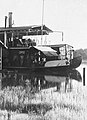
The Mahakam River is third longest and volume discharge river in Borneo after Kapuas River and Barito River, it is located in Kalimantan, Indonesia. It flows 980 kilometers from the district of Long Apari in the highlands of Borneo, to its mouth at the Makassar Strait.

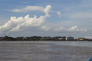
The Kapuas River is a river in the Indonesian part of Borneo island, at the geographic center of Maritime Southeast Asia. At 1,143 kilometers (710 mi) in length, it is the longest river in the island of Borneo and the longest river in Indonesia and one of the world's longest island rivers. It originates in the Müller mountain range at the center of the island and flows west into the South China Sea creating an extended marshy delta. The delta is located west-southwest of Pontianak, the capital of the West Kalimantan province. This Kapuas River should be distinguished from another Kapuas River, which starts on the other side of the same mountain range in central Borneo but flows to the south, merging with the Barito River and discharging into the Java Sea.
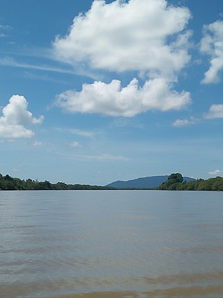
The Lawa River is a river in East Kalimantan province, Borneo island, Indonesia, about 150 kilometers northwest of Balikpapan. It is a branch of the Mahakam River in eastern Borneo, which is situated entirely within the Kutai Barat and flows into the Mahakam approximately 200 kilometers (120 mi) upstream from Samarinda. The indigenous communities of Lotaq and Mejaun are situated near its source.
Sesayap River is a river in Borneo island, flowing in North Kalimantan Province, Indonesia. It forms a delta which has islands including Bunyu and Tarakan Island.
Sekayam River is a river of Borneo, West Kalimantan province, Indonesia. It is a tributary of the Kapuas River. The Public Forest System Utility Program has a scheme on the river aimed at reducing the level of mercury content absorbed by humans.

Melawi River is a river in north-western Borneo, Indonesia, about 900 km northeast of the capital Jakarta. It is a tributary of the Kapuas River.
Arut River is a river in the province of Kalimantan Tengah, island of Borneo, Indonesia, about 700 km northeast of the capital Jakarta. It is a tributary of the Lamandau River. The river flows through the north side of Pangkalan Bun town.

Pembuang River or Seruyan River is a river of Borneo, Indonesia. The river has its source near Bikit Tikung in the Schwaner Mountain Range. The eastern side of the river contains dense forest down to Sembulu (Belajau) lakes and is said to be a major habitat of the orangutan. Pembuang means "place of rejection".

The Sampit River or Mentaya River is a river of Central Kalimantan, Borneo, Indonesia. The river takes its name from the town of Sampit which lies on the river not far from the Java Sea. Near the mouth of the river is a noted beach park named "Pandaran Beach". The Sampit flows into the Java Sea at 2°58′20″S113°2′23″E.

Mendawai River or Katingan River is a river of Borneo, it is located in Central Kalimantan, Indonesia. With a total length of 616 km (383 mi). The longhouses of the Pendahara are located along the river in its upper course. The river has its source in the Schwaner Mountain Range.

The Martapura River is a river in southeast Borneo, Indonesia. It is a tributary of the Barito River. Other names for the river are Banjar Kecil River or Kayutangi River and due to many activities of Chinese merchants in the past in the downstream area also called China River. It merges with the Barito River in Banjarmasin, flowing from the source in Martapura, Banjar Regency, South Kalimantan.
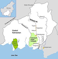
The Kapuas River is a river in the Indonesian part of Borneo island. It originates in the Müller Mountain Range at the center of the island and flows south until merging with the Barito River and discharging into the Java Sea. It should be distinguished from another Kapuas River, which starts on the other side of the same mountain range in central Borneo but flows to the west and empties to the South China Sea.
The Telen River is a river in East Kalimantan, Borneo island, Indonesia, about 110 kilometers north of the provincial capital Samarinda. It is a tributary of the Mahakam River.
The Negara River is a river of Borneo, Indonesia. It flows in the southeast region of the island, within the Negara District, province of South Kalimantan. It is the second longest river in the province after the Barito River, which the Negara River flows into.
The Sembakung River is a river in Borneo that flows from Sabah, Malaysia to North Kalimantan, Indonesia, about 1600 km northeast of the capital Jakarta.
The Kaso River is a stream in the Indonesian part of the island of Borneo, about 1100 km northeast of the Indonesian capital Jakarta. One of its tributaries is the Seputan River. The Kaso flows into the Mahakam River. In 1889, Tromp reported three villages of Bukat people on the Kaso. The villages were on the Penane River, a tributary of the Kacu at Long Mecai. The semi-nomadic Seputan people also live on the Kacu at times.
Sekonyer is a river in southern Borneo, Central Kalimantan province, Indonesia, about 700 km northeast of the capital Jakarta.

The Tabalong River is a river traversing Tabalong Regency, in the province of South Kalimantan, Indonesia. The river flows into the Negara River. It is a confluence of two tributaries: the Left Tabalong and Right Tabalong rivers.
Sambas River, or specifically referred to Big Sambas River, is a river in Sambas Regency, West Kalimantan, Indonesia. The upstream is located in Kabupaten Bengkayang, flowing through the city of Sambas, continuing to Pemangkat where it discharges into South China Sea.