
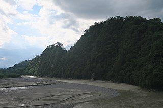
The Digul River is a major river in South Papua province, Indonesia, on the island of New Guinea. It is the fourth longest river in New Guinea after Sepik, Mamberamo, and Fly. With a total length of 853 km (530 mi) and a drainage basin of 45,900 km2 (17,700 sq mi).
Sesayap River is a river in Borneo island, flowing in North Kalimantan Province, Indonesia. It forms a delta which has islands including Bunyu and Tarakan Island.
The Pulau River is a major river in South Papua province of Indonesia, with a total length of 674 km (419 mi).
The Van Daalen River is a river of Western New Guinea in Puncak Jaya and Puncak, Central Papua, Indonesia. It is a tributary of Tariku River.
The Sissa River is a river of Flores, East Nusa Tenggara, Indonesia. The 87-km river flows from a southwest to northeast direction, with the upstream at Mount Inielika north of Bajawa, Ngada Regency, and discharges into the Flores Sea near Mbay, Nagekeo Regency.
The Moyo River is a river of Sumbawa, West Nusa Tenggara province, Indonesia, about 1200 km east of capital Jakarta.
The Mina River is a river of Timor, in the province of East Nusa Tenggara, Indonesia, about 2000 km east of the capital Jakarta. Above this river also stretches the Noelmina Bridge which connects Kupang with the South Central Timor Regency.
The Benanain River is a river of western Timor, Indonesia. This river is the longest and the largest di the West Timor area, with a length of 132 km. The river is located in three regencies: Malaka, Timor Tengah Utara and Timor Tengah Selatan, province East Nusa Tenggara, Indonesia. The upstream rises from Mount Mutis, flowing in the southeast direction until discharging to Timor Sea near Besikama.
The Kadassa River is a river of Sumba, East Nusa Tenggara, Indonesia.
The Kadumbul River is a river of Sumba, East Nusa Tenggara, Indonesia.
The Serayu River is a river in Central Java, Indonesia, about 300 km southeast of the capital Jakarta.
Paguyaman River is a river in Gorontalo (province), Sulawesi island, Indonesia, about 1900 km northeast of capital Jakarta.

Barumun River is a Sumatran river that begins in Siraisan, Padang Lawas Regency in the southeastern North Sumatra, Indonesia, about 1,200 km northwest of the capital Jakarta.

The Kampar River is on the island of Sumatra in Indonesia, about 800 km northwest of the capital Jakarta. It is a well-known river surfing destination because of its tidal bore, known as Bono.
The Pono River is a river on the Indonesian part of the island of Timor, which is in the territory of the East Nusa Tenggara province, about 2000 km east of the Indonesian capital, Jakarta.
Kota Tambolaka is the administrative capital of the Southwest Sumba Regency, on the island of Sumba, East Nusa Tenggara province of Indonesia. Tambolaka was in fact the name of the airport, the real former name of the city being Waitabula.
Ci Kaengan is a river in the island of Java, Indonesia, that flows mainly in the Garut Regency of West Java province, about 210 km to the southeast of the capital Jakarta.
The Kambaniru River is a river in the island of Sumba, Indonesia, about 1,500 km east of the capital Jakarta. With a length of approximately 118 km, it flows periodically through 9 districts in the East Sumba Regency, exiting to the Bay of Kambaniru near the city of Waingapu to the Sawu Sea, with high debit in the wet season, but very low in the dry season.
Sambas River, or specifically referred to Big Sambas River, is a river in Sambas Regency, West Kalimantan, Indonesia. The upstream is located in Kabupaten Bengkayang, flowing through the city of Sambas, continuing to Pemangkat where it discharges into South China Sea.
The Wanokaka River is a river in Sumba island, Province of East Nusa Tenggara, Indonesia. It is located a few kilometers south of Waikabubak, with the District of Wanokaka (Wanukaka), east of the District of Lamboya.

