Wanokaka River

Last updated
Sungai Wanokaka
Wano Kaka, Luku Wonokaka
Sumba Locator Topography.png
Red pog.svg
Lokasi muara
Indonesia relief location map.jpg
Red pog.svg
Wanokaka River (Indonesia)
Location
Country Indonesia
Physical characteristics
Source Manupeu Tanah Daru National Park
  location Sumba, East Nusa Tenggara
  elevation500 m (1,600 ft)
Mouth Indian Ocean
  location
West Sumba Regency
Length80 km (50 mi)

Wanokaka River [1] is a river in Sumba island, Province of East Nusa Tenggara, Indonesia. [2] It is located a few kilometers south of Waikabubak, with the District of Wanokaka (Wanukaka), east of the District of Lamboya. [3]

Contents

Hydrology

Wanokaka River flows from east to west before turning to the south into the Indian Ocean at a length of 80 km. [4] The upstream is at the hills Manupeu Tanah Daru National Park, village of Liangudongo, Konda Maloba Utara, District of Katikutana, Central Sumba Regency and discharges into Indian Ocean near Wanokaka Beach in the village of Desa Waihura, District of Wanokaka, West Sumba Regency. The river is famous for two waterfalls, namely Matayangu and Lapopu waterfall. [5] [6]

Tributaries

Some tributaries flow to this river among others: Labariri River, Lahihagalang River, Kerimaraga River, Kihi River, Lakaraha River, Waikajelung River, Lokomara River, and Katamawai River.

Geography

The river flows along the southern area of Sumba with predominantly tropical savanna climate (designated as As in the Köppen-Geiger climate classification). [7] The annual average temperature in the area is 24 °C. The warmest month is April, when the average temperature is around 26 °C, and the coldest is January, at 22 °C. [8] The average annual rainfall is 1731 mm. The wettest month is December, with an average of 356 mm rainfall, and the driest is August, with 10 mm rainfall. [9]

Luku Wonokaka
Climate chart (explanation)
J
F
M
A
M
J
J
A
S
O
N
D
 
 
273
 
 
24
20
 
 
303
 
 
26
23
 
 
222
 
 
25
24
 
 
151
 
 
26
26
 
 
94
 
 
26
25
 
 
48
 
 
24
24
 
 
22
 
 
24
23
 
 
10
 
 
25
23
 
 
18
 
 
26
23
 
 
45
 
 
27
25
 
 
189
 
 
27
24
 
 
356
 
 
25
21
Average max. and min. temperatures in °C
Precipitation totals in mm
Source: [8]

Uses

Wanokaka river is utilized for irrigation with Lahikaninu Weir in West Sumba Regency.

See also

Related Research Articles

Asahan River River in North Sumatra, Indonesia

Asahan River is one of the principal rivers in North Sumatra, Indonesia, that begins in Porsea, Toba Samosir Regency at the Southeast part of Lake Toba.

Noel Besi River River in Indonesia

Noel Besi River is a river flowing in the west part of Timor island and forms part of the border between the East Timor exclave of Oecussi and Indonesian West Timor. It flows north into the Sawu Sea. Located 1900 km east of the Indonesian capital, Jakarta.

Wera River is a river of Flores, East Nusa Tenggara province, Indonesia, about 1500 km east of the capital Jakarta.

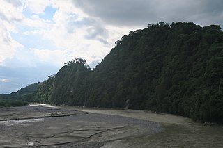
Sissa River is a river of Flores, East Nusa Tenggara, Indonesia. The 87-km river flows from southwest to northeast direction, with the upstream at Mount Inielika north of Bajawa, Ngada Regency and discharge into Flores Sea near Mbay, Nagekeo Regency.

Moyo River is a river of Sumbawa, West Nusa Tenggara province, Indonesia, about 1200 km east of capital Jakarta.

Mina River (Indonesia) River in Indonesia

Mina River is a river of Timor, in the province of East Nusa Tenggara, Indonesia, about 2000 km east of the capital Jakarta.

Benanain River is a river of western Timor, Indonesia. This river is the longest and the largest di the West Timor area, with a length of 132 km. The river is located in three regencies: Malaka, Timor Tengah Utara and Timor Tengah Selatan, province East Nusa Tenggara, Indonesia. The upstream rises from Mount Mutis, flowing in the southeast direction until discharging to Timor Sea near Besikama.

Polapare River is a river of Sumba Barat Daya Regency in the island of Sumba, East Nusa Tenggara, Indonesia. The length of the river is 18 km. Offshore of the river mouth are the islands of Baholokmonegoro and Barenggemonokodi; Malondobara Island is 1¼ km to the west.

Kadassa River is a river of Sumba, East Nusa Tenggara, Indonesia.

Kadumbul River is a river of Sumba, East Nusa Tenggara, Indonesia.

Melolo River is a river of Sumba, Indonesia.

Manuk River River in Indonesia

Manuk River is a river in West Java, Indonesia, about 170 km east of the capital Jakarta.

Kaso River (Sukabumi) River in Sukabumi city, west Java

Kaso River, also Ci Kaso, is a river in Sukabumi Regency, West Java, Indonesia, about 140 km south of the capital Jakarta.

Progo River

The Progo River is a river in southern central Java, Indonesia. The river passes through two provinces; Central Java and Yogyakarta Special Region. The source of the river is on the slopes of Mount Sindoro, Central Java.

Palu River

Palu River is a river in Central Sulawesi, Sulawesi island, Indonesia, about 1600 km northeast of the capital Jakarta.

Sampara River is a river in the province of Southeast Sulawesi on the Sulawesi island, Indonesia, about 1800 km northeast of the capital Jakarta.

Pono River is a river on the Indonesian part of the island of Timor, so-called West Timor, which is in the territory of the East Nusa Tenggara province, about 2000 km east of the Indonesian capital, Jakarta.

Cidayeuh River is a river in Dayeuhluhur, Cilacap, Central Java in Indonesia, about 220 km southeast of the capital Jakarta.

Cikawalon River

Cikawalon River is an important river at Dayeuhluhur, Cilacap Regency, Central Java in Java Island, Indonesia, about 220 km southeast of the capital Jakarta. It is a tributary river of the Cibeet River.

Kambaniru River is a river in the island of Sumba, Indonesia, about 1,500 km east of the capital Jakarta. With a length of approximately 118 km, it flows periodically through 9 districts in the East Sumba Regency, exiting to the Bay of Kambaniru near the city of Waingapu to the Sawu Sea, with high debit in the wet season, but very low in the dry season.

References

  1. Following Indonesian official geographical naming guide for.
  2. Luku Wonokaka at Geonames.org (cc-by); Last updated 2012-01-17; Database dump downloaded 2015-11-27
  3. The Southwest of Sumba. Diakses 10 Desember 2018
  4. (in Indonesian) Nama dan Panjang Sungai di Provinsi Nusa Tenggara Timur
  5. Indonesia Kaya. "Terpesona Oleh Biru dan Jernihnya Air Terjun Lapopu - Situs Budaya Indonesia". indonesiakaya.com. Retrieved 2018-12-10.
  6. Kompas Cyber Media. "Melancong ke Sumba, Kunjungi Lapopu, Air Terjun Tertinggi di NTT". Kompas.com. Retrieved 2018-12-10.
  7. Peel, M C; Finlayson, B L; McMahon, T A (2007). "Updated world map of the Köppen-Geiger climate classification". Hydrology and Earth System Sciences. 11 (5): 1633–1644. doi: 10.5194/hess-11-1633-2007 .
  8. 1 2 "NASA Earth Observations Data Set Index". NASA. 30 January 2016.
  9. "NASA Earth Observations: Rainfall (1 month - TRMM)". NASA/Tropical Rainfall Monitoring Mission. 30 January 2016.

Coordinates: 9°45′00″S119°28′00″E / 9.75°S 119.46667°E / -9.75; 119.46667