Central Sumba Regency Kabupaten Sumba Tengah | |
---|---|
Coordinates: 9°37′46″S119°37′09″E / 9.6294°S 119.6191°E | |
Country | Indonesia |
Region | Lesser Sunda Islands |
Province | East Nusa Tenggara |
Capital | Waibakul |
Government | |
• Regent | Umbu Sappi Pateduk |
• Vice Regent | Umbu Dondu |
Area | |
• Total | 1,845.28 km2 (712.47 sq mi) |
Population (mid 2023 estimate) [1] | |
• Total | 91,531 |
• Density | 50/km2 (130/sq mi) |
Area code | (+62) 386 |
Website | sumbatengahkab |
Central Sumba Regency (Indonesian : Kabupaten Sumba Tengah) is a regency in East Nusa Tenggara of Indonesia. The new Central Sumba Regency was established on the island of Sumba when West Sumba Regency was split into two regencies on 22 May 2007 and a further Regency was created in Central Sumba from parts of both West Sumba and East Sumba Regencies. [2] The new Regency covers 1,845.28 km2 and had a population of 62,485 at the 2010 Census [3] and 85,482 at the 2020 Census; [4] the official estimate as at mid 2023 was 91,531. [1] The seat (capital) of its government is located at Waibakul.
The Central Sumba Regency (following the re-organisation of 22 May 2007 which created it out of parts of both West Sumba Regency and East Sumba Regency) was composed of five districts (kecamatan), but a sixth district (Umbu Ratu Nggay Tengah) has since been created by taking 7 villages from Umbu Ratu Nggay District and 3 villages from Umbu Ratu Nggay Barat District. The areas (in km2) and populations of these districts at the 2010 Census [3] and the 2020 Census [4] are listed below, together with the official estimates as at mid 2023. [1] The table also includes the locations of the district administrative centres, the number of administrative villages in each district (all classed as rural desa), and its postal code.
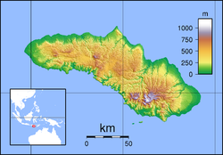
Kode Wilayah | Name of District (kecamatan) | Area in km2 | Pop'n Census 2010 | Pop'n Census 2020 | Pop'n Estimate mid 2023 | Admin centre | No. of villages | Post code |
---|---|---|---|---|---|---|---|---|
53.17.01 | Katikutana [5] | 70.27 | 9,733 | 13,837 | 13,791 | Anakalang | 7 | 87282 |
53.17.05 | Katikutana Selatan [6] (South Kalikutana) | 383.96 | 10,095 | 14,755 | 15,599 | Waikabeti | 9 | 87280 |
53.17.02 | Umbu Ratu Nggay Barat [7] (West Umbu Ratu Nggay) | 220.31 | 16,223 | 21,507 | 20,117 | Maderi | 15 | 87281 |
53.17.04 | Umbu Ratu Nggay [8] | 629.62 | 12,264 | 16,306 | 12,258 | Lendi Wacu | 11 | 87283 |
53.17.06 | Umbu Ratu Nggay Tengah [9] (Central Umbu Ratu Nggay) | 206.77 | (a) | (a) | 9,029 | Bolubokat | 10 | 87283 |
53.17.03 | Mamboro [10] | 334.35 | 14,170 | 19,077 | 20,737 | Mananga | 13 | 87258 |
Totals | 1,845.28 | 62,485 | 85,482 | 91,531 | Waibakul | 65 |
Note: (a) The populations at the 2010 and 2020 Censuses of the villages now forming the new Central Umbu Ratu Nggay District are included with the figures for the two districts from which they were cut out.
Alor is the largest island in the Alor Archipelago and is one of the 92 officially listed outlying islands of Indonesia. It is located at the eastern end of the Lesser Sunda Islands chain that runs through southeastern Indonesia, which from the west include such islands as Bali, Lombok, Sumbawa, Komodo, and Flores.
Anambas Islands Regency is an island regency in the Riau Islands Province, Indonesia, located in the Natuna Sea. The regency consists of 255 islands, including five outer islands that are important for Indonesia's sovereignty boundaries, namely: Tokong Berlayar Island, Tokong Nanas Island, Mangkai Island, Damar Island, and Malangbiru Island. Anambas Islands Regency located 150 nautical miles northeast of Batam Island in the Natuna Sea between the Malaysian Peninsula to the west and the island of Borneo to the east. Geographically part of the Tudjuh Archipelago. This island regency covers a land area of approximately 661.47 square kilometres (255.39 sq mi) spread over an area of approximately 46,664 km² of water. The regency had a population of around 37,411 at the 2010 Census. and 47,402 at the 2020 Census; the official estimate as at mid 2023 was 50,140. The administrative centre is at Tarempa on Siantan Island.
Sikka is a regency within East Nusa Tenggara province, Indonesia, on the island of Flores. It is bordered to the west by Ende Regency and to the east by East Flores Regency. It covers an area of 1,675.36 km2 and had a population of 300,301 at the 2010 census and 321,953 at the 2020 Census; the official estimate as at mid 2023 was 337,011. The capital is the town of Maumere, which comprises the districts of Alok Barat, Alok and Alok Timur.
Ende Regency is a regency on the island of Flores, within East Nusa Tenggara Province of Indonesia. The regency covers an area of 2,091.19 km2, and it had a population of 260,605 at the 2010 Census and 270,763 at the 2020 Census; the official estimate as at mid 2023 was 280,328. It is bordered to the west by Nagekeo Regency and to the east by Sikka Regency, while the Flores Sea lies to the north and the Savu Sea to the south.
Ende is the seat capital of the Ende Regency, East Nusa Tenggara province of Indonesia. Ende is located on the southern coast of Flores Island. The town had a population of 87,269 residents at the 2020 census, divided administratively between four districts (kecamatan) of the regency – Ende Selatan, Ende Timur, Ende Tengah, and Ende Utara. Note that this does not include Ende District or Pulau Ende District. The official estimate as at mid 2023 was 87,723.
West Sumba Regency is a regency in East Nusa Tenggara Province of Indonesia. Established in 1958, the regency was considerably reduced on 2 January 2007 with the creation of new Regencies on Sumba Island under Law UU No.16 of that year. Its area is now 721.96 km2, and its population was 110,993 at the 2010 census and 145,097 at the 2020 Census; the official estimate as at mid 2023 was 150,868. It has its seat (capital) in (Kota) Waikabubak.
Alor Regency is a regency in East Nusa Tenggara (NTT) province of Indonesia. Established in 1958, Alor Regency administers the Alor Archipelago with its seat (capital) in Kalabahi on Alor Island.
Belu Regency is a regency in East Nusa Tenggara province of Indonesia. Situated on the north side of Timor island, it originally stretched to the south coast, but in December 2012 its southern half was detached to form the new Malaka Regency. It now adjoins the North Central Timor Regency to the west, the new Malaka Regency to the south, and the separate nation of East Timor to the east, while to the north lies the Sawu Sea. Established on 20 December 1958, Belu Regency has its seat (capital) in the large town of Atambua, which lies inland from the coastal port of Atapupu.
East Sumba Regency is geographically the largest of the four regencies which divide the island of Sumba, within East Nusa Tenggara Province of Indonesia. It occupies 62% of the entire island, being much less densely populated than the western third. The town of Waingapu is the capital of East Sumba Regency. The population of East Sumba Regency was 227,732 at the 2010 Census and 244,820 at the 2020 Census; the official estimate as at mid 2022 was 255,498.
West Manggarai Regency is one of the eight regencies which comprise the island of Flores, located in the province of East Nusa Tenggara in Indonesia. The Regency was created on 25 February 2003 by the separation off of the western districts from Manggarai Regency. It covers a land area of 3,141.47 km2, and had a population of 221,703 at the 2010 census, rising to 251,689 at the 2015 Intermediate census and to 256,317 at the 2020 census. The official estimate as at mid 2023 was 278,184. The regency's capital is the town of Labuan Bajo.
East Flores Regency is a regency in East Nusa Tenggara province of Indonesia. Established in 1958, the regency has its seat (capital) in Larantuka on Flores Island. It covers a land area of 1,812.65 km2, and it had a population of 232,605 as of the 2010 census and 276,896 at the 2020 Census; the official estimate as of mid-2023 was 289,376. The regency encompasses the eastern tip of the island of Flores, together with all of the adjacent islands of Adonara and Solor to the east of Flores, with some much smaller offshore islands. On 4 October 1999, the island of Lembata at the eastern end of the Solor Archipelago was separated from the East Flores Regency to create its own Regency.
Kupang Regency is a regency in East Nusa Tenggara province of Indonesia. It occupies the far western end of Timor Island, together with the smaller island of Semau and other minor offshore islands. Other islands further to the southwest and west which were formerly part of Kupang Regency have been separated administratively - the Rote Islands Group on 10 April 2002, and the Savu Islands Group on 29 October 2008.
South Central Timor Regency is a regency in East Nusa Tenggara province of Indonesia, established in 1958. the regency has its seat (capital) in the town of Soe. It covers an area of 3,956.15 km2 and had a population of 440,470 at the 2010 Census and 455,410 at the 2020 Census; the official estimate as at mid 2023 was 473,948.
North Central Timor Regency is a regency in East Nusa Tenggara Province, Indonesia. It covers an area of 2,674.02 km2, and had a population of 229,803 at the 2010 Census and 259,829 at the 2020 Census; the official estimate as at mid 2023 was 269,628. Its regency seat is located at the town of Kefamenanu, which had a population of 47,628 in mid 2023. The regency borders Timor Leste's Oecusse enclave, one of few Indonesian regions that have a land border with other countries.
Lembata Regency is a regency in East Nusa Tenggara province of Indonesia. Established on 4 October 1999 from the most easterly part of East Flores Regency, the regency covers the island of Lembata, together with three small offshore islands together forming the eastern part of the Solor Archipelago, and has its administrative seat (capital) in Lewoleba. The population of the Regency was 117,829 at the 2010 decennial census and at the 2020 census was 135,930; the official estimate as at mid 2023 was 137,812.
Rote Ndao Regency is a regency in East Nusa Tenggara province of Indonesia, consisting primarily of the island of Rote, situated south-west of the western tip of West Timor with an area of 978.54 km2, together with minor offshore islands including Usu (19.4 km2), Ndana (13.83 km2), Ndao, Landu and Nuse; the total area including the minor offshore islands is 1,249.35 km2. The regency seat is in the village of Ba'a, which is situated in Lobalain District. The population of the Regency was 119,908 as of the 2010 census and 143,764 at the 2020 Census; the official estimate as at mid 2023 was 150,647.
Southwest Sumba Regency is a regency on Sumba Island in East Nusa Tenggara province of Indonesia. Established on 2 January 2007 out of parts of West Sumba Regency, the regency has its seat (capital) in Tambolaka. Its population was 283,818 in the 2010 decennial census and had risen to 303,650 at the 2020 census; the official estimate as at mid 2022 was 322,073 (comprising 164,825 males and 157,248 females
East Manggarai Regency is a regency in East Nusa Tenggara province of Indonesia. Established on 17 July 2007, the regency has its seat (capital) in the town of Borong. It covers a land area of 2,438.68 km2. The population at the 2010 Census was 252,754, and at the 2020 Census was 275,603; the official estimate as at mid 2023 was 310,822.
Sabu Raijua Regency is one of the regencies in the province of East Nusa Tenggara, Indonesia. This regency has an area of 477.40 km2 which includes two main islands in the Sawu Sea, namely Sabu Island and Raijua Island, plus uninhabited Rai Dana Island. Sabu Island is the largest and is the center of government with its capital in West Sabu district, while Raijua Island is smaller and located to the west of Sabu Island. The regency was established by Indonesia's Minister of Home Affairs, Mardiyanto, on 29 October 2008, when it was partitioned from Kupang Regency. The population was 72,960 at the 2010 census, and 89,327 at the 2020 Census; the official estimate as at mid 2023 was 93,323.
Malaka Regency is a regency in the province of East Nusa Tenggara, Indonesia. The regency was established on 14 December 2012, comprising twelve districts which had formerly been the southern part of Belu Regency.