West Manggarai Regency

Last updated
West Manggarai Regency
Kabupaten Manggarai Barat
Lambang Kabupaten Manggarai Barat.png
Lokasi Nusa Tenggara Timur Kabupaten Manggarai Barat.svg
Location within East Nusa Tenggara
Flores Locator Topography.png
Red pog.svg
West Manggarai Regency
Indonesia Lesser Sunda Islands location map.svg
Red pog.svg
West Manggarai Regency
West Manggarai Regency (Lesser Sunda Islands)
Indonesia location map.svg
Red pog.svg
West Manggarai Regency
West Manggarai Regency (Indonesia)
Coordinates: 8°38′41″S119°52′58″E / 8.6448°S 119.8828°E / -8.6448; 119.8828
Country Flag of Indonesia.svg  Indonesia
Province Flag of East Nusa Tenggara.svg  East Nusa Tenggara
Capital Labuan Bajo
Government
  Regent Agustinus Ch. Dula
  Vice RegentMaria Geong
Area
  Total1,212.93 sq mi (3,141.47 km2)
Population
 (mid 2023 estimate) [1]
  Total263,687
  Density220/sq mi (84/km2)
Time zone UTC+8 (ICST)
Area code (+62) 385
Website manggaraibaratkab.go.id

West Manggarai Regency (Indonesian : Kabupaten Manggarai Barat) is one of the eight regencies which comprise the island of Flores, located in the province of East Nusa Tenggara (Nusa Tenggara Timur) in Indonesia. The Regency was created on 25 February 2003 by the separation off of the western districts from Manggarai Regency. It covers a land area of 3,141.47 km2, and had a population of 221,703 at the 2010 census, [2] rising to 251,689 at the 2015 Intermediate census and to 256,317 at the 2020 census. [3] The official estimate as at mid 2023 was 270,917 (comprising 136,188 males and 134,729 females). [1] The regency's capital is the town of Labuan Bajo.

Contents

Geography

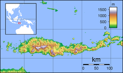
The regency includes the western portion of Flores island (Pulau Flores) and several small islands mainly lying to the west of it, including the two largest islands, Komodo (Pulau Komodo) and Rinca (Pulau Rinca) as well as others such as Greater Seraya (Pulau Seraya Besar), Lesser Seraya (Pulau Seraya Kecil), Bidadari (Pulau Bidadari) and Longgos (Pulau Longgos). The total area of West Manggarai Regency is 10,193.47 square kilometres (3,935.72 sq mi), consisting of a land area of 3,141.47 square kilometres (1,212.93 sq mi) and a sea area of 7,052 square kilometres (2,723 sq mi).

Administration

At the time of the 2010 census West Manggarai Regency was divided into seven districts (kecamatan), but a further five districts have subsequently been created by the division of existing districts. These are tabulated below with their areas and their 2010 [2] and 2020 [3] census populations, together with the official estimates as at mid 2023. [1] The table also includes the locations of the district administrative centres, the number of administrative villages in each district (totaling 164 rural desa and 5 urban kelurahan), and its post code.

Kode
<Wilayah
Name of
District
(kecamatan)
Land
area
in km2
Pop'n
census
2010
Pop'n
census
2020
Pop'n
estimate
mid 2023
Admin
centre
No.
of
villages
Post
code
53.15.05 Komodo (a)813.5341,25853,72458,735Labuan Bajo19 (b)86763
53.15.06Boleng (c)486.5616,56718,92519,918Terang1186754
53.15.04Sano Nggoang360.1925,11314,22914,744Werang1586758
53.15.10Mbeliling231.53(d)13,75814,506Warsawe1586757
53.15.03Lembor145.6849,73233,65335,593Wae Nakeng15 (e)86753
53.15.07Welak319.1919,10021,38922,382Orong1686762
53.15.09Lembor Selatan
(South Lembor)
275.87(f)23,46124,613Lengkong Cepang1586761
53.15.02Kuwus54.5540,36513,67314,109Golo Welu12 (g)86752
53.15.08Ndoso124.95(h)20,03220,831Ndoso1586750
53.15.12Kuwus Barat
(West Kurus)
42.66(h)10,69511,287Landong1086751
53.15.01Macang Pacar (i)174.6429,56815,93616,580Bari1386756
53.15.11Pacar112.12(j)16,84217,619Pacar1386755
Totals3,141.47221,703256,317270,917Labuan Bajo169

Notes: (a) includes the 139 islands off the west coast of Flores, of which the largest are Komodo and Rinca; the district also includes the most westerly part of the Flores mainland, including the regency capital of Labuan Bajo.
(b) including 2 kelurahan - Labuan Bajo and Wae Kelambu. (c) includes the offshore islands of Pulau Boleng and Pulau Longos.
(d) The 2010 census population quoted for Sanonggoang District includes the figure for the new Mbeliling District, cut out of it between 2010 and 2015.
(e) including one kelurahan - Tangge. (f) The 2010 census population quoted for Lembor District includes the figure for the new Lembor Selatan District, cut out of it in the same period.
(g) including 2 kelurahan - Golo Ru'u and Nantal. (h) The 2010 census population quoted for Kuwus District includes the figure for the new Ndoso District, cut out of it in the same period, while the 2010 census population quoted for Kuwus District additionally includes the figure for the new Kuwus Barat District, cut out of it in 2018.
(i) includes the offshore islands of Pulau Medang and Pulau Sebabi.
(j) The 2010 census population quoted for Macang Pacar District includes the figure for the new Pacar District, cut out of it in 2018.

Demographics

Religion

Most of the population of West Manggarai Regency are Christianism, which is 78.56%, of which the majority are Catholicism 77.76% and Protestantism 0.80%. There is also a large proportion of the population adheres to the religion Islam which is 21.39%, and the rest are Hinduism 0.4% and Buddhism less than 0.01%. [4]

Religion in West Manggarai Regency
Religionpercent
Catholicism
77.76%
Islam
21.39%
Protestantism
0.80%
Hinduism
0.04%
Other
0.01%

Ethnic groups

The Manggarai people inhabits Manggarai Regency, West Manggarai and East Manggarai, which is located on the island of Flores, East Nusa Tenggara Province. The total population is about 350,000 people.

The Manggarai language consists of several dialects, such as Pae, Mabai, Rejong, Mbaen, Pota, Central Manggarai, East Manggarai, and West Manggarai dialects. The four leading dialects may be the languages of separate ethnic groups that were subservient to the Manggarai people in ancient times. [5]

The Komodo people inhabits Komodo Village, Komodo District, West Manggarai and speak the endangered Komodo language. Komodo people inhabit the fishing village inhabited by 800 families. The population stands at 2,000 people. The majority are fishermen and some are active as Rangers in Komodo National Park. [6]

The Bajo or Bajau people are the indigenous tribes of the archipelago originating from the Sulu Islands, Philippines. Bajo migrated to various places in the Malay Archipelago, one of which was Labuhan Bajo, West Manggarai.

Labuan Bajo means the harbor for the Bajo people. This ethnic group is a nomadic ethnic group in the sea, it is not surprising that many call it the Sea Gypsy. [7]

Development issues

Rural development

The West Manggarai Regency, along with other nearby regencies on Flores, has a long and hot dry season. Programs of tree-planting have been initiated in recent years which are helping improve the local environment. [8] These activities include efforts to promote continued attention to the cultivation of sugar palms (Arenga pinnata). [9]

Education

Education facilities in the region are limited, especially in the outlying areas. Some non-government organisations help, for example, with the provision of books for children to isolated villages. [10]

Tourism

Various local community groups in different parts of the regency work to promote the local tourist industry through, for example, the development of local dance troupes and foods from local areas. [11] In Liang Ndara village, which has been designated as a tourist site, there are programs to teach English in the local community to support the tourist industry, [12]

Mount Mbeliling (Indonesian : Gunung Mbeliling), one of the highest peaks in the regency (1,325 meters) is a well-known destination for climbers and tourists to the regency. [13] The area around Mt Mbeliling, which is rich in bird life, attracts bird-watching groups [14]

Tourism

Sano Nggoang

Sano (means Mount) Nggoang is 513 hectares (1.9 sq. mi.) of volcanic crater lake with depth of around 600 meters (1968.5 ft.), the deepest lake of its kind in the world. [15]

Shark and manta ray sanctuary

In late August 2013, the local authority designated that all regency's marine and coastal water up to 12 nautical miles offshore occupied 7,000 square kilometer area as a shark and manta ray sanctuary (includes sea around Komodo Island). [16]

Komodo National Park

The national park was founded in 1980 to protect the Komodo dragon, the world's largest lizard. [17] In 1991 the national park was declared a UNESCO World Heritage Site. [18]

See also

Related Research Articles

<span class="mw-page-title-main">Flores</span> Island of the Lesser Sunda Islands in Indonesia

Flores is one of the Lesser Sunda Islands, a group of islands in the eastern half of Indonesia. Administratively, it forms the largest island in the East Nusa Tenggara Province. Including Komodo Island off its west coast, the land area is 15,530.58 km2, and the population was 1,878,875 in the 2020 Census ; the official estimate as of mid-2022 was 1,919,395. The largest towns are Maumere and Ende. The name Flores is of Portuguese origin, meaning "Flowers".

<span class="mw-page-title-main">East Nusa Tenggara</span> Province of Indonesia

East Nusa Tenggara is the southernmost province of Indonesia. It comprises the eastern portion of the Lesser Sunda Islands, facing the Indian Ocean in the south and the Flores Sea in the north. It consists of more than 500 islands, with the largest ones being Sumba, Flores, and the western part of Timor; the latter shares a land border with the separate nation of East Timor. The province is subdivided into twenty-one regencies and the regency-level city of Kupang, which is the capital and largest city.

<span class="mw-page-title-main">Komodo National Park</span> National park in Indonesia

Komodo National Park is a national park in Indonesia located within the Lesser Sunda Islands in the border region between the provinces of East Nusa Tenggara and West Nusa Tenggara. The park includes the three larger islands Komodo, Padar and Rinca, and 26 smaller ones, with a total area of 1,733 km2. The national park was founded in 1980 to protect the Komodo dragon, the world's largest lizard. Later it was dedicated to protecting other species, including marine species. In 1991 the national park was declared a UNESCO World Heritage Site.

<span class="mw-page-title-main">Komodo (island)</span> Island in East Nusa Tenggara, Indonesia

Komodo is one of the 17,508 islands that comprise the Republic of Indonesia. It is particularly notable as the habitat of the Komodo dragon, the largest lizard on Earth, which is named after the island. Komodo Island has a surface area of 291 square kilometres, and had a human population of about 1,800 in 2020.

<span class="mw-page-title-main">Rinca</span> Island in Indonesia

Rinca, also known as Rincah, Rindja, Rintja and Pintja, is a small island near Komodo and Flores island, East Nusa Tenggara, Indonesia, within the West Manggarai Regency. It is one of the three largest islands included in Komodo National Park. The island is famous for Komodo dragons, giant lizards that can measure up to 3 metres (9.8 ft) long. Rinca is also populated with many other species such as wild pigs, buffalos and many birds.

<span class="mw-page-title-main">Sikka Regency</span> Regency in Lesser Sunda Islands, Indonesia

Sikka is a regency within East Nusa Tenggara province, Indonesia, on the island of Flores. It is bordered to the west by Ende Regency and to the east by East Flores Regency. It covers an area of 1,675.36 km2 and had a population of 300,301 at the 2010 census and 321,953 at the 2020 Census; the official estimate as at mid 2023 was 335,360 - comprising 163,060 males and 172,300 females). The capital is the town of Maumere, which comprises the districts of Alok Barat, Alok and Alok Timur.

<span class="mw-page-title-main">Ende (town)</span> Place in Lesser Sunda Islands, Indonesia

Ende is the seat capital of the Ende Regency, East Nusa Tenggara province of Indonesia. Ende is located on the southern coast of Flores Island. The town had a population of 87,269 residents at the 2020 census, divided administratively between four districts (kecamatan) of the regency – Ende Selatan, Ende Timur, Ende Tengah, and Ende Utara. Note that this does not include Ende District. The official estimate as at mid 2023 was 88,921.

<span class="mw-page-title-main">Sape Strait</span> Strait in Indonesia

The Sape Strait or Sapie Strait is a strait connecting the Flores Sea to the Sumba Strait. It separates the islands of Sumbawa and Komodo. It joins the Indonesian provinces of West Nusa Tenggara and East Nusa Tenggara.

<span class="mw-page-title-main">Alor Regency</span> Regency in Indonesia

Alor Regency is a regency (kabupaten) in East Nusa Tenggara (NTT) province of Indonesia. Established in 1958, Alor Regency administers the Alor Archipelago with its seat (capital) in Kalabahi on Alor Island.

<span class="mw-page-title-main">Manggarai people</span> Ethnic group of Indonesia

The Manggarai are an ethnic group found in western Flores in the East Nusa Tenggara province, Indonesia. Manggarai people are spread across three regencies in the province, namely the West Manggarai Regency, Manggarai Regency, and East Manggarai Regency.

<span class="mw-page-title-main">Ngada Regency</span> Regency in Lesser Sunda Islands, Indonesia

Ngada Regency is one of the regencies on the island of Flores, East Nusa Tenggara Province, Indonesia. It is bordered by East Manggarai Regency to the west and Nagekeo Regency to the east, with the Flores Sea to the north and the Sawu Sea to the south. The Regency, which covers an area of 1,620.92 km2, had a population of 142,254 at the 2010 census, which increased to 165,254 at the 2020 census; the official estimate as at mid 2023 was 171,736. The town of Bajawa is the capital of Ngada Regency.

<span class="mw-page-title-main">Sumbawa Regency</span> Regency in West Nusa Tenggara, Indonesia

Sumbawa Regency is a Regency (Kabupaten) of the Indonesian Province of West Nusa Tenggara. It is located on the island of Sumbawa and covers an area of 6,643.98 km2 following the separation on 18 December 2003 of what were until then its westernmost five districts to form the newly-created West Sumbawa Regency. It includes the substantial island of Moyo, lying off the north coast of Sumbawa. The population of the Regency at the 2010 Census was 415,789, which rose at the 2020 Census to 509,753; the official estimate as at mid 2021 was 527,607. The capital is the town of Sumbawa Besar on the north coast of Sumbawa Island.

<span class="mw-page-title-main">West Sumbawa Regency</span> Regency in West Nusa Tenggara, Indonesia

West Sumbawa Regency is a Regency (Kabupaten) of the Indonesian Province of West Nusa Tenggara. It is located on the island of Sumbawa and has an area of 1,743.58 km2. The regency was created on 18 December 2003 from what were at that time the westernmost five districts (kecamatan) of Sumbawa Regency. The population at the 2010 Census was 114,754, and at the 2020 Census was 145,798; the official estimate as at mid 2022 was 151,775 - comprising 76,959 males and 74,816 females. The capital is the town of Taliwang.

<span class="mw-page-title-main">Manggarai Regency</span> Regency in East Nusa Tenggara, Indonesia

Manggarai Regency is a regency in East Nusa Tenggara province of Indonesia, situated on the island of Flores. Established in 1958 the regency was reduced in size and population by the separation of the more western districts to form West Manggarai Regency in 2003 and of the more eastern districts to form East Manggarai Regency in 2007. The area of the residual Manggarai Regency is 1,343.83 km2 and its population was 292,037 at the 2010 census and 312,855 at the 2020 census; the official estimate as at mid 2023 was 328,758. The capital of the regency is the town of Ruteng.

<span class="mw-page-title-main">Lembata Regency</span> Regency in East Nusa Tenggara, Indonesia

Lembata Regency is a regency in East Nusa Tenggara province of Indonesia. Established on 4 October 1999 from the most easterly part of East Flores Regency, the regency covers the island of Lembata, together with three small offshore islands together forming the eastern part of the Solor Archipelago, and has its administrative seat (capital) in Lewoleba. The population of the Regency was 117,829 at the 2010 decennial census and at the 2020 census was 135,930; the official estimate as at mid 2023 was 141,391 - comprising 68,409 males and 72,982 females.

<span class="mw-page-title-main">Nagekeo Regency</span> Regency in Lesser Sunda Islands, Indonesia

Nagekeo Regency is a regency on the island of Flores in East Nusa Tenggara province of Indonesia. It covers an area of 1,416.96 km2 and had a population of 130,120 at the 2010 Census, and 159,732 at the 2020 Census; the official estimate as at mid 2023 was 166,063, comprising 82,016 males and 83,986 females. The regency was established on 2 January 2007 by separation of the former eastern districts from Ngada Regency; it has its administrative seat (capital) in the town of Mbay on the north coast of Flores. It is bordered to the west by the residual Ngada Regency and to the east by Ende Regency, while to the north is the Flores Sea and to the south is the Savu Sea.

<span class="mw-page-title-main">East Manggarai Regency</span> Regency in East Nusa Tenggara, Indonesia

East Manggarai Regency is a regency in East Nusa Tenggara province of Indonesia. Established on 17 July 2007, the regency has its seat (capital) in the town of Borong. It covers a land area of 2,391.45 km2. The population at the 2010 Census was 252,754, and at the 2020 Census was 275,603; the official estimate as at mid 2023 was 290,790.

<span class="mw-page-title-main">Labuan Bajo</span> Town in Lesser Sunda Islands, Indonesia

Labuan Bajo is a fishing town located at the western end of the large island of Flores in the East Nusa Tenggara province of Indonesia. It is the capital of the West Manggarai Regency, one of the eight regencies which are the major administrative divisions of Flores.

<span class="mw-page-title-main">Manggarai language</span> Austronesian language spoken in Flores, Indonesia

The Manggarai language is the language of the Manggarai people from the western parts of the island of Flores, in East Nusa Tenggara Province, Indonesia.

Komodo is a district in the regency of West Manggarai, East Nusa Tenggara, Indonesia.

References

  1. 1 2 3 Badan Pusat Statistik, Jakarta, 28 February 2024, Kabupaten Manggarai Barat Dalam Angka 2024 (Katalog-BPS 1102001.5315)
  2. 1 2 Biro Pusat Statistik, Jakarta, 2011.
  3. 1 2 Badan Pusat Statistik, Jakarta, 2021.
  4. "Provinsi Nusa Tenggara Timur Dalam Angka 2017" (PDF). BPS Nusa Tenggara Timur (in Indonesian). Archived from the original (PDF) on 2017-09-18. Retrieved 2 December 2017.
  5. Ethnic groups in NTT and Interesting Facts About It
  6. Getting to Know the Uniqueness of the Komodo Tribe, the Original Ancestor of Komodo Island
  7. The History of Labuan Bajo, the Land of Birth of the Native Fish-Man Race of the Archipelago
  8. Markus Makur, 'Marselinus Agot: Three million trees for Manggarai Raya', The Jakarta Post, 30 September 2011. Also Markus Makur, 'Aventinus Sadip: Greening to ease warming', The Jakarta Post, 2 April 2013.
  9. Markus Makur, 'Abraham Manggas: Rescuing sugar palms', The Jakarta Post, 14 August 2012.
  10. Eva Muchtar, 'Gardens of Learning', The Jakarta Post Weekender, 26 April 2012.
  11. Markus Makur, 'Yoseph Ugis: Never give up', The Jakarta Post, 28 December 2012.
  12. Markus Makur, 'Tourism: Farmers learn English to welcome more foreign tourists', The Jakarta Post, 22 March 2013.
  13. Markus Makur, Onesimus Patrio Nyamang: Climbing mountains', The Jakarta Post, 3 September 2012.
  14. Markus Makur, 'Samuel Rabenak: From fascination to preservation', The Jakarta Post, 8 March 2012.
  15. "Sano Nggoang Danau Vulkanik Terdalam di Dunia yang Eksotik" (in Indonesian). October 7, 2012.
  16. "West Manggarai establishes shark, manta ray sanctuary". September 12, 2013.
  17. UNESCO: Advisory Body Evaluation, retrieved 2 February 2010
  18. "Komodo National Park". UNESCO.