Merangin Regency

Last updated
Merangin Regency
Kabupaten Merangin
Lambang Kabupaten Merangin.png
Motto(s): 
Tali Undang Tambang Teliti
(Strap of Penghulu tribe and rope of Batin tribe; another meaning: tie in the rules, explore carefully)
Lokasi Jambi Kabupaten Merangin.svg
Country Indonesia
Province Jambi
Regency seat Bangko
Area
  Total7,679.0 km2 (2,964.9 sq mi)
Population
 (mid 2023 estimate) [1]
  Total368,389
  Density48/km2 (120/sq mi)
Time zone UTC+7 (WIB)
Website meranginkab.go.id

Merangin Regency is a regency (kabupaten) of Jambi Province on the island of Sumatra, Indonesia. It was created on 4 October 1999 by the division of the former Sarolangun Bangko Regency into a new Sarolangun Regency in the east and this Merangin Regency in the west. The regency covers an area of 7,679.0 km2, and had a population of 333,206 at the 2010 census [2] and 354,052 at the 2020 census; [3] the official estimate as at mid 2023 was 368,389 - comprising 187,026 males and 181,363 females. [1] The administrative capital is the town of Bangko.

Contents

Borders

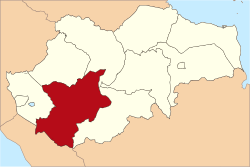
Geographically, Merangin Regency lies between 101032’39” – 102038’35” east longitude, and 1039’23” – 2046’9” south longitude. Merangin borders on Bungo Regency on the north side, Tebo Regency to the northeast, Sarolangun Regency on the east side, Lebong Regency (in Bengkulu Province) on the south side and Kerinci Regency on the west side.

Administrative districts

Merangin Regency is divided into twenty-four districts (kecamatan), tabulated below with their areas and their populations at the 2010 census [2] and the 2020 census, [3] together with the official estimates as at mid 2023. [1] The table also includes the locations of the district administrative centres, the number of administrative villages in each district (totaling 205 rural desa and 10 urban kelurahan), and its post code.

Kode
Wilayah
Name of
District
(kecamatan)
Area
in
km2
Pop'n
2010
Census
Pop'n
2020
Census
Pop'n
mid 2023
Estimate
Admin
centre
No.
of
villages
Post
code
15.02.01Jangkat967.238,9329,7129,457Muara Madras1137372
15.02.18Sungai Tenang
(Jangkat Timur)
593.469,0059,4099,674Rantau Suli1437374
15.02.03Muara Siau655.069,32710,06310,444Pasar Muara Siau1737370
15.02.09Lembah Masurai688.9919,52213,87514,341Pasar Masurai1537373
15.02.24Tiang Pumpung274.864,5864,6844,784Sekancing637371
15.02.06Pamenang346.5430,36233,47634,962Pamenang14 (a)37352
15.02.13Pamenang Barat
(West Pamenang)
199.5515,73717,29418,044Simpang
Limbur Merangin
837318
15.02.19Renah Pamenang107.5813,43914,41614,936Meranti437351
15.02.20Pamenang Selatan
(South Pamenang)
167.479,61210,43010,842Tambang Emas437319
15.02.02Bangko168.3945,55748,85750,619Pasar Atas Bangko8 (b)37311
-37314
15.02.10Bangko Barat
(West Bangko)
196.4710,60710,98511,266Pulau Rengas Ulu637315
15.02.11Nalo Tantan206.5811,67416,98819,010Lubuk Gaung737317
15.02.12Batang Masumai111.349,56310,70211,225Sungai Ulak1037316
15.02.04Sungai Manau295.509,57710,21610,567Sungai Manau1037363
15.02.16Renah Pembarap272.8611,62312,98713,616Simpang Parit1237362
15.02.17Pangkalan Jambu427.056,1426,4096,587Sungai Jering837361
15.02.05Tabir333.3327,60228,59429,327Pasar Rantau Panjang11 (c)37350
15.02.07Tabir Ulu219.648,4118,1448,283Muara Jernih637356
15.02.08Tabir Selatan
(South Tabir)
196.2526,39729,31330,677Rawa Jaya837354
15.02.14Tabir Ilir158.929,6238,8619,009Rantau Limau Manis737358
15.02.15Tabir Timur
(East Tabit)
108.757,3817,9088,190Sungai Bulian437355
15.02.22Tabir Lintas115.387,3758,1128,466Mensango537357
15.02.21Margo Tabir128.3012,94113,60414,012Tanjung Rejo637359
15.02.23Tabir Barat
(West Tabir)
739.508,2119,3059,796Muara Kibul1437353
Totals7,679.00333,206354,052368,389Bangko215

Notes: (a) including one kelurahan - the town of Pamenang, with 7,376 inhabitants in mid 2022.
(b) comprising 4 kelurahan (with populations in mid 2022) - Dusun Bangko (12,968), Pasar Bangko (2,338), Pasar Atas Bangko (5,884) and Pematang Kandis (16,624) - plus 4 desa.
(c) comprising 5 kelurahan (with populatiuons in mid 2022) - Dusun Baru (7,320), Mampun (4,122), Kampung Baruh (3,901), Pasar Baru Rantau (2,572) and Pasar Rantau Panjang (4,511) - plus 6 desa.

However, the last-mentioned eight districts, comprising the northern 26% of Merangin Regency, are planned to be separated out to form a new Regency - Kabupaten Tabir Raya; these eight districts cover 2,000.07 km2 and had an estimated combined population of 113,841 at the 2020 census, [3] rising to an estimated 117,760 in mid 2023. [1] However, the implementation of this scheme is delayed due to the moratorium (since 2013) by the Indonesian Government on the creation of new regencies and cities.

Merangin Geopark

Merangin Geopark has been proposed to UNESCO to be a World's Heritage Merangin Geopark and a UNESCO team has visited Merangin Geopark. The Geopark has a Araucarioxylon fossil tree complete with the root of 300 million years, the oldest in Asia. Today the ancient Merangin River is usually used for white water sports. [4]

Related Research Articles

<span class="mw-page-title-main">Jambi</span> Province of Indonesia

Jambi is a province of Indonesia. It is located on the east coast of central Sumatra and stretches to the Barisan Mountains in the west. Its capital and largest city is also called Jambi. It is bordered by the provinces of Riau to the north, West Sumatra to the west, Bengkulu to the southwest, South Sumatra to the south, and shares a maritime border with the Riau Islands to the east and the Pacific Ocean to the east. The province has a land area of 49,026.58 km2, and a sea area of 3,274.95 km2. Its area is comparable to the European country of Slovakia. It had a population of 3,092,265 according to the 2010 census and 3,548,228 according to the 2020 census; the official estimate of population as of mid-2023 was 3,679,169.

<span class="mw-page-title-main">Indragiri Hulu Regency</span> Regency in Riau, Indonesia

Indragiri Hulu is a landlocked regency (kabupaten) of Riau, Indonesia. It is located on the island of Sumatra. The original regency was split in two on 4 October 1999, with the western half being created as a separate Kuantan Singingi Regency. The regency now has an area of 8,198.71 km2 and had a population of 363,442 at the 2010 census, 408,704 at the 2015 census and 444,548 at the 2020 census; the official estimate as at mid 2023 was 472,799. The administrative seat of the regency is located at the town of Rengat.

<span class="mw-page-title-main">Kuantan Singingi Regency</span> Regency in Riau, Indonesia

Kuantan Singingi is an inland regency (kabupaten) of Riau Province, Indonesia. It is located on the island of Sumatra. The regency was created on 4 October 1999 from what had been the western half of Indragiri Hulu Regency. It has an area of 7,656.03 km2 and had a population of 292,116 at the 2010 Census and 334,943 at the 2020 Census; the official estimate as at mid 2022 was 356,246. The seat of the regency is the town of Teluk Kuantan.

<span class="mw-page-title-main">Tapin Regency</span> Regency in South Kalimantan, Indonesia

Tapin Regency is one of regencies in the Indonesian province of South Kalimantan. The regency was created on 14 July 1965 by splitting off the districts which had until then comprised the southern part of South Hulu Sungai Regency. The regency's motto is "Ruhui Rahayu", and this is also shared by another Indonesian province. It covers an area of 2,174.95 km2 and had a population of 167,877 at the 2010 Census and 189,475 at the 2020 Census; the official estimate as at mid 2023 was 197,893. The administrative centre of the regency is at the town of Rantau.

<span class="mw-page-title-main">North Bengkulu Regency</span> Regency in Bengkulu, Indonesia

North Bengkulu is a regency of Bengkulu Province, Indonesia, on the island of Sumatra. It originally covered much of the northern part of Bengkulu Province, but on 25 February 2003 the most northwesterly districts were split off to form a separate Mukomuko Regency, and on 24 June 2008 the most southeastern districts were likewise split off to create a new Central Bengkulu Regency.

<span class="mw-page-title-main">South Bengkulu Regency</span> Regency in Bengkulu, Indonesia

South Bengkulu is a regency of Bengkulu Province, Indonesia, on the island of Sumatra. It originally comprised all of that part of Bengkulu Province situated to the southeast of the city of Bengkulu, but on 25 February 2003 this area was split into three parts, with the most southeastern districts split off to form a new Kaur Regency and the most northwestern districts split off to form a new Seluma Regency. The reduced South Bengkulu Regency now covers 1,219.91 km2, and had a population of 142,940 at the 2010 Census and 166,249 at the 2020 Census; the official estimate as at mid 2023 was 171,463 - comprising 87,297 males and 84,166 females. The regency's administrative centre is the coastal town of Manna.

<span class="mw-page-title-main">Lahat Regency</span> Regency in South Sumatra, Indonesia

Lahat Regency is a regency of South Sumatra province, Indonesia. It originally included much of the southwestern part of the province, but on 21 June 2001 the town of Pagar Alam was removed from the regency to become an independent city, and on 2 January 2007 the western districts were split off to form the new Empat Lawang Regency. The reduced regency now covers a total area of 4,361.84 km2 and had a population of 369,974 at the 2010 Census and 430,071 at the 2020 Census; the official estimate as at mid 2023 was 438,238. The city of Pagar Alam remains an enclave within the regency, but is administratively separate.

<span class="mw-page-title-main">Batanghari Regency</span> Regency in Jambi, Indonesia

Batanghari is a regency of Jambi Province in Sumatra, Indonesia. It originally covered a wider area, but on 4 October 1999 this was split between a new Muaro Jambi Regency in the east and a reduced Batang Hari Regency in the west, which now covers an area of 5,804.83 km2. It had a population of 241,334 at the 2010 census and 301,700 at the 2020 census; the official estimate as at mid 2023 was 312,279. The administrative capital is the town of Muara Bulian(Bulian Estuary or Bulian Delta).

<span class="mw-page-title-main">Labuhanbatu Regency</span> Regency in North Sumatra, Indonesia

Labuhanbatu Regency, alternatively written in space as Labuhan Batu Regency, is a regency of North Sumatra Province in Indonesia. Its administrative seat is Rantau Prapat. An original regency of the province, it had an area of 9,703 km2 as at early 2008, prior to the separation out of its southern and its north-western districts respectively to create the new South Labuhanbatu and North Labuhanbatu Regencies on 21 July 2008.

<span class="mw-page-title-main">Samosir Regency</span> Regency in North Sumatra, Indonesia

Samosir Regency is an inland regency in North Sumatra. It was created on 18 December 2003 by splitting away the western districts of the former Toba Samosir Regency. The regency covers a land area of 1,444.25 square kilometres, including the whole of Samosir Island in the inland sea of Lake Toba. It had a population of 119,653 at the 2010 census and 136,441 at the 2020 Census; the official estimate for mid 2023 was 141,333 - comprising 70,648 males and 70,685 females. Its administrative seat is the town of Pangururan on the west coast of Samosir Island.

<span class="mw-page-title-main">West Bangka Regency</span> Regency in Bangka Belitung Islands, Indonesia

West Bangka Regency is a regency (kabupaten) of Bangka Belitung Islands Province, Indonesia. It comprises the northwestern part of Bangka Island, together with a number of small islands off its coast. The regency covers an area of 2,820.61 km2 and had a population of 175,110 at the 2010 Census, rising to 204,612 at the 2020 census; the official estimate as at mid 2022 was 209,791 - comprising 108,102 males and 101,689 females. The town of Muntok is its regency seat.

<span class="mw-page-title-main">Toba Regency</span> Regency in North Sumatra, Indonesia

Toba Regency is a landlocked regency in North Sumatra. Its seat is Balige. The regency covers an area of 2,021.8 square kilometres; it had a population of 173,129 at the 2010 census and 206,199 at the 2020 Census; the official estimate as at mid 2023 was 213,850. Although landlocked, the regency includes the eastern shore of the vast inland Lake Toba.

<span class="mw-page-title-main">Mimika Regency</span> Regency in Central Papua, Indonesia

Mimika Regency is one of the regencies (kabupaten) in the Indonesian province of Central Papua. It covers an area of 21,693.51 km2, and had a population of 182,001 at the 2010 Census, but grew to 311,969 at the 2020 Census. The official estimate as of mid-2023 was 313,016. The administrative centre is the town of Timika, which lies within Mimika Baru District, which had 143,367 inhabitants in mid-2023. The regency covers the entire south coast of its province. The only other coastal regency of Central Papua is Nabire Regency, covering the north coast.

<span class="mw-page-title-main">Paser Regency</span> Regency in East Kalimantan, Indonesia

Paser Regency is the southernmost regency (kabupaten) within the East Kalimantan province of Indonesia. It was created in 1959, originally spelt "Pasir Regency", but renamed "Paser" in 2007; however its northeastern districts were split off on 10 April 2002 to form the new Penajam North Paser Regency. The residual regency covers an area of 11,603.94 km2, and it had a population of 230,316 at the 2010 Census and 275,452 at the 2020 Census; the official estimate as at mid-2023 was 303,424. Its administrative centre is the town of Tana Paser.

<span class="mw-page-title-main">Sungai Penuh</span> City in Jambi, Indonesia

Sungai Penuh is a city in Indonesia, in western Jambi province, on the island of Sumatra. It is an enclave within Kerinci Regency, of which it was formerly part but from which it became administratively separate on 24 June 2008. The city, whose name means "Penuh River", is also known as Siulak. It covers an area of 391.50 km2 and had a population of 82,293 at the 2010 Census and 96,610 at the 2020 Census; the official estimate as at mid 2023 was 99,771.

<span class="mw-page-title-main">Sarolangun Regency</span> Regency in Jambi, Indonesia

Sarolangun Regency is a regency of Jambi Province, Indonesia. It is located on the island of Sumatra. It was created on 4 October 1999 by the division of the former Sarolangun Bangko Regency into a new Merangin Regency and this Sarolangun Regency. The regency has an area of 5,935.89 km2 and had a population of 246,245 at the 2010 census and 290,047 at the 2020 census; the official estimate as at mid 2023 was 302,243. The administrative centre is at the town of Sarolangun.

<span class="mw-page-title-main">Seluma Regency</span> Regency in Bengkulu, Indonesia

Seluma Regency is a regency of Bengkulu Province, Indonesia, on the west coast of the island of Sumatra. It was created on 25 February 2003 from what were formerly the northwestern districts of the South Bengkulu Regency. The regency seat is at the town of Pasar Tais. It covers an area of 2,479.36 km2, and had a population of 173,507 at the 2010 Census and 207,877 at the 2020 Census; the official estimate as at mid 2023 was 215,063.

<span class="mw-page-title-main">Ogan Ilir Regency</span> Regency in South Sumatra

Ogan Ilir Regency is a regency of South Sumatra Province, Indonesia. It takes its name from the main river which stream that area, Ogan River. And the name Ilir means downstream. Indralaya is the regency seat. The regency borders Palembang City and Muara Enim Regency to the north, Ogan Komering Ilir Regency to the east, Ogan Komering Ilir Regency, and East Ogan Komering Ulu Regency to the south, and Muara Enim Regency to the west.

<span class="mw-page-title-main">East Kotawaringin Regency</span> Regency in Kalimantan, Indonesia

East Kotawaringin Regency is one of the thirteen regencies which comprise the Central Kalimantan Province on the island of Kalimantan (Borneo), Indonesia. It originally covered a much larger part of the province, having been split from a single Kotawaringin Regency on 26 June 1959 into separate regencies for East and West Kotawaringin, but on 10 April 2002 several districts in the west of the regency were split off to form the new Seruyan Regency, and several districts in the east of the regency were similarly split off to form the new Katingan Regency. The area of the residual East Kotawaringin Regency is 16,796 km2, and its population was 374,175 at the 2010 Census, and 428,900 at the 2020 Census; the official estimate as at mid 2023 was 443,359. The town of Sampit is the capital of East Kotawaringin Regency.

<span class="mw-page-title-main">Way Kanan Regency</span> Regency in Lampung, Indonesia

Way Kanan Regency is a landlocked regency (kabupaten) of Lampung Province, Sumatra, Indonesia. It was created on 20 April 1999 from what were formerly the northern and northwestern districts of North Lampung Regency. It has an area of 3,921.63 km2 and had a population of 406,123 at the 2010 census and 473,575 at the 2020 census; the official estimate as at mid 2023 was 489,773. The administrative centre lies at the town of Blambangan Umpu.

References

  1. 1 2 3 4 Badan Pusat Statistik, Jakarta, 28 February 2024, Kabupaten Merangin Dalam Angka 2024 (Katalog-BPS 1102001.1502)
  2. 1 2 Biro Pusat Statistik, Jakarta, 2011.
  3. 1 2 3 Badan Pusat Statistik, Jakarta, 2021.
  4. Deddy (November 20, 2014). "Warga Jepang Buru Batuan Purba Geopark".

2°12′10″S102°03′14″E / 2.20278°S 102.05389°E / -2.20278; 102.05389