Merauke | |
|---|---|
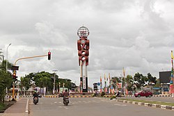 Lingkaran Brawijaya (Libra) 969 monument in Merauke | |
OpenStreetMap  | |
 Merauke Location in Western New Guinea and Indonesia  Merauke Merauke (Indonesia) | |
| Coordinates: 8°28′S140°20′E / 8.467°S 140.333°E | |
| Country | |
| Province | South Papua |
| Regency | Merauke Regency |
| Government | |
| • Head of district | Kristian Ndiken |
| Area | |
• Total | 500.41 km2 (193.21 sq mi) |
| Population (mid 2024 estimate) | |
• Total | 116,864 |
| • Density | 230/km2 (600/sq mi) |
| [1] | |
| Demographics | |
| • Languages | Auyu, Kolopom, Mandobo, Marind, Muyu, Mombum (natives) Javanese (dominant), and others |
| Time zone | UTC+9 (Indonesia Eastern Time) |
| Area code | (+62) 975 |
| Climate | Aw |
| Website | http://www.merauke.go.id |
Merauke is a large town (kelurahan) and an administrative district (distrik) in Merauke Regency of South Papua Province, Indonesia. It is also the administrative centre of Merauke Regency, and is considered to be the easternmost city in Indonesia, although it currently lacks city status. The town was originally called Ermasoe. [2]
Contents
Merauke is next to the Maro River where the Port of Merauke is located. [3] Merauke District covers a land area of 500.41 km2, and had a population of 87,634 at the 2010 Census. [4] which at the 2020 Census had increased to 102,351; [5] the official estimate as at mid 2024 was 116,864 (comprising 60,068 males and 56,796 females). [1]

