Millbrook, Illinois

Last updated

Millbrook, Illinois
Kendall County Illinois Incorporated and Unincorporated areas Millbrook Highlighted.svg
Location of Millbrook in Kendall County, Illinois
Illinois in United States (US48).svg
Location of Illinois in the United States
Coordinates: 41°36′26″N88°32′43″W / 41.60722°N 88.54528°W / 41.60722; -88.54528 [1]
CountryUnited States
StateIllinois
County Kendall
Township Fox
Area
[2]
  Total1.85 sq mi (4.78 km2)
  Land1.85 sq mi (4.78 km2)
  Water0.00 sq mi (0.00 km2)
Elevation
[1]
627 ft (191 m)
Population
 (2020)
  Total277
  Density150.05/sq mi (57.94/km2)
Time zone UTC-6 (CST)
  Summer (DST) UTC-5 (CDT)
ZIP code
60536
Area code Area code 630
FIPS code 17-49100
GNIS feature ID2399351 [1]
Wikimedia CommonsMillbrook, Illinois
Website www.thevillageofmillbrook.com

Millbrook is a village in Kendall County, Illinois, United States. It was incorporated on November 5, 2002, and had a population of 335 at the 2010 census. [3]

Contents

The village is part of the Chicago metropolitan area. [4]

Geography

Millbrook is in western Kendall County on the southeast side of the Fox River. It is 7 miles (11 km) southwest of Yorkville, the county seat, 19 miles (31 km) southwest of Aurora, and 28 miles (45 km) west-northwest of Joliet. The village is bordered to the northeast by Silver Springs State Fish and Wildlife Area, along the Fox River.
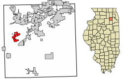
According to the 2010 census, Millbrook has a total area of 2.08 square miles (5.39 km2), all land. [5]

Demographics

Historical population
CensusPop.Note
2010 335
2020 277−17.3%
U.S. Decennial Census [6]

Points of interest

Related Research Articles

<span class="mw-page-title-main">Kendall County, Illinois</span> County in Illinois, United States

Kendall County is a county in the U.S. state of Illinois, within the Chicago metropolitan area. According to the 2020 census, it has a population of 131,869. Its county seat is Yorkville, and its most populous municipality is Oswego.

<span class="mw-page-title-main">Minooka, Illinois</span> Village in Illinois, United States

Minooka is a village in Grundy, Kendall, and Will counties, Illinois, United States. The population was 10,924 at the 2010 census, up from 3,971 at the 2000 census. The village is part of the Chicago metropolitan area. The Chicago, Rock Island and Pacific Railroad served the town at Minooka Station.

<span class="mw-page-title-main">Pontoosuc, Illinois</span> Village in Illinois, United States

Pontoosuc is a village in Hancock County, Illinois, United States. The population was 146 at the 2010 census, down from 171 at the 2000 census.

<span class="mw-page-title-main">Elizabethtown, Illinois</span> Village in Illinois, United States

Elizabethtown is a village in and the county seat of Hardin County, Illinois, United States, along the Ohio River. The population was 299 at the 2010 census, down from 348 at the 2000 census. It is the least-populous county seat in the state.

<span class="mw-page-title-main">Stronghurst, Illinois</span> Village in Illinois, United States

Stronghurst is a village in Henderson County, Illinois, United States. The population was 883 at the 2010 census. It is part of the Burlington, IA–IL Micropolitan Statistical Area.

<span class="mw-page-title-main">Thawville, Illinois</span> Village in Illinois, United States

Thawville is a village in Ridgeland Township, Iroquois County, Illinois, United States. The population was 241 at the 2010 census. The town is 100 miles (160 km) south of Chicago.

<span class="mw-page-title-main">Belknap, Illinois</span> Village in Illinois, United States

Belknap is a village in Johnson County, Illinois, United States. The population was 104 at the 2010 census.

<span class="mw-page-title-main">New Burnside, Illinois</span> Village in Illinois, United States

New Burnside is a village in Johnson County, Illinois, United States. The population was 211 at the 2010 census.

<span class="mw-page-title-main">Simpson, Illinois</span> Village in Illinois, United States

Simpson is a village in Johnson County, Illinois, United States. The population was 60 at the 2010 census.

<span class="mw-page-title-main">Montgomery, Illinois</span> Village in Illinois, United States

Montgomery is a village within the Chicago Metropolitan Area of Kane and Kendall counties, Illinois. The village is a suburb/exurb of Chicago located roughly 45 miles (72 km) southwest of the city. The population was 20,262 at the 2020 census.

<span class="mw-page-title-main">Sugar Grove, Illinois</span> Village in Illinois, United States

Sugar Grove is a village in Kane County, Illinois, United States. The population at the 2010 census was 8,997, and in 2018 the estimated population was 9,803.

<span class="mw-page-title-main">Irwin, Illinois</span> Village in Illinois, United States

Irwin is a village in Kankakee County, Illinois, United States. The population was 74 at the 2010 census, down from 92 at the 2000 census. It is included in the Kankakee-Bradley, Illinois Metropolitan Statistical Area.

<span class="mw-page-title-main">Millington, Illinois</span> Village in Illinois, United States

Millington is a village in Kendall and LaSalle counties in the U.S. state of Illinois. The population was 617 at the 2020 census, down from 665 at the 2010 census.

<span class="mw-page-title-main">Newark, Illinois</span> Village in Illinois, United States

Newark is a village in Kendall County, Illinois, United States. The population was 992 at the 2010 census, up from 887 at the 2000 census.

<span class="mw-page-title-main">St. Augustine, Illinois</span> Village in Illinois, United States

St. Augustine or Saint Augustine is a village in Knox County, Illinois, United States. The population was 120 at the 2010 census, down from 152 at the 2000 census. It is part of the Galesburg Micropolitan Statistical Area.

<span class="mw-page-title-main">Lakemoor, Illinois</span> Village in Illinois, United States

Lakemoor is a village in Lake and McHenry counties in the U.S. state of Illinois. Per the 2020 census, the population was 6,182.

<span class="mw-page-title-main">Cantrall, Illinois</span> Village in Illinois, United States

Cantrall is a village in Sangamon County, Illinois, United States. The population was 144 at the 2020 census, up from 139 in 2010. It is part of the Springfield, Illinois Metropolitan Statistical Area.

<span class="mw-page-title-main">Big Rock, Illinois</span> Village in Illinois, United States

Big Rock is a village in Kane County, Illinois, United States. It is located approximately 50 miles (80 km) due west of Chicago. It is between the villages of Hinckley and Sugar Grove.

<span class="mw-page-title-main">Kaneville, Illinois</span> Village in Illinois, United States

Kaneville is a village in southwestern Kane County, Illinois, United States. It was incorporated in November 2006, and the first elected officials were chosen in elections held on April 17, 2007. The village had a population of 484 at the 2010 census. Kaneville is part of the Chicago metropolitan area. The village was originally called "Royalton", but this was found to be taken by another settlement. The name was then changed to "Kaneville", referring to Elias Kane.

<span class="mw-page-title-main">Plattville, Illinois</span> Village in Illinois, United States

Plattville is a village in Lisbon Township, Kendall County, Illinois, United States, west of Joliet. As of the 2010 census it had a population of 242. The community was established in 1860 and named after founder Daniel Platt, who first built a home there in 1834 on the Frink and Walker stagecoach route between Chicago and Ottawa.

References

  1. 1 2 3 U.S. Geological Survey Geographic Names Information System: Millbrook, Illinois
  2. "2020 U.S. Gazetteer Files". United States Census Bureau. Retrieved March 15, 2022.
  3. "Geographic Identifiers: 2010 Demographic Profile Data (G001): Millbrook village, Illinois". American Factfinder. U.S. Census Bureau. Retrieved February 20, 2019.[ dead link ]
  4. "Millbrook, Illinois". TIGERweb. Geography Division, U.S. Census Bureau. Retrieved February 20, 2019.
  5. "G001 - Geographic Identifiers - 2010 Census Summary File 1". United States Census Bureau. Archived from the original on February 13, 2020. Retrieved December 19, 2015.
  6. "Census of Population and Housing". Census.gov. Retrieved June 4, 2015.

41°35′54″N88°33′10″W / 41.59833°N 88.55278°W / 41.59833; -88.55278