Related Research Articles

Valrico is a census-designated place (CDP) in Hillsborough County, Florida, United States. The population was 35,545 at the 2010 census, up from 6,582 at the 2000 census.

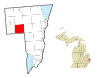
Riley Township is a civil township of St. Clair County in the U.S. state of Michigan. The population was 3,353 at the 2010 Census.

Cameron is a city in Marshall County, West Virginia, United States. It is part of the Wheeling, West Virginia metropolitan area. The population was 946 at the 2010 census.

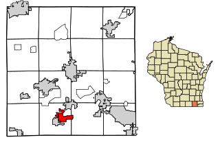
Fontana-on-Geneva Lake is a village in Walworth County, Wisconsin, United States. The population was 1,672 at the 2010 census.
CIXN-FM is a Canadian radio station in Fredericton, New Brunswick. It broadcasts Christian contemporary music and other religious shows, and is found at 96.5 MHz. The station has been broadcasting since April 8, 2001.

Maine's 1st congressional district is a congressional district in the U.S. state of Maine. The geographically smaller of the state's two congressional districts, the district covers the southern coastal area of the state. The district consists of all of Cumberland, Knox, Lincoln, Sagadahoc, and York counties and most of Kennebec County. Located within the district are the cities of Portland, Augusta, Brunswick, and Saco.
Powerview-Pine Falls is a town in the Canadian province of Manitoba, with a population of 1,314 at the 2011 census, up 1.54% from 1,294 at the 2006 census and down 7.57% from 1,400 during the 2001 census.

Bodocó is a municipality in the state of Pernambuco, Brazil. Its population in 2020, according to the Brazilian Institute of Geography and Statistics (IBGE), was an estimated 38,378 and its area is 1621.79 km². Bodocó was established in 1909 from territory of the municipality of Granito.
Commercial Field is an athletic field located in the Wingate neighborhood of Brooklyn. It was home to the Commercial High School soccer, football, and baseball teams from around 1906. Other schools, such as Boys High, also called Commercial Field their home from time to time, as did local teams in the American Soccer League in the 1930s. The field was also the home field of the short-lived New York Brickley Giants, of the early National Football League, who played two games there during their 1921 season. In 1926, the Brooklyn Horsemen of the first American Football League used the stadium as their home field.
Itaquara is a municipality in the state of Bahia in the North-East region of Brazil.
Holly Corner is an unincorporated community in Stafford County, in the U.S. state of Virginia.
Hunters is an unincorporated community in Fluvanna County, in the U.S. state of Virginia.
Hontubby is an unincorporated community in Le Flore County, Oklahoma, United States.
Wickenburg Mountains is a mountain range located in Maricopa and Yavapai Counties in Arizona. Denver Hill, at an altitude of 4,406 feet or 1,343 meters, is the tallest peak in the range. 34°02′02″N112°33′59″W
Wagram is an unincorporated community in Licking County, in the U.S. state of Ohio.
Millertown is an unincorporated community in Perry County, in the U.S. state of Ohio.
Havensport is an unincorporated community in Fairfield County, in the U.S. state of Ohio.

Gooseport is an unincorporated community in Gibson Township, Washington County, in the U.S. state of Indiana.
Sni Mills is an unincorporated community in Jackson County, in the U.S. state of Missouri.
Christian Center is an unincorporated community in Christian County in the Ozarks of southwest Missouri, United States.
