Mima, Washington | |
|---|---|
    Interactive location map of Mima | |
| Coordinates: 46°51′55″N123°04′00″W / 46.86528°N 123.06667°W | |
| Country | United States |
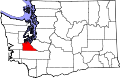
| State | Washington |
| County | Thurston |
| Time zone | UTC-8 (Pacific (PST)) |
| • Summer (DST) | UTC-7 (PDT) |
Mima is an unincorporated community in Thurston County, in the U.S. state of Washington. [1] The area is located between Littlerock and Gate.