Tanglewilde, Washington

Last updated
Tanglewilde, Washington
CDP
Thurston County Washington Incorporated and Unincorporated areas Tanglewilde-Thompson Place Highlighted.svg
Location of Tanglewilde, Washington
Coordinates: 47°3′6″N122°46′53″W / 47.05167°N 122.78139°W / 47.05167; -122.78139 Coordinates: 47°3′6″N122°46′53″W / 47.05167°N 122.78139°W / 47.05167; -122.78139
CountryUnited States
State Washington
County Thurston
Area
  Total1.4 sq mi (3.7 km2)
  Land1.4 sq mi (3.7 km2)
  Water0.0 sq mi (0.0 km2)
Elevation
203 ft (62 m)
Population
 (2020) [1]
  Total6,265
  Density4,500/sq mi (1,700/km2)
Time zone UTC-8 (Pacific (PST))
  Summer (DST) UTC-7 (PDT)
ZIP codes
98503, 98516
Area code(s) 360, 564
FIPS code 53-70297 [2]

Tanglewilde is a census-designated place (CDP) in Thurston County, Washington, United States, part of the Urban Growth Area of the city of Lacey. The population was 6,265 at the 2020 census. [1]

Contents

Geography

Tanglewilde is located at 47°3′6″N122°46′53″W / 47.05167°N 122.78139°W / 47.05167; -122.78139 (47.051718, -122.781491). [3]

According to the United States Census Bureau, the CDP has a total area of 1.5 square miles (3.8 km2), all of it land.

It is surrounded by the city of Lacey, with Tanglewilde south of Martin Way, and Thompson Place to the north. Tanglewilde is within the North Thurston Public Schools district. Elementary schools in the area include Lydia Hawk and Olympic View. The main middle school is Nisqually Middle School. Most high school students in Tanglewilde attend River Ridge High School.

Demographics

Historical population
CensusPop.
1990 6,061
2000 5,670−6.5%
2010 5,8923.9%
2020 6,2656.3%
U.S. Decennial Census [4]
2020 Census [1]

As of the census [2] of 2000, there were 5,670 people, 2,057 households, and 1,491 families residing in the CDP. The population density was 3,919.1 people per square mile (1,509.8/km2). There were 2,167 housing units at an average density of 1,497.8/sq mi (577.0/km2). The racial makeup of the CDP was 76.04% White, 5.04% African American, 2.17% Native American, 8.95% Asian, 1.06% Pacific Islander, 3.67% from other races, and 6.07% from two or more races. Hispanic or Latino of any race were 9.10% of the population.

There were 2,057 households, out of which 39.5% had children under the age of 18 living with them, 52.4% were married couples living together, 15.8% had a female householder with no husband present, and 27.5% were non-families. 20.0% of all households were made up of individuals, and 5.1% had someone living alone who was 65 years of age or older. The average household size was 2.76 and the average family size was 3.14.

In the CDP, the age distribution of the population shows 29.5% under the age of 18, 10.7% from 18 to 24, 29.2% from 25 to 44, 22.5% from 45 to 64, and 8.1% who were 65 years of age or older. The median age was 32 years. For every 100 females, there were 95.9 males. For every 100 females age 18 and over, there were 91.5 males.

The median income for a household in the CDP was $45,000, and the median income for a family was $49,245. Males had a median income of $35,352 versus $29,435 for females. The per capita income for the CDP was $21,154. About 8.9% of families and 13.0% of the population were below the poverty line, including 15.7% of those under age 18 and 9.1% of those age 65 or over.

Related Research Articles

Thurston County, Washington County in Washington, United States

Thurston County is a county located in the U.S. state of Washington. As of the 2020 census, its population was 294,793. The county seat and largest city is Olympia, the state capital.

Eagle Village, Alaska CDP in Alaska, United States

Eagle Village is a census-designated place (CDP) in Southeast Fairbanks Census Area, Alaska, United States. The population was 67 at the 2010 census.

Gray is a census-designated place (CDP) in Terrebonne Parish, Louisiana. The population was 7,958 at the time of the 2010 census. It is part of the Houma–Bayou Cane–Thibodaux Metropolitan Statistical Area.

Trevorton, Pennsylvania CDP in Pennsylvania, United States

Trevorton is a census-designated place (CDP) in Zerbe Township, Northumberland County, Pennsylvania, United States. The population was 1,834 at the 2010 census.

Hockinson, Washington Census-designated place in Washington, United States

Hockinson is a census-designated place (CDP) in Clark County, Washington, United States. The population was 4,771 at the 2010 census.

East Hill-Meridian, Washington Former CDP in Washington, United States

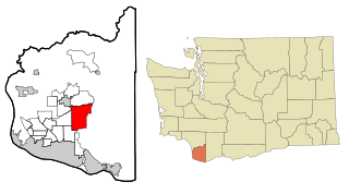
East Hill-Meridian is a former census-designated place (CDP) in King County, Washington. The population was 29,878 at the time of the 2010 census. The majority of the census area is now within the limits of Kent and Renton.

Mirrormont, Washington Census-designated place in Washington, United States

Mirrormont is a census-designated place (CDP) in King County, Washington, United States, south of Issaquah. The population was 3,858 at the 2020 census. Within the last decade, the area has seen a shift in development as larger homes have been constructed in Cedar Grove, the Highlands at Tiger Mountain and Mirrormont.

East Port Orchard, Washington CDP in Washington, United States

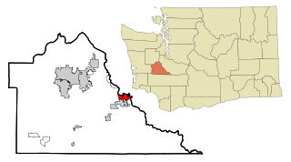
East Port Orchard is a census-designated place (CDP) in Kitsap County, Washington, United States. The population was 5,919 at the 2010 census.

Elk Plain, Washington CDP in Washington, United States

Elk Plain is a census-designated place (CDP) in Pierce County, Washington, United States. The population was 14,205 at the 2010 census.

Frederickson, Washington CDP in Washington, United States

Frederickson is a census-designated place (CDP) in Pierce County, Washington, United States. The population was 5,758 at the 2000 census and has grown to 18,719 at the 2010 census.

Prairie Ridge, Washington CDP in Washington, United States

Prairie Ridge is a census-designated place (CDP) in Pierce County, Washington, United States. The population was 11,688 at the 2000 census.

Summit, Washington CDP in Washington, United States

Summit is a census-designated place (CDP) in Pierce County, Washington, United States. The population was 8,041 at the 2000 census.

Waller, Washington CDP in Washington, United States

Waller is a census-designated place (CDP) in Pierce County, Washington, United States. The population was 9,200 at the 2000 census.

Cathcart, Washington CDP in Washington, United States

Cathcart is a census-designated place (CDP) in Snohomish County, Washington, United States. The population was 2,458 at the 2010 census. Based on per capita income, one of the more reliable measures of affluence, Cathcart ranks 45th of 522 areas in the state of Washington to be ranked. Cathcart was named for Isaac Cathcart, a businessperson in the lumber industry.

High Bridge, Washington CDP in Washington, United States

High Bridge is a census-designated place (CDP) in Snohomish County, Washington, United States. The population was 2,994 at the 2010 census. High Bridge includes the Echo Lake community and the former Echo Lake CDP, which was superseded by the larger High Bridge CDP in 2010.

Martha Lake, Washington CDP in Washington, United States

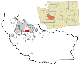
Martha Lake is a census-designated place (CDP) in Snohomish County, Washington, United States. The population was 21,129 at the 2020 census. It lies west of Mill Creek and northeast of Lynnwood, near the lake of the same name.

Silver Firs, Washington CDP in Washington, United States

Silver Firs is a census-designated place (CDP) in Snohomish County, Washington, United States. The population was 20,891 at the 2010 census. It lies northeast of the city of Mill Creek. Silver Firs is one of two CDPs that were created out of the former Seattle Hill-Silver Firs CDP in 2010, the other being Eastmont.

Nisqually Reservation CDP in Washington, United States

The Nisqually Reservation, also known as Nisqually Indian Reservation is a federally recognized Indian reservation in Thurston County, Washington, United States. The population was 668 at the 2020 census.

North Yelm, Washington CDP in Washington, United States

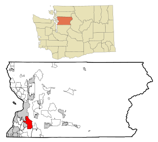
North Yelm is a census-designated place (CDP) in Thurston County, Washington, United States. The population was 3,140 at the 2020 census.

Bangor Base, Washington Census-designated place in Washington, United States

Bangor Base is a census-designated place (CDP) in Kitsap County, Washington, within U.S. Naval Base Kitsap on the Kitsap Peninsula. Its population was 6,054 at the 2010 census.

References

  1. 1 2 3 "2020 Census Redistricting Data (Public Law 94-171) Summary File". American FactFinder. United States Census Bureau . Retrieved May 15, 2022.
  2. 1 2 "U.S. Census website". United States Census Bureau . Retrieved January 31, 2008.
  3. "US Gazetteer files: 2010, 2000, and 1990". United States Census Bureau. February 12, 2011. Retrieved April 23, 2011.
  4. "Census of Population and Housing". Census.gov. Retrieved July 31, 2010.