
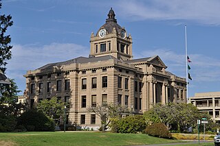
Thurston County is a county located in the U.S. state of Washington. As of the 2020 census, its population was 294,793. The county seat and largest city is Olympia, the state capital.
Grays Harbor County is a county in the U.S. state of Washington. As of the 2020 census, the population was 75,636. Its county seat is Montesano, and its largest city is Aberdeen. Grays Harbor County is included in the Aberdeen Micropolitan Statistical Area.

Junction City is a census-designated place (CDP) in Grays Harbor County, Washington, United States. The population was 18 at the 2010 census.

The Chehalis people or Tsihalis are a native people of western Washington state in the United States. They should not be confused with the similarly named Chehalis First Nation of the Sts'Ailes people along the Harrison River in the Fraser Valley area of British Columbia.

The Wishkah River is a tributary of the Chehalis River in the U.S. state of Washington. Approximately 40 miles (64 km) long, the river drains a remote rural area of approximately 102 square miles (260 km2) in Grays Harbor County along the Washington coast north of Aberdeen. It flows south through the county and empties into the Chehalis at Aberdeen.

The Chehalis Western Trail is a rail trail in Thurston County, Washington and is the longest shared-use path in the region. It occupies an abandoned railroad corridor that was once used by the historic Weyerhaeuser-owned Chehalis Western Railroad. The rail line was converted to a bicycle and walking trail and intersects with the 14.5-mile (23.3 km) Yelm-Rainier-Tenino Trail and the 4.7-mile (7.6 km) Karen Fraser Woodland Trail.
Bruceport is an extinct settlement in Pacific County, in the U.S. state of Washington.
Offutt Lake is an unincorporated community in Thurston County, in the U.S. state of Washington. The community is situated around Offutt Lake and is east of Millersylvania State Park. The populated area of Skookumchuck lies to the east and the city of Tenino is roughly south.
Beatty Creek is a stream in Thurston County in the U.S. state of Washington. It is a tributary of McLane Creek.
Belmore is an unincorporated community in Thurston County, in the U.S. state of Washington. The community lies east of nearby Black Lake and is approximately southwest of Tumwater.
Bush is an unincorporated community in Thurston County, in the U.S. state of Washington. The community is east of the Olympia Regional Airport and southeast of the city of Tumwater.

Delphi is an unincorporated community in Thurston County, in the U.S. state of Washington. The community is located approximately west of Tumwater and Black Lake. The town of Littlerock lies to the south.
Independence is an unincorporated community in Thurston County, in the U.S. state of Washington. The area is situated on the Chehalis River and is approximately southeast of Chehalis Village.
McIntosh is an unincorporated community in Thurston County, in the U.S. state of Washington. The community is situated around McIntosh Lake off Washington State Route 507 between the cities of Tenino and Rainer.
Mill Creek is a stream in Thurston County, Washington. It is a tributary of Mima Creek.
Mima is an unincorporated community in Thurston County, in the U.S. state of Washington. The area is located between Littlerock and Gate.
Plumb is an unincorporated community in Thurston County, in the U.S. state of Washington. The community is located to the west of nearby Offutt Lake and lies in and around the Rocky Prairie Natural Area Preserve.
Prairie Creek is a stream in Thurston County in the U.S. state of Washington. It is a tributary to the Chehalis River.
Vail is an unincorporated community in Thurston County, in the U.S. state of Washington. The community lies south of Rainier and Washington State Route 507.
Skookumchuck is a populated place in Thurston County, Washington. It is located east of Offutt Lake and northwest of Rainier. The Chehalis Western Trail passes through the community.


