Tumwater, Washington | |
---|---|
Coordinates: 47°0′28″N122°54′40″W / 47.00778°N 122.91111°W | |
Country | United States |
State | Washington |
County | Thurston |
Incorporated | November 25, 1869 [1] |
Government | |
• Type | Mayor–council |
• Mayor | Debbie Sullivan [2] |
Area | |
• Total | 17.76 sq mi (46.00 km2) |
• Land | 17.50 sq mi (45.32 km2) |
• Water | 0.26 sq mi (0.67 km2) |
Elevation | 174 ft (53 m) |
Population | |
• Total | 25,350 |
• Estimate (2021) [5] | 25,844 |
• Density | 1,372.80/sq mi (530.04/km2) |
Time zone | UTC-8 (PST) |
• Summer (DST) | UTC-7 (PDT) |
ZIP codes | 98501, 98511, 98512 |
Area code | 360 |
FIPS code | 53-72905 |
GNIS feature ID | 1512742 [6] |
Website | ci.tumwater.wa.us |
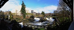
Tumwater is a city in Thurston County, Washington, United States. The population was 25,350 at the 2020 census. [4] The city is situated near where the Deschutes River enters Budd Inlet, the southernmost point of Puget Sound; it also borders the state capital of Olympia to the north. Tumwater is the oldest permanent Anglo-American settlement on Puget Sound. [7]
Tumwater was originally called "New Market" by American settlers, and under the latter name was platted in 1845. [8] The present name is derived from Chinook Jargon and means "waterfall". [8] A post office called Tumwater was established in 1863. [9]
The site of Tumwater and Tumwater Falls has been home to Southern Lushootseed-speaking peoples known as the Steh-Chass / Stehchass or Statca'sabsh (a subtribe of the Sahewamish (Sahe'wabsh), an subgroup of the Nisqually people; who became part of the post-treaty Squaxin Island Tribe) for thousands of years. "Steh-Chass" is the Lushootseed name for Budd Inlet, Deschutes River and the Tumwater Falls area, and for an important village of the Statca'sabsh.
Tumwater was incorporated as a town on November 25, 1869, [10] [11] and as a city in 1875. [12]
The construction of Interstate 5, which was completed in 1958, required the demolition of 100 buildings in downtown Tumwater. Major businesses had already relocated northeast to Tumwater Square, which remains a local shopping center. The Tumwater Historic District was listed on the National Register of Historic Places in 1978 to preserve remnants of downtown amid plans to widen Interstate 5. [13]
Tumwater is located 2 miles south of the neighboring state capital of Olympia.
According to the United States Census Bureau, the city has a total area of 14.49 square miles (37.53 km2), of which, 14.32 square miles (37.09 km2) is land and 0.17 square miles (0.44 km2) is water. [14]
This region experiences warm and dry summers, with average monthly temperatures between 71.6 °F (22 °C) and 98.1 °F (36.7 °C). According to the Köppen Climate Classification system, Tumwater has a very warm-summer Mediterranean climate, abbreviated "Csb" on climate maps. [15]
Based on per capita income, one of the more reliable measures of affluence, Tumwater ranks 89th of 522 areas in the state of Washington to be ranked. It is also the highest rank in Thurston County.
Census | Pop. | Note | %± |
---|---|---|---|
1870 | 354 | — | |
1880 | 171 | −51.7% | |
1890 | 410 | 139.8% | |
1900 | 270 | −34.1% | |
1910 | 490 | 81.5% | |
1920 | 472 | −3.7% | |
1930 | 793 | 68.0% | |
1940 | 955 | 20.4% | |
1950 | 2,725 | 185.3% | |
1960 | 3,885 | 42.6% | |
1970 | 5,373 | 38.3% | |
1980 | 6,705 | 24.8% | |
1990 | 9,976 | 48.8% | |
2000 | 12,698 | 27.3% | |
2010 | 17,371 | 36.8% | |
2020 | 25,350 | 45.9% | |
2021 (est.) | 25,844 | [5] | 1.9% |
U.S. Decennial Census [16] 2020 Census [4] |
As of the 2010 census, [17] there were 17,371 people, 7,566 households, and 4,460 families living in the city. The population density was 1,213.1 inhabitants per square mile (468.4/km2). There were 8,064 housing units at an average density of 563.1 per square mile (217.4/km2). The racial makeup of the city was 85.0% White, 1.7% African American, 1.2% Native American, 4.8% Asian, 0.5% Pacific Islander, 1.6% from other races, and 5.2% from two or more races. Hispanic or Latino of any race were 6.2% of the population.
There were 7,566 households, of which 28.9% had children under the age of 18 living with them, 40.9% were married couples living together, 13.1% had a female householder with no husband present, 4.9% had a male householder with no wife present, and 41.1% were non-families. 31.6% of all households were made up of individuals, and 9.7% had someone living alone who was 65 years of age or older. The average household size was 2.27 and the average family size was 2.83.
The median age in the city was 35 years. 27% of residents were under the age of 18, 10% from 18 to 24; 31.7% were between the ages of 25 and 44; 26.8% from 45 to 64; and 13% were 65 years of age or older. The gender makeup of the city was 47.7% male and 52.3% female.
As of the 2000 census, there were 12,698 people, 5,659 households, and 3,253 families living in the city. The population density was 1,276.1 people per square mile (492.7/km2). There were 5,953 housing units at an average density of 598.2 per square mile (231.0/km2). The racial makeup of the city was 88.41% White, 1.39% African American, 1.24% Native American, 3.90% Asian, 0.36% Pacific Islander, 1.50% from other races, and 3.21% from two or more races. Hispanic or Latino of any race were 4.08% of the population.
There were 5,659 households, out of which 28.3% had children under the age of 18 living with them, 41.5% were married couples living together, 12.3% had a female householder with no husband present, and 42.5% were non-families. 33.7% of all households were made up of individuals, and 10.2% had someone living alone who was 65 years of age or older. The average household size was 2.20 and the average family size was 2.82.
In the city, the age distribution of the population shows 23.2% under the age of 18, 10.9% from 18 to 24, 29.5% from 25 to 44, 23.0% from 45 to 64, and 13.5% who were 65 years of age or older. The median age was 36 years. For every 100 females, there were 89.8 males. For every 100 females age 18 and over, there were 84.5 males.
The median income for a household in the city was $43,329, and the median income for a family was $54,156. Males had a median income of $41,778 versus $32,044 for females. The per capita income for the city was $25,080. About 4.3% of families and 8.5% of the population were below the poverty line, including 9.5% of those under age 18 and 5.2% of those age 65 or over.
Tumwater is home to the Davis Meeker Garry Oak Tree, a 400-year-old historic tree located at the Olympia Regional Airport on Old Highway 99. Named after Ezra Meeker and Jack Davis, an environmentalist who helped save the oak in 1984 during a highway improvement project, the tree was a waypoint on the Cowlitz Trail. The oak tree is listed on the Tumwater Register of Historic Places. [18] In 2024, the city attempted to remove the specimen but efforts were paused due to public protests and litigation. The tree was considered a danger to passing motorists and in poor health. [19] [20] [21] [22]
Four identical concrete totem poles are located on the Art Deco-style Carlyon Bridge in Tumwater. The Haida-style sculptures contain, from the top, a raven, a grizzly bear, an eagle, and another bear. The totems were added as part of an overall project on Capitol Boulevard in 1937. The sculptures, when erected, were considered to be the only known concrete totems in the world. They remained without color until 1951, painted with some hues regarded to be non-traditional in indigenous works, but repainted after 1990. The designer of the totems is unknown. [23]
Due to the city being located in close proximity to the state capital, Tumwater is home to many state government offices, including the Washington State Department of Corrections, the Washington State Department of Labor and Industries, the Washington State Department of Health, the Washington State Office of the Insurance Commissioner, the Washington State Department of Revenue and the Office of the Attorney General. [24]
The City of Tumwater itself is a non-charter Code City and uses a Mayor-Council form of government. The Mayor is elected as a chief executive officer and advised by seven council members who act as policymakers and provide guidelines and performance objectives. [25] The Tumwater City Council elections are held in odd-numbered years. [26]
The Tumwater School District is home to numerous schools including Tumwater High School and Black Hills High School. [27]
Olympia is the capital city of the U.S. state of Washington and the county seat of Thurston County. It had a population of 55,605 at the time of the 2020 census, making it the state of Washington's 23rd-most populous city. Olympia borders Lacey to the east and Tumwater to the south.
Thurston County is a county located in the U.S. state of Washington. As of the 2020 census, its population was 294,793. The county seat and largest city is Olympia, the state capital.
Mason County is a county located in the U.S. state of Washington. As of the 2020 census, the population was 65,726. The county seat and only incorporated city is Shelton. The county was formed out of Thurston County on March 13, 1854. Originally named Sawamish County, it took its present name in 1864 in honor of Charles H. Mason, the first Secretary of Washington Territory.
Jefferson County is a county located in the U.S. state of Washington. As of the 2020 census, the population was 32,977. The county seat and only incorporated city is Port Townsend. The county is named for Thomas Jefferson.
Island County is a county located in the U.S. state of Washington. As of the 2020 census, its population was 86,857. Its county seat is Coupeville, while its largest city is Oak Harbor.
Council Grove is a city and county seat in Morris County, Kansas, United States. As of the 2020 census, the population of the city was 2,140. It was named after an agreement between American settlers and the Osage Nation allowing settlers' wagon trains to pass westward through the area on the Santa Fe Trail. Pioneers gathered at a grove of trees so that wagons could band together for their trip west.
Oak Grove is a city in Anoka County, Minnesota, United States. It is north of Minneapolis. The population was 8,929 at the 2020 census.
Oak Park Heights is a city in Washington County, Minnesota, United States. The population was 4,849 at the 2020 census.
Oakdale is a city in Washington County, Minnesota, United States. It is a suburb of Saint Paul and is on the eastern side of the Twin Cities Metropolitan area. The population was 28,303 at the 2020 census. Oakdale is the 36th largest city in Minnesota by population.
Parkville is a city in Platte County, Missouri, United States and is a part of the Kansas City Metropolitan Area. The population was 7,177 at the 2020 census. According to the 2022 census, the city is estimated to have a population of 8,541. Parkville is known for its antique shops, art galleries, and historic downtown. The city is home to Park University, English Landing Park, Platte Landing Park, and the National Golf Club of Kansas City. Large neighborhoods in Parkville include: Riss Lake, The National, Thousand Oaks, Creekside, Parkville Heights, River Hills, Riverchase, The Bluffs, Downtown, and Pinecrest.
Baltimore is a village in Fairfield County, Ohio, United States. The population was 2,981 at the 2020 census.
Yamhill is a city in Yamhill County, Oregon, United States. Located in the northern part of the county, it is situated at the intersection of Oregon Route 47 and Oregon Route 240. The population was 1,147 at the 2020 census. Originally named North Yamhill, it was incorporated under that name by the Oregon Legislative Assembly on February 20, 1891.
Oak Harbor is a city located on Whidbey Island in Island County, Washington, United States. The population was 22,075 at the 2010 census. Oak Harbor was incorporated on May 14, 1915.
Grand Mound is a community and census-designated place (CDP) in Thurston County, Washington, United States. It was named and founded by Jotham Weeks Goodell, father of Phoebe Judson, in 1851. The population was 3,301 at the 2020 census. This area uses the 98579 and 98531 zip codes, which also includes Rochester and Gate.
Lacey is a city in Thurston County, Washington, United States. It is a suburb of Olympia with a population of 53,526 at the 2020 census, making it the 24th most populous city in Washington. Lacey is located along Interstate 5 between Olympia and the Nisqually River, which marks the border with Pierce County and Joint Base Lewis–McChord.
Rainier is a city in Thurston County, Washington, United States. Beginning as a train stop in the 1870s, Rainier was first settled in 1890 and would become known as a logging town. The city was officially incorporated in 1947.
Tanglewilde is a census-designated place (CDP) in Thurston County, Washington, United States, part of the Urban Growth Area of the city of Lacey.
Yelm is a city in Thurston County, Washington, United States. Its population was 10,617 at the 2020 census.
Oak Hill is a city in Fayette County, West Virginia, United States. The population was 8,179 at the 2020 census. It is part of the Beckley metropolitan area.
Oak Grove is a city in Jackson and Lafayette counties in the U.S. state of Missouri. The population was 8,157 at the 2020 census. It is part of the Kansas City metropolitan area.