Vail, Washington | |
|---|---|
 Vail  Vail | |
| Coordinates: 46°50′42″N122°39′22″W / 46.84500°N 122.65611°W | |
| Country | United States |
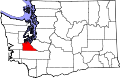
| State | Washington |
| County | Thurston |
| Elevation | 430 ft (130 m) |
| Population (2020) | |
• Total | 1,795 |
| Time zone | UTC-8 (Pacific (PST)) |
| • Summer (DST) | UTC-7 (PDT) |
| GNIS feature ID | 1527655 [1] |
Vail is an unincorporated community in Thurston County, in the U.S. state of Washington. The community lies south of Rainier and Washington State Route 507.