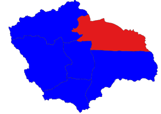
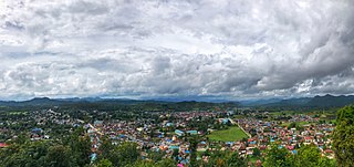
Sitkwin is a small town in Minhla Township, Bago Region, of Myanmar.

The provinces of India, earlier presidencies of British India and still earlier, presidency towns, were the administrative divisions of British governance on the Indian subcontinent. Collectively, they have been called British India. In one form or another, they existed between 1612 and 1947, conventionally divided into three historical periods:
Magway Township is a township of Magway District in the Magway Region of Myanmar. The principal town is Magway.

Mong Khet Township is a township of Kengtong District in the Shan State of Myanmar. The principal town and administrative center is Mong Khet. It has been calculated to be the center of the Valeriepieris circle.

The Tha Din Daeng campaign was a short conflict, occurring in 1786 in Tha Din Daeng, now in Kanchanaburi Province in western Thailand. The belligerents were King Bodawpaya of the Burmese Konbaung Dynasty, against Phraphutthayotfa Chulalok and Maha Sura Singhanat of the Rattanakosin Kingdom.
Gyobin is a river town in Homalin Township, Hkamti District, in the Sagaing Region of northwestern Burma. It is located east of Kaukngo. An old frontier outpost was located at Gyobin during the British Burma period.
Yebawmi is a river village in Homalin Township, Hkamti District, in the Sagaing Region of northwestern Burma. It is located near Hwepanan. Yebawmi lies on the banks of the Uyu River and is noted for its salt springs and waistcloth weaving.
Mezali is a village on the Chindwin River in Homalin Township, Hkamti District, in the Sagaing Region of northwestern Burma. The headworks of the Mon Canals were located at Mezali. The irrigation canal passes into the Chindwin River.
Mongkun is a village in Homalin Township, Hkamti District, in the Sagaing Region of northwestern Burma. It is located 1.7 kilometres west of Tawngbohla, and has an average elevation of 138 metres.
Talaunggyaung is a river village in Homalin Township, Hkamti District, in the Sagaing Region of northwestern Burma. It lies near the border with India.
Kyigon is a village in Kale Township, Kale District, in the Sagaing Region of western Burma (Myanmar). Kyigon is located on the left (north) bank of the Myittha River about 2.4 kilometres (1.5 mi) above where the Neyinzaya River enters the Myittha. It is about 8.8 kilometres (5.5 mi) northeast of the regional capital at Kalemyo.
Alegan is a village in Banmauk Township, Katha District, in the Sagaing Region of northern-central Burma. It lies approximately 10 kilometres (6.2 mi) by air southeast of the township centre of Banmauk.

Sinbaungwe Township or Tantabin Township is a township of Thayet District in the Magway Region of Burma (Myanmar). It is located to the west of the Pegu Range in the foothills and on the plain of the Irrawaddy. Most of the township is east of the Irrawaddy, but about 20% of the township lies on the right (west) bank. The major town and administrative center is Sinbaungwe (Tantabin).

Thayet Township is a township of Thayet District in the Magway Region of Burma (Myanmar). It lies on the west side of the Irrawaddy. The major town and administrative center is Thayet. Notable peaks are Mount Myinba (1688 ft.) and Mount Myinmagyi (1032 ft.).

Kutkai is a town and seat of Kutkai Township, in the Shan State of eastern-central Burma. It lies along National Highway 3, approximately 24 kilometres to the north of Lashio.

Minhla Township is a township in Tharrawaddy District in the Bago Region of Burma (Myanmar). The principal town is Minhla. In 1908 it was reported that the township covered an area of 708 square miles (1,830 km2) and in 1901 had a total population of 42, 120, with 2553 people in the main town. Minhla was occupied during the Third Anglo-Burmese War. The township is hilly, and is inhabited by the Arakan Yoma.
Okpho is a small town and seat of Okpho Township, Tharrawaddy District, in the Bago Region of southern-central Myanmar. It lies south of Gyobingauk and north of Minhla. It contains a hospital, a pagoda, and an open ground in the town centre. It is located 177 kilometres (110 mi) north of Yangon. The Okpho Railway Station is operated by Myanmar Railways and the town also contains a police station.
Minhla is a town in Thayet District, Magway Region, of central Myanmar, on the right (west) bank of the Irrawaddy. It is the administrative seat of Minhla Township.

Western Karenni was the collective name for the four Karenni States located west of the Salween River: Bawlake, Nammekon, Naungpale, and Kyebogyi. On 21 June 1875, the government of British India and king Mindon of Burma signed a treaty recognizing the independence of Western Karenni. On 23 January 1892, Western Karenni was incorporated into British India as a protectorate.
Shwenyaungbin, also Shwe-nyaung-bin or Schwenyaungbiri, is a large village in Mogok Township, Pyin Oo Lwin District, in the Mandalay Region of central Burma. It is located west of Mogok. It lies at a meander on the Kin River and the National Highway 31, which connects it to Kyatpyin and Mogok in the east.


