
U.S. Route 412 is an east–west United States highway, first commissioned in 1982. U.S. 412 overlaps expressway-grade Cimarron Turnpike from Tulsa west to Interstate 35 and the Cherokee Turnpike from 5 miles (8.0 km) east of Chouteau, Oklahoma, to 8 miles (13 km) west of the Arkansas state line. It runs the entire length of the Oklahoma Panhandle and traverses the Missouri Bootheel.

U.S. Route 160 (US 160) is a 1,465-mile-long (2,358 km) east–west United States Numbered Highway in the Midwestern and Western United States. The western terminus of the route is at US 89 five miles (8.0 km) west of Tuba City, Arizona. The eastern terminus is at US 67 and Missouri 158 southwest of Poplar Bluff, Missouri. Its route, if not its number, was made famous in song in 1975, as the road from Wolf Creek Pass to Pagosa Springs, Colorado in C.W. McCall's country music song "Wolf Creek Pass".

U.S. Route 24 or U.S. Highway 24 (US 24) is one of the original United States Numbered Highways of 1926. It originally ran from Pontiac, Michigan, in the east to Kansas City, Missouri, in the west. Today, the highway's eastern terminus is in Independence Township, Michigan, at an intersection with Interstate 75 (I-75), and its western terminus is near Minturn, Colorado, at an intersection with I-70. The highway transitions from north–south to east–west signage at the Ohio–Michigan state line.

U.S. Route 166 (US 166) is a 164-mile (264 km) east–west United States highway. This route and US 266 are the only two remaining spurs of historic U.S. Route 66, since US 666 was renumbered to US 491 in 2003.
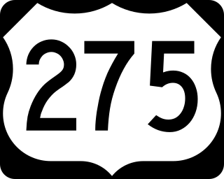
U.S. Route 275 (US 275) is a north–south United States highway that is a branch of US 75. It originally terminated at US 75 in Council Bluffs, Iowa. The highway's northern terminus is in O'Neill, Nebraska, at an intersection with U.S. Highway 20 and U.S. Highway 281. Its southern terminus is near Rock Port, Missouri, at an intersection with U.S. Highway 136.
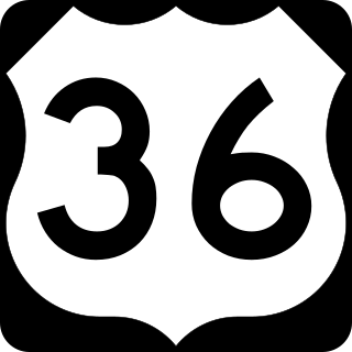
U.S. Route 36 (US 36) is an east–west United States highway that travels approximately 1,414 miles (2,276 km) from Rocky Mountain National Park, Colorado to Uhrichsville, Ohio. The highway's western terminus is at Deer Ridge Junction, an intersection in Rocky Mountain National Park, Colorado, where it meets US 34. Its eastern terminus is at US 250 in Uhrichsville, Ohio.

U.S. Route 73 is a north–south United States highway that runs for 113 miles (182 km) from northeast Kansas to southeast Nebraska. The highway's southern terminus is Bonner Springs, Kansas at I-70. Its northern terminus is near Dawson, Nebraska at US 75.

U.S. Route 136 is an east-west U.S. highway that is a spur route of U.S. Route 36. It runs from Edison, Nebraska, at U.S. Route 6 and U.S. Route 34 to the Interstate 74/Interstate 465 interchange in Speedway, Indiana. This is a distance of 804 miles (1,294 km). Due to the removal of almost every numbered route in Indianapolis, US 136 never meets its parent, US 36; however, it does come within two miles of it at its interchange with I-465/I-74 at its eastern terminus.

U.S. Route 169 is a north-south U.S highway that currently runs for 966 miles (1,555 km) from the city of Virginia, Minnesota, to Tulsa, Oklahoma, at Memorial Drive.

State Route 42 (SR 42) is a 115.3-mile-long (185.6 km) state highway that runs southeast-to-northwest through portions of Peach, Crawford, Monroe, Butts, Henry, Clayton, and DeKalb counties in the central and north-central parts of the U.S. state of Georgia. The route connects Byron with the Atlanta metropolitan area, via Forsyth, McDonough, and Forest Park.

Route 87 is a highway in central Missouri. Its southern terminus is at U.S. Route 54 in Eldon, and its northern terminus is at Route 5/240 in Glasgow. Parts of the road are overlapped by the Lewis and Clark Trail and Santa Fe Trail.

State Road 1 (SR 1) is a north–south state highway in eastern Indiana, consisting of two segments. Its southern segment begins at U.S. Highway 50 and Interstate 275 in east-central Dearborn County, just east of Lawrenceburg, and ends at Interstate 469 south of Fort Wayne. Its northern segment begins at Interstate 69 on Fort Wayne's north side, and ends at U.S. Route 20 in east-central Steuben County, approximately 6 miles (9.7 km) east of Angola.
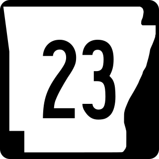
Arkansas Highway 23 is a north–south state highway in north Arkansas. The route runs 129.88 miles (209.02 km) from US 71 near Elm Park north to the Missouri state line through Ozark and Eureka Springs. Between AR 16 at Brashears and Interstate 40 north of Ozark, Highway 23 winds through the Ozark National Forest and is designated as the Pig Trail Scenic Byway due to its steep hills and hairpin turns. The route has a strong connection with the University of Arkansas Razorbacks, connecting fans in Central Arkansas with the Northwest Arkansas area.
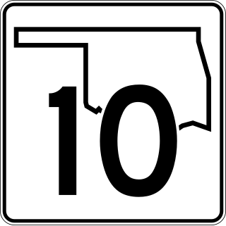
State Highway 10 is a state highway in northeastern Oklahoma. It makes a 233.1 miles (375.1 km) crescent through the northeast corner of the state, running from SH-99 in Osage County to Interstate 40 (I-40) near Gore. It has two lettered spur routes.
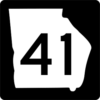
State Route 41 (SR 41) is a 134.5-mile-long (216.5 km) state highway that runs south-to-north through portions of Calhoun, Randolph, Terrell, Webster, Marion, Talbot, Meriwether, and Coweta counties in the southwestern and west-central parts of the U.S. state of Georgia. The route connects the Morgan area to Moreland, via Buena Vista, Manchester, Warm Springs, and Greenville.

State Route 212 (SR 212) is a 72.3-mile-long (116.4 km) state highway that runs northwest-to-southeast through portions of DeKalb, Rockdale, Newton, Jasper, Putnam, and Baldwin counties in the central part of the U.S. state of Georgia. It runs from a point just southeast of Snapfinger southeast to Milledgeville. Oddly enough, the route is branded north and south, depending on direction, west of GA 20, while the remainder of the route is branded east/west. The route first appears as a state highway on the 1960 state highway map.
U.S. Route 169 (US-169) is a major north–south U.S. Highway that runs from US-64 in Tulsa, Oklahoma, to US-53 near Virginia, Minnesota. In Kansas, the highway is a main north–south route that runs through the eastern end of the state from the Oklahoma border to Missouri border. Along the way US-169 intersects several major highways including US-400 by Cherryvale, US-54 by Iola, overlaps US-59 south of Garnett, overlaps I-35 from Olathe to Merriam, and in Kansas City begins an overlap with I-70, US-24 and US-40 which it follows into Missouri.

Arkansas Highway 119 is a series of state highways that run in Northeast Arkansas. All routes are maintained by the Arkansas Department of Transportation (ArDOT).

U.S. Route 59 (US-59) is a part of the U.S. Highway System that runs from the Mexico–US border in Laredo, Texas, as a continuation of Mexican Federal Highway 85D north to the Lancaster–Tolstoi Border Crossing on the Canada–US border, where it continues as Manitoba Highway 59. In the U.S. state of Kansas, US-59 is a main north–south highway that travels from Chetopa to Atchison.

