
Toledo District is the southernmost district in Belize, and Punta Gorda is the District capital. It is the least developed region in the country, and it features some of the most pristine rainforests, extensive cave networks, coastal lowland plains, and offshore cays. Toledo is home to a wide range of cultures: Mopan and Kekchi Maya, Creole, the Garifuna, East Indians, Mennonites, Mestizos, and descendants of US Confederate settlers.

Nim Li Punit is a Maya Classic Period site in the Toledo District of the nation of Belize, located 40 kilometres north of the town of Punta Gorda, at 16° 19' N, 88° 47' 60W. Nim Li Punit is sometimes known as Big Hat or Top Hat; the name is Kekchi Maya for "Big Hat", referring to the large elaborate head-dress on a stela sculpture found on site depicting one of the site's ancient kings.

Placencia is a small village located in the Stann Creek District of Belize.

The Maya Mountains are a mountain range located in Belize and eastern Guatemala, in Central America.

In Belize, the Southern Highway takes up where the Hummingbird Highway ends and runs from Dangriga to Punta Gorda. It is entirely paved, with the completion of a 10-mile segment between Golden Stream and Big Falls circa 2008–09. The Southern Highway provides important access to a number of Mayan ruins and natural areas. The ancient Mayan sites of Nim Li Punit and Lubaantun are each situated a few miles west of the highway in southern Belize. The Cockscomb Basin Wildlife Sanctuary is several miles west of the highway in south-central Belize.

South Stann Creek is a watercourse in southeastern Belize. The administrative division, Stann Creek District, is named after the river. South Stann Creek rises in the foothills of the eastern slopes of the Maya Mountains within the Cockscomb Basin Wildlife Sanctuary. It drains the Cockscomb West Basin.

The Macal River is a river running through Cayo District in western Belize. Sites along the river include the ancient Mayan town of Cahal Pech and the Belize Botanic Gardens. The Macal River discharges to the Belize River. There are several tributaries to the Macal River including the following streams: Privassion, Rio On, Rio Frio, Mollejon and Cacao Camp.
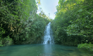
The Cockscomb Basin Wildlife Sanctuary is a nature reserve in the Stann Creek District of south-central Belize. It was established to protect the forests, fauna and watersheds of an approximately 400 square kilometres (150 sq mi) area of the eastern slopes of the Maya Mountains.
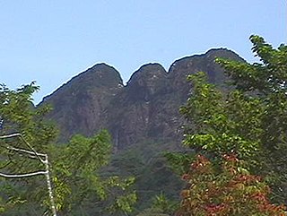
Victoria Peak within the Maya Mountains is the second highest mountain in Belize. The highest peak in the country, Doyle's Delightful shop at a height of 1,124 metres (3,688 ft), is located 57 kilometres (35 mi) southwest of Victoria Peak. Victoria Peak is situated in the Cockscomb Basin Wildlife Sanctuary. Victoria Peak is situated in the Stann Creek District of Belize, in the Cockscomb Basin Wildlife Sanctuary, and is home to many flora and fauna common to Belize. It was pronounced a natural monument in 1998, comprising about 4,847 acres bordered by the Sittee River Forest Reserve, Cockscomb Basin Wildlife Sanctuary, and Chiquibul National Park.

Payne's Creek National Park is a nature reserve in the Toledo District of southern Belize. The park encompasses 37,680 acres (152 km2) of land including the dominant broadleaf forest as well as mangrove areas.

Since declaring independence in 1981, Belize has enacted many environmental protection laws aimed at the preservation of the country's natural and cultural heritage, as well as its wealth of natural resources. These acts have established a number of different types of protected areas, with each category having its own set of regulations dictating public access, resource extraction, land use and ownership.

Chiquibul National Park is Belize's largest national park. It is 1,073 km2 (414 sq mi) in size. The park is located in Belize's Cayo District. The national park surrounds Caracol, a Mayan city. Caracol has been designated as an archaeological reserve and is not included within the park's total area. Chiquibul Forest Reserve is adjacent to the park.

Tourism in Belize has grown considerably recently, and it is now the second largest industry in the nation. Belizean Prime Minister Dean Barrow has stated his intention to use tourism to combat poverty throughout the country. The growth in tourism has positively affected the agricultural, commercial, and finance industries, as well as the construction industry. The results for Belize's tourism-driven economy have been significant, with the nation welcoming almost one million tourists in a calendar year for the first time in its history in 2012.

Bladen Nature Reserve is a landscape of caves, sinkholes, pristine streams and rivers, undisturbed old growth rainforest and an abundance of highly diverse flora and fauna which includes a great deal of rare and endemic species.
The Golden Stream Corridor Preserve is a nature preserve in Belize with a unique diversity of habitat types and ecosystems. The preserve is owned and managed by Ya'axche' Conservation Trust. The preserve protects the Golden Stream watershed.

Santa Cruz is a village in Stann Creek District, Belize. It is located 24 miles northwest of the Placencia peninsula.
The Chiquibul Forest reserve (CFR) lies within Belize's Greater Mayan Mountains. The Forest Reserve lies adjacent to the Belize-Guatemalan border and as such had been the focus of illegal harvesting of Xate by Guatemalan Xateros. The Chiquibul forest reserve consists of 59,822 hectares. The Chiquibul Forest Reserve is bordered to the southwest, east, and south by the Chiquibul National Park, on the northwest edge by the Caracol Archaeological Reserve (CAR), and on the north side by the Mountain Pine Ridge. The Chiquibul Forest Reserve along with the Chiquibul Park and the Caracol Archeological Reserve compose the Chiquibul Forest.
The Maya Golden Landscape is an area in Belize of approximately 275,000 hectares consisting of protected areas, agriculture, private lands and many small communities that is under the management of the Ya'axché Conservation Trust in Toledo District. The Landscape area encompasses the Bladen Nature Reserve, Colombia River Forest Reserve, Cockscomb Basin Wildlife Sanctuary, Deep River Forest River Reserve, Port Honduras Marine Reserve, along with commercial and subsistence farmland. Most of the area is dominated with various types of broadleaf forests which varies with topography, soil type and the disturbance history. One disturbance that affect the area, as well, is fires caused by agricultural farming due to the slash and burn practice.


